14 Best Hikes in Moab
Peter BrahanMoab is a great place for outdoor adventure in general, which makes it a challenge to pick out the very best hikes in Moab. Moab is the home base for two amazing nearby national parks (Arches and Canyonlands), Dead Horse Point State Park, and a ton of other great places to explore.
In recent years, Moab has become quite well known for a number of sports, including four-wheeling, rafting, rock-climbing, mountain-biking and even more extreme sports like BASE jumping. However, there are many dozens of hiking experiences within a short drive. That proximity combined with beautiful spring and fall temperatures make this a popular location with tourists.
While it was hard to narrow down the best hikes in Moab, we did our best-here are a few that we highly recommend to help you plan your visit!

MOAB HIKES (GREATER MOAB AREA)
Everyone knows that there are a ton of hikes inside the nearby National and State Parks, but the greater Moab area has nearly 200 hikes that are within an hour’s drive from the town center. While it’s tough to pick a few, here are some of the best that suit a variety of skill levels:
- The Corona and Bowtie Arch Trail is a moderate 2.3-mile round-trip hike. Starting from Potash Road (which hugs the shoreline of the Colorado River), this trail climbs approximately 500 feet in elevation, with most of the elevation gain occurring in the first quarter of a mile and between mile 0.75 and 1. The trail does have sheer drops and while it is not a difficult hike, you’ll want to be sure to keep a close eye on your children. At the end of the hike are two arches that are amazing to see.

- The Grandstaff Trail is a moderately-challenging 4.3-mile out-and back hike (round-trip). Starting along Highway 128 just northeast of the town of Moab (in Negro Bill Canyon), the trail climbs only 400 feet over the entire length of the trail. At the end of the trail is a large arch (spanning approximately 70 feet). The arch is very close to the rock walls behind it, so while it doesn’t photograph quite like other arches, it is really cool to experience.

Grandstaff Trail under Morning Glory Arch, courtesy of John Buie
- The Hunter Canyon Trail is an easy 3.0-mile (round-trip) out-and-back trail that starts from Kane Springs Road along the Kane Springs River just southwest of the town of Moab and south of the Colorado River. The trail follows along Hunter Canyon, with only about 200 feet total elevation gain (though there is some small ups and downs along the way). Dogs are more than welcome on this trail (which is unlike trails in the National Parks). Since this trail is alongside water the entire way, it’s great for cooling off.
- The Fisher Towers Trail is a moderately-challenging 3.9-mile round-trip hike that climbs 1,500 feet and includes a ladder along the way. Starting from Fisher Towers Road (of Highway 128 to the east of Moab), this trail features amazing rock art (from wind and water erosion). The landscape is beautiful along the entire way, but at the end is a breathtaking viewpoint.

Fisher Towers, courtesy of Tmarantette
- The Professor Creek and Mary Jane Canyon Trail is a moderate 7.6-mile round-trip (out-and-back) trail that climbs only about 550 feet. The trail starts at the end of Professor Valley Road, which is off Highway 128, approximately 12 miles east of Moab. The trail is not the easiest to find. The trailhead is unmarked and while you park in the same lot as the Sylvester Trail, the hike begins opposite to the Sylvester Trail trailhead. Note: you may get your boots wet while you are hiking, depending on the water level, as you’ll cross the stream at least 50 times (so you might want to wear water shoes).
Professor Creek and Mary Jane Canyon Trail, courtesy of Hannah Cowan, Bureau of Land Management
ARCHES NATIONAL PARK HIKES
Arches National Park has a ton of hiking opportunities and is perhaps the most well-known area around Moab for hiking and exploring, and you should check out our complete blog on The Best Hikes in Arches National Park. For those who would like to just stay in the car, there is a great drive through the park with some overlooks that are amazing. Even if you are looking for a few short hikes, this is a great place to go. Here are some of the trails that we recommend:
- The Delicate Arch Trail is a moderate, 3.0-mile round-trip trail. The hike climbs slightly over 600 feet during it’s out-and-back journey. This is one of the most popular trails in the park, and for those that can hike a few miles, it is definitely the hike to do. At the end of the trail is Delicate Arch, a freestanding arch which appears on nearly every photo collage of Arches National Park (and the Utah license plate!).

- The Double Arch Trail is the shortest of the hikes that we’ll highlight here. At a round-trip distance of only 0.5 miles (with no significant elevation gain), the Double Arch trail travels into a small amphitheater created by two arches. The hike is easy and must-do in the park, even if you are only here for a couple hours.

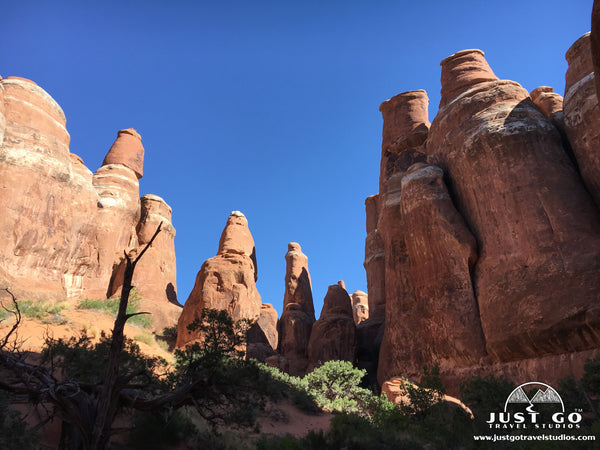
- The Fiery Furnace Trail takes the prize as being the most adventurous trail in Arches National Park. Requiring a ranger guide and reservations, this 1.8-mile round-trip hike travels into a rock formation full of arches and amazing scenery. There is a bit of elevation gain (700 feet total), but the rock scrambling is so interesting that it doesn’t seem like you have to work much at all. Our kids loved this trail. Make sure you get reservations well in advance!

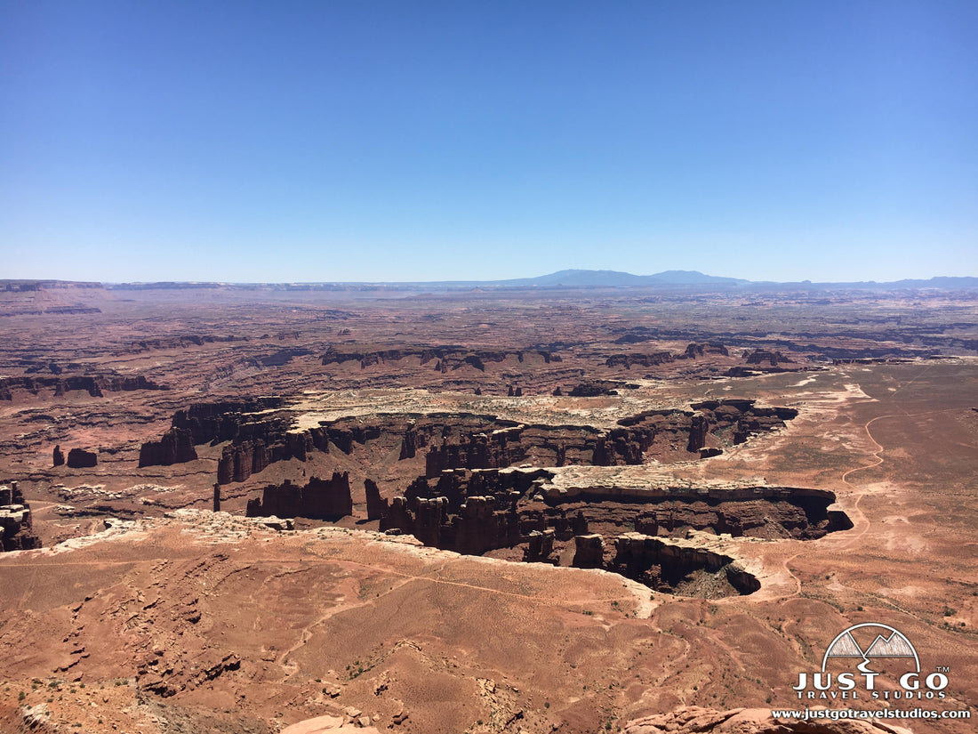
CANYONLANDS NATIONAL PARK HIKES
Located about 45 minutes from the town of Moab, Canyonlands National Park is a completely different experience than Arches National Park. There are two districts-the Island in the Sky District (located to the north) and the Needles District (to the south). Both are worthwhile visiting. We covered all the Best hikes in Canyonlands National Park in another post, but here are a couple of the best hikes:
- The Mesa Arch Trail (Island in the Sky District) is a perfect hike if you are looking for short and easy hike with a great payoff. At just 0.6 miles (round-trip), this hike barely climbs 100 feet on the way to Mesa Arch. The arch is against a backdrop of a sheer canyon and is especially spectacular during sunrises in the park. It can get crowded here for sunrise photos, so just be prepared!

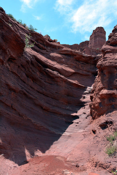
- The False Kiva Trail (Island in the Sky District) is a challenging 1.9-mile (round-trip) hike on a trail that is not marked very well. Climbing a bit over 400 feet (total), the trail includes rock scrambling near the end to an alcove (though the alcove is currently closed due to issues with vandalism). The views from here at sunset are phenomenal, but be sure to bring headlamps if you do hike in the evening!

False Kiva Trail, courtesy of John Buie
- The Druid Arch Trail (Needles District) is one of the more difficult hikes in the park. At 10.4-miles (round-trip), this hike will take most of the day as you climb up over 1600 feet in elevation. At the end of the hike, the trail gets steep, but it leads to an arch that is 450 feet high inside a canyon. This is a great hike if you are up for a challenge!

Druid Arch photo, courtesy of Richie B pics
- The Cave Spring Trail (Needles District) is an easy, 0.6-mile trail with little elevation gain (though there are two small ladders). At the end of this shaded trail is a camp with cowboy artifacts and petroglyphs.

Cave Spring photo, courtesy of John Fowler
DEAD HORSE POINT STATE PARK HIKES
Dead Horse Point State Park is located just north of the Island in the Sky District of Canyonlands National Park. It is not as popular as Canyonlands National Park but is absolutely worthwhile going to. Though there are fewer hikes and the park is smaller than Canyonlands, some suggest that this park is more impressive. Either way, make sure you make time for this great spot.
While visiting Dead Horse Point State Park, some hikes that we recommend include:
- The Dead Horse Rim Loop Trail is a moderately challenging 5.0-mile loop that is mostly flat (though there is about 300 feet in elevation gain at the end, and perhaps more depending on what overlooks you stop at). The trail heads around a peninsula of sorts, and hugs the edge of a sheer cliff for most of the hike (so make sure no one in your party is afraid of heights!). There are views of the Colorado River and plenty of overlooks that provide great stopping points. The views on the east side of the hike are a bit more scenic than the west side, so if you only have time for part of the hike, just stay on the east side.
- The Dead Horse Point Short Loop Trail starts at the parking area at the end of Highway 313. This short 1-mile hike makes a loop around the point and has only about 300 feet gain in elevation. This is a good alternative to the full loop trail, as you can see the best views of the bends in the Colorado River right from this trail.

Dead Horse Point State Park, courtesy of faungg’s photos
HOW TO GET TO MOAB, UTAH
Moab is located on the eastern side of Utah, equidistant from the north and south borders of Utah. The closest major airport to Moab is Salt Lake City, but that is approximately four hours away. A great option that is only two hours away is Grand Junction, CO. Many carriers fly into this airport, but you’ll likely have to fly with a connection if you are coming in from any distance.
Basic directions to Moab can be found below:
- Directions from Grand Junction, CO to Moab, UT (113 miles)
- Directions from Salt Lake City, UT to Moab, UT (234 miles)
FURTHER INFORMATION ON MOAB FROM JUST GO TRAVEL STUDIOS

- Our most popular itinerary for the area is our Utah National Parks itinerary. We cover the most popular things to see and do in Utah’s “Big 5” National Parks, including the best hikes, what to pack and what else to see while visiting the area.
- In addition to our itineraries, we have a variety of blogs on the area, including the Best Hikes in Arches National Park and the Best Hikes in Canyonlands National Park. We also cover Canyonlands in detail in our blog, What to See and Do in Canyonlands National Park.
- Our signature product are custom travel posters that we make using one of your photos. We take a photo that you send us, edit it and provide our special filtering technique. We then apply your custom wording and ship it to you after printing it. We’re sure you’ll love it!

- In addition to our custom posters, we also offer standard posters of the National Parks in Utah. We have a large collection, so make sure you check them out!


