Camping in Sequoia National Park: Campground Maps, Site Photos & More
Peter BrahanTaking a trip in the Sierra Mountains of California and staying one of the great Sequoia National Park campgrounds can be one of the most memorable vacations you’ll ever have. There are quite a few options in both Sequoia National Park and Kings Canyon National Park, but spending time in the forest among the trees in any of these campgrounds will prove to be a wonderful experience.
While we would love to pick the best campground in Sequoia National Park, it really depends on what you are looking for. We hope that our guide will help you narrow them down to one or two!
SEQUOIA NATIONAL PARK CAMPGROUNDS: OVERVIEW
There are seven total campgrounds inside of Sequoia National Park and seven inside of nearby Kings Canyon National Park. While both can be busy in the summertime, if one of the parks happens to be full, make sure you head to the adjacent park to see if there might be a vacancy.
We strongly recommend getting reservations during the peak season, which is in the summer. This is due to the extreme amounts of snow that the parks can get and the fact that some of the roads are routinely closed in the winter. Since many of the campgrounds fill up quickly and sometimes months in advance, we recommend calling for reservations well in advance of your visit. Reservations are usually open six months in advance.
The campgrounds are located in three general locations in the park: Lodgepole and Giant Forest, the Mineral King and Foothills Areas. All of these areas are on the western side of Sequoia National Park, with the Lodgepole and Giant Forest campgrounds being in the most populated area of the park.
SEQUOIA NATIONAL PARK CAMPING SUPPLIES
While the most cost-effective option is to stock up on supplies ahead of your camping trip to the park, supplies are available at the Lodgepole Market Center and the Grant Grove Market. Since all the campgrounds are closes to the southwest part of the park, the Lodgepole Market Center is likely the best bet for supplies.
Outside of the park, the best options to purchase supplies include the town of Three Rivers, CA and Badger, CA. If you need to pickup camping gear, it’s likely that Visalia, CA is your best option.
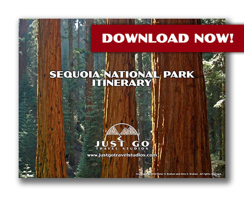
While we have an extensive amount of information online, the best option is to make sure you download a copy of our itinerary for Sequoia National Park. We cover information on the best hikes in the park, must-see sights, what to pack, what to see nearby and what to do ahead of your trip.
SEQUOIA NATIONAL PARK CAMPGROUNDS – LODGEPOLE AND GIANT FOREST AREAS
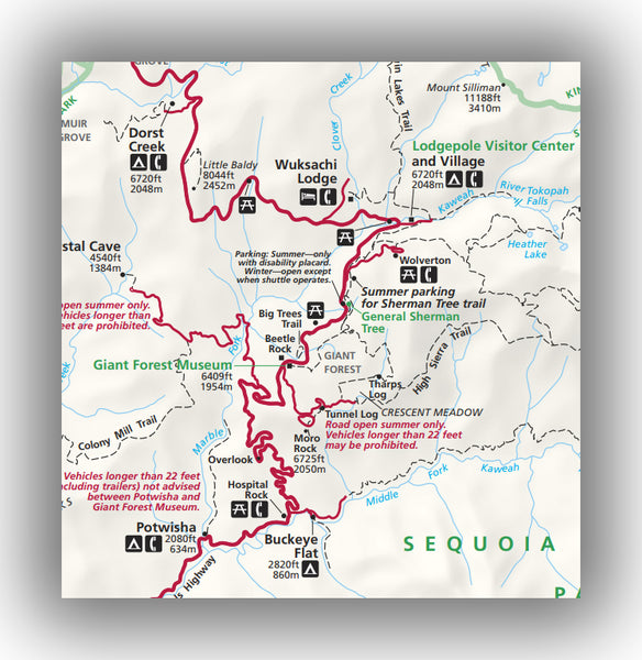
Map of the Lodgepole and Giant Forest Areas of Sequoia National Park, courtesy of the National Park Service
Dorst Creek Campground:
- Location: The Dorst Creek Campground is located on Highway 198 (Generals Highway), about 9 miles north of the Lodgepole Visitor Center. Directions from the Lodgepole Visitor Center to Dorst Creek Campground.
- Reservations: Offered June through September. Dorst Creek Campground reservations.
- Capacity: 218 sites.
- Electricity / Water Hookups / Dump Station: No / No / Yes.
- Toilets / Showers: Flush toilets and no showers (but showers are available in Lodgepole).
- Nearby: The Muir Grove trail starts at the Dorst Creek Campground. This moderately difficult hike climbs a bit over 500 feet on the 3.9-mile round trip hike. The trail ends in a large grove of Sequoia Trees-one of the largest groves in the entire park. Another nearby trail is the Little Baldy Trail, which is between the campground and the Lodgepole Visitor Center. This trail is 3.3-miles (round-trip) and climbs nearly 800 feet for a wonderful view of the Great Western Divide.
- Additional details: In addition to having a few nice trails in the area, the campground has spacious sites and is generally quiet. Make sure you use the bear boxes for your food. Each campsite is surrounded by trees, making it an absolutely beautiful setting. If you prefer a bit of seclusion, this is a better choice than the Lodgepole campground.

Dorst Creek Campground map in Sequoia National Park, courtesy of the National Park Service
Lodgepole Campground:
- Location: The Lodgepole Campground is located on Lodgepole Road, about 0.7 miles east of the Lodgepole Visitor Center. Directions from the Lodgepole Visitor Center to Lodgepole Campground.
- Reservations: Offered May through September. Lodgepole Campground Reservations.
- Capacity: 214 sites.
- Electricity / Water Hookups / Dump Station: No / No / No.
- Toilets / Showers: Flush toilets and showers.
- Nearby: Where to begin? The campground is right near many activities, including the Lodgepole Visitor Center, which includes a video and historical information on the area. The Tokopah Valley Trail starts right from the Visitor Center. This is a relatively easy 3.7-mile round-trip hike that, travels along the Kaweah River under a canopy of trees. The trail climbs over 500 feet. You can also go to the amazing Tokopah Falls Trail.
- Additional details: The Lodgepole Campground is located in the heart of Sequoia National Park, making it accessible to a ton of great walks and hikes, amenities (like a store and laundry) and the park shuttle.

Lodgepole Campground map in Sequoia National Park, courtesy of the National Park Service

Lodgepole Campground image provided by Ray Explores
SEQUOIA NATIONAL PARK CAMPGROUNDS – MINERAL KING AREA

Map of the Mineral King Area of Sequoia National Park, courtesy of the National Park Service
Cold Springs Campground:
- Location: The Cold Springs Campground is located on Mineral King Road, about 23.3 miles east of the intersection with Highway 198 (Generals Highway). Directions from Generals Highway to Cold Springs Campground.
- Reservations:
- Capacity: 41 sites.
- Electricity / Water Hookups / Dump Station: No / No / No.
- Toilets / Showers: Pit toilets and no showers, though showers are available in the Silver City Resort just 2.5 miles to the west.
- Nearby: At the end of the road is the 6.5-mile (round-trip) Eagle Lake Trail. This challenging trial climbs over 2000 feet on the way of up Eagle Lake. This will take at least 4 hours, so plan on it being the main activity you do in the day
- Additional details: The Cold Springs Campground is one of the most remote campgrounds in the park. Expect it to take about 90 minutes to get to the center of Sequoia National Park. What you give up in convenience you gain in beauty and quiet! This is a great spot to relax and wind down without distractions.

Cold Springs Campground map in Sequoia National Park, courtesy of the National Park Service
Atwell Mill Campground:
- Location: The Atwell Mill Campground is located on Mineral King Road, about 19.2 miles east of the intersection with Highway 198 (Generals Highway). Directions from Generals Highway to Atwell Mill Campground.
- Reservations:
- Capacity: 21 sites.
- Electricity / Water Hookups / Dump Station: No / No / No.
- Toilets / Showers: Pit toilets and no showers (showers are available in the Silver City resort, 1.73 miles to the east).
- Nearby: The Paradise Ridge Trail and the Atwell-Hockett Trail intersect the campground. The Paradise Ridge Trail is a 5.8-mile (round-trip) hike that climbs 700 feet. This is a relatively easy trail despite the distance.
- Additional details: The campground is secluded and the sites are quite large, making this a great place to camp and relax. The campground is surrounded by trees.

Atwell Mill Campground map in Sequoia National Park, courtesy of the National Park Service
SEQUOIA NATIONAL PARK CAMPGROUNDS – FOOTHILLS AREA

Map of the Foothills Area of Sequoia National Park, courtesy of the National Park Service
Potwisha Campground:
- Location: The Potwisha Campground is located on Highway 198 (Generals Highway), 2.8 miles north of the Foothills Visitor Center. Directions from Foothills Visitor Center to Potwisha Campground
- Reservations: Offered May through September. Potwisha Campground reservations.
- Capacity: 36 sites.
- Electricity / Water Hookups / Dump Station: No / No / Yes.
- Toilets / Showers: Flush toilets and no showers.
- Nearby: From the campground is the Marble Fork Trail which leads to Marble Falls. This 7.2-mile (round-trip) hike is challenging as it climbs the 1600+ feet to Marble Falls. The trail is shaded and heads to gorgeous cascades.
- Additional details: Though a nice location, don’t expect to be among large trees as this is in the foothills of the Sierras, though there are wildflowers and oak trees.

Potwisha Campground map in Sequoia National Park, courtesy of the National Park Service

Potwisha Campground image provided by the National Park Service
South Fork Campground:
- Location: The South Fork Campground is located at the end of South Fork Drive, 12.3 miles east of the intersection with Highway 198 (Generals Highway). Directions from Generals Highway to South Fork Campground
- Reservations:
- Capacity: 10 sites.
- Electricity / Water Hookups / Dump Station: No / No / No.
- Toilets / Showers: Pit toilets and no showers.
- Nearby: From the campground you can access the Ladybug Camp Trail. This is a 7.2-mile (round-trip) hike along the Kaweah River. Be advised that this hike is known for having a lot of mosquitoes in the summer. The Garfield Grove Trail is also accessible, but this hike is mainly for overnight backpacking as it is 13 miles+ long and climbs over 5,000 feet. The trail is not the best maintained either.
- Additional details: This campground is one of the most remote in the park. The road can be rough (though is passable) and the campground is primitive. There is a mix of brush, oak and evergreens on the sites. This location is known for being very quiet!
Buckeye Flat Campground:
- Location: The Buckeye Flat Campground is located just off Highway 198 (Generals Highway), 5.7 miles northeast of the Foothills Visitor Center. Directions from Foothills Visitor Center to Buckeye Flat Campground
- Reservations: Offered May through September. Buckeye Flat Campground reservations.
- Capacity: 28 sites.
- Electricity / Water Hookups / Dump Station: No / No / No.
- Toilets / Showers: Flush toilets and no showers.
- Nearby: The Paradise Creek Trail heads to the south from the campground. This 5.5-mile hike is not crowded at all and heads up a little over 1000 feet. The trail is a little overgrown, so just be advised that you’ll encounter a small amount of bushwhacking on the way up.
- Additional details: The campground is not completely shaded like many of the other campgrounds, so it can get hot in the summertime. The Kaweah River flows through the campground and is accessible for swimming.

Buckey Flat Campground map, courtesy of the National Park Service
SEQUOIA NATIONAL PARK GROUP CAMPING
For details on group camping in Dorst Creek, refer to the Sequoia National Park Group Camping information on their website. Additional group camping is available in Kings Canyon National Park at the Sunset, Crystal Springs and Canyon View campgrounds.
CAMPING OUTSIDE SEQUOIA NATIONAL PARK
If you are unable to find a place to camp inside the park, there is plenty of camping outside of Sequoia National Park. This includes Sequoia National Forest and Giant Sequoia National Monument. For details on camping outside the park, check out the Sequoia National Forest Camping website.
FURTHER INFORMATION ON SEQUOIA NATIONAL PARK FROM JUST GO TRAVEL STUDIOS
- There is so much to see and do inside of Sequoia National Park and neighboring Kings Canyon National Park that having a guide to help you is a must. Our downloadable itinerary for Sequoia National Park and itinerary for Kings Canyon National Park will help you get started on your planning for your next adventure!
- If you are flying into the area before you camp, then check out our blog on the Best Airports for Sequoia National Park.
- You need to also check out our definitive blog on the park, What to See and Do in Sequoia National Park. If you are looking for specific information on one of our favorite hikes, be sure to check out our blog, Hiking the Moro Rock Trail in Sequoia National Park or the Tokopah Falls Trail. The Crescent Meadows trail is also worth exploring!
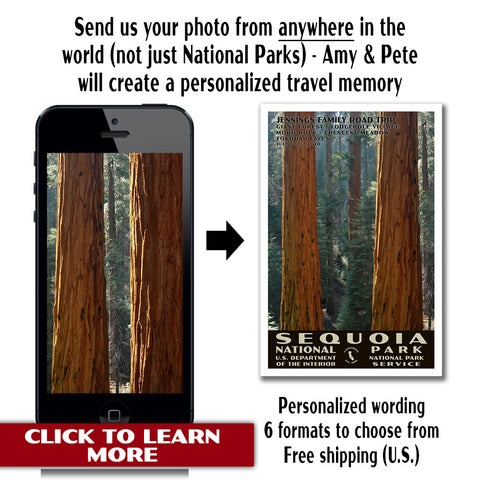
- After you get back from your trip, check out our custom, vintage-style travel posters. We take a photo that you give to us as well as your desired personalized wording and turn it into a poster that we print and ship to you.