Rocky Mountain National Park: Things to Do, Maps, Camping, Fees & More
Peter BrahanRocky Mountain National Park takes up over 265,000 acres, and the truth is that there is a ton to see and do in your time here. We’ve broken down the park into five main sections, and each one can be the subject of a day or more of visiting and exploring. Trying to figure out exactly what to do here during what is always too little time can be challenging. Hopefully, this guide will help break down exactly what you should consider during your visit!
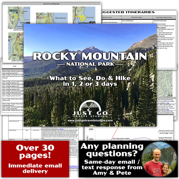
Ahead of your trip, we recommend taking the time to download our 26-page Rocky Mountain National Park itinerary. Cell service in the park is pretty much non-existent, and our guide provides maps, information on hikes, what to bring, what to see and do in the park and what to see in the area. We also have 1, 2 and 3-day itineraries for travelers of all types.
ROCKY MOUNTAIN NATIONAL PARK HISTORY
Like many National Parks, the area that is currently occupied by Rocky Mountain National Park was once inhabited by American Indians and nomadic peoples that would use the area for hunting and gathering. As western exploration occurred and gold was discovered, the landscape changed and more people came to the area.
Word got out about the beauty, and tourists started to come to the Rocky Mountains in the early 1900s. Rocky Mountain National Park was established in 1915. Since then, it has gone through continuous improvement, with the most significant changes occurring because of the Civilian Conservation Corps in the 1930s. They built trails and other infrastructure, but the most notable improvement was the construction of Trail Ridge Road, which is the highest continuous road in the United States.
ROCKY MOUNTAIN NATIONAL PARK RESERVATIONS
With the increase in popularity of the National Parks, some parks have had to put reservations systems in place, and Rocky Mountain National Park is one of them. While this may seem inconvenient, trust us-sitting in traffic for an hour or more at the entrance gate unexpectedly is not a very efficient use of your vacation time and can be a bit frustrating.

Reservations are required from late May through early October and open 1-2 months in advance of the entry date. You can book timed entry passes for Rocky Mountain National Park here. Timed entry is offered between 9 am and 3 pm, and does not include entry into the Bear Lake area with your vehicle. Note, if you have a reservation at a campground, then you are not required to get a timed entry reservation as well.
If you want to drive into the Bear Lake Area and park, you can get reservations for 5 am to 6 am in the Bear Lake Area here. If you don’t have reservations, then you can take a shuttle into the Bear Lake Area. If you end up getting reservations for the Bear Lake Area, this serves as an entry reservation into the entire park, though nobody will check when you enter the park that early (checking begins at 9).
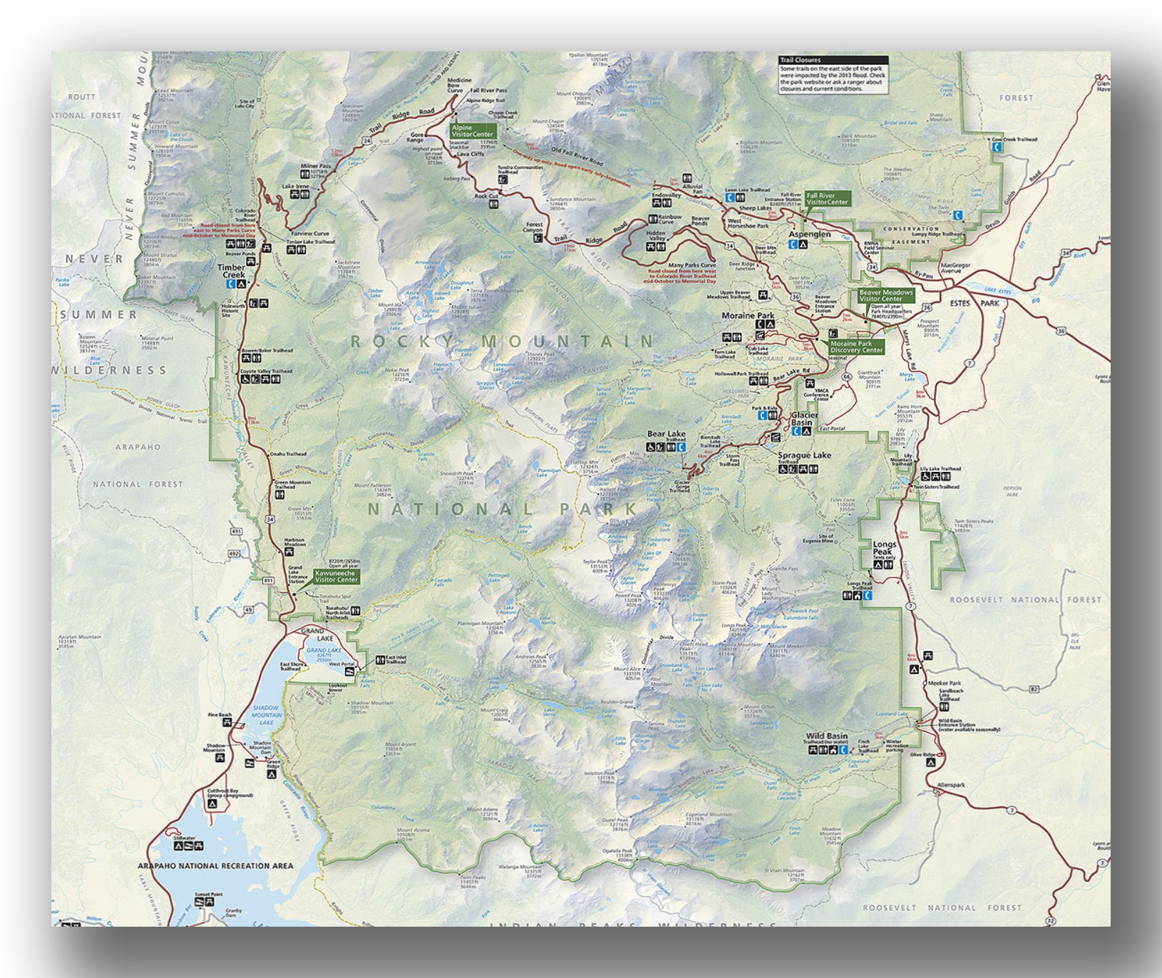
Rocky Mountain National Park map, courtesy of the National Park Service
MORAINE PARK, FALL RIVER AND BEAVER MEADOWS AREAS
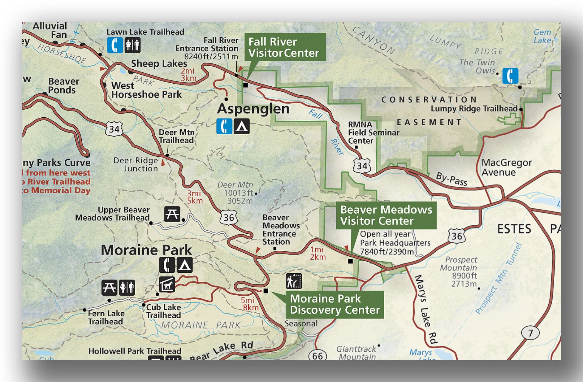
Moraine Park, Fall River and Beaver Meadows map, courtesy of the National Park Service
Most visitors to Rocky Mountain National Park come into the park via the east side that is closest to Estes Park, CO. There are two options for entering over here: the more popular Beaver Meadows entry, and the Fall River entry point. If you are coming in during a more crowded time of day, we recommend the Fall River entry station.
Many people skip this area in favor of driving Trail Ridge Road. While Trail Ridge Road is not something to miss, there is a ton to do in this part of the park.
Some recommendations in this part of the park include:
- Beaver Meadows Visitor Center. Designed by the architectural firm led by Frank Lloyd Right, the Beaver Meadows Visitor Center is a very impressive building even before you enter. Inside you’ll find an detailed 3D map, access to Rangers as well as a park film that plays every 30 minutes.
- Fall River Visitor Center. Near the Fall River entrance station, the Fall River Visitor Center has a few small exhibits. There is a store, and access to Rangers for information. If you are heading to one of the Visitor Centers, the Beaver Meadows Visitor Center is a bit more interesting, but this is worth going to as well if you have the time.
- Moraine Park Discovery Center. This is small center that is open during the summer and early fall. It was a few great exhibits as well as a nature trail. It’s about 1.5 miles from the Moraine Park Discovery Center. It was originally a lodge in the early 1900’s, but was purchased by the National Park Service in 1931.
-
Hiking. There are a ton of hikes to do in the park, and this area of the park is home to a few amazing hikes. Here are the ones that we recommend:
- The Deer Mountain Trail is a moderate, 5.9-mile (round-trip) hike that takes you into a valley before heading into a forest with switchbacks. At the top you get panoramic views! The climb is not particularly hard, though it is a nearly 1,500 feet change in elevation. The Deer Mountain Trail begins where Highways 34 and 36 meet.
- Take the Fern Lake Trail if you have a bit of time on your hands. This 7.3-mile (round-trip) trail gains about 1400 feet. It starts off by going through a forest, with a few openings that are great for wildflower viewing. About halfway through is a pool where the two rivers meet. Take a break here before continuing on to Fern Lake, which has great views of several area peaks. The trailhead is about 2.8 miles west of the Moraine Park Discovery Center.
- One of the harder hikes in the area is the Ypsilon Lake Trail. An 8.8-mile trek (round-trip), this challenging hike climbs 2400 feet along a tree-lined path. There are views of Long Peak along the way. At the end of the hike is Chipmunk Pond and Ypsilon Lake, where the views are incredible. Be advised that there may be snow on the trial or mud in the early summer. Access the trail by going 2.5 miles west of the Fall River Visitor Center at the Lawn Lake Trailhead.
- For an easier hike the Cub Lake Trail is a 4.8-mile (round-trip) hike that climbs just 700 feet. After hiking through meadows, the trail then heads uphill to Cub Lake. Again, there are amazing views. The trailhead for Cub Lake begins 1.9-miles west of the Moraine Park Discovery Center.
BEAR LAKE, SPRAGUE LAKE AND GLACIER BASIN AREAS
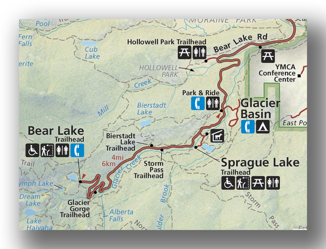
Bear Lake, Sprague Lake and Glacier Basin area map, courtesy of the National Park Service
The Bear Lake area is a very busy part of the park. In fact, in order to get a parking spot, you’ll need to get reservations and head here between the hours of 5 am and 6 am…no kidding! But there is good reason why visitors flock here-the amount of easily accessible breathtaking scenery is rarely matched by any other park in the United States.
If you are unable to reserve a spot to drive into the park (or unwilling to get up then!), then there is a free shuttle that operates to take you around the area from the Glacier Basin parking area.
While in the Bear Lake area, we recommend the following:
-
Hiking. Hiking is the “thing to do” in this part of the park, and there is a good variety of trails to visit (ranging from Easy to Hard). We recommend the following, though we have others covered in our itinerary as well:
- The most popular moderate trail in the area is the Emerald Lake Trail. This 3.2-mile (round-trip) hike heads up 600 feet in elevation as it traverses near Nymph Lake. It flattens out by Dream Lake and then ascends one more time up to Emerald Lake. Be ready-you will be awestruck by the scenery. This is incredible in the early morning as well as in the winter. The trailhead begins on the western end of the Bear Lake parking area. You can also just hike to Nymph Lake (1.0-mile, round-trip) or Dream Lake (2.1-mile, round-trip) if you don’t have the time or the energy to head to Emerald Lake.
- For a challenging hike, take the Sky Pond Trail. This 8.4-mile (round-trip) hike ascends 1680 feet and includes going by Alberta Falls, Loch Vale and then climbing more to Sky Pond. There is some scrambling, but the view is amazing. The Sky Pond Trail begins at the Glacier Gorge Trailhead, just before the Bear Lake Parking Lot. You can also just end the hike at the Loch, which cuts the hike to 5.7-miles (round-trip) with only 1000 feet of elevation gain.
- The popular Alberta Falls Trail is worth visiting as well. This 1.6-mile trail passes through aspen trees before opening up to a granite area with a 30-foot waterfall. Start on the Glacier Gorge Trailhead, just before the Bear Lake Parking area on Bear Lake Road.

- An easy and popular route is the Bear Lake Loop Trail. This 0.7-mile hike has little elevation gain and heads around Bear Lake. There are great mountain views, and if you get it on a calm day, there will be great reflections in the water. The Bear Lake Loop Trail begins on the western end of the Bear Lake Parking Lot.
- Finally, another hike is the Nymph, Dream and Emerald Lakes Trail combined with Lake Haiyaha and Alberta Falls. This 8.1-mile loop will take about 4 hours, but it hits all the main sights in the area in a loop trail. It climbs about 1250 feet. You can read all about it in our blog post, Hiking the Lake Haiyaha, Alberta Falls, Dream and Emerald Lake Loop. This shares the same trail as the Emerald Lake Trail, starting at the western end of the Bear Lake Parking area.

TRAIL RIDGE ROAD
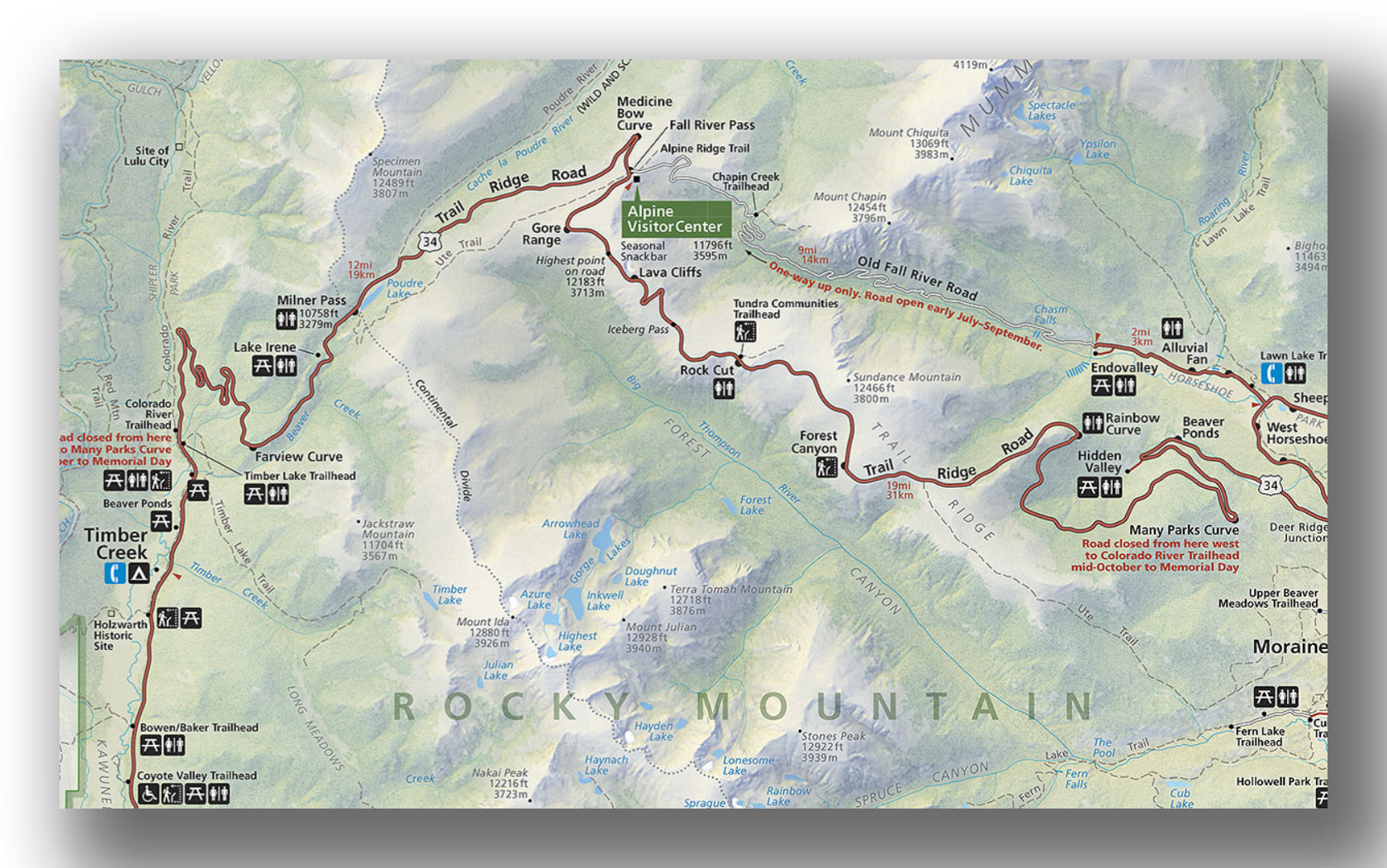
Trail Ridge Road map, courtesy of the National Park Service
The highest contiguous road in the United States, Trail Ridge Road will leave you speechless. The road covers 48 miles and hits an elevation of over 12,100 feet. Along the way you’ll see plenty of wildlife (elk and deer will be the main animals) and more stops than you can imagine. Plan on spending 2-6 hours driving this road. There are also a few notable stops along the way:
- Alpine Visitor Center. The highest visitor center in the National Park Service, this is a crowded spot but it’s worth checking it out and looking around. It has the only restaurant in the park. Be prepared for it to be cold, as well as windy up here!


- Old Fall River Road. Driving Trail Ridge Road is fairly easy. The road is wide, paved and well maintained. If you want a bit more of a “hair raising” experience, then take the Old Fall River Road (covered in detail in our blog). This 11-mile long, dirt, one-way road goes from near the Alluvial Fan to the Alpine Visitor Center. There are some great views, but this is without guardrails. If you are afraid of heights, then we recommend sticking to Trail Ridge Road both ways.


-
Hiking. There are a few good trails in particular along the way. Be advised that if you do hike in the park, you are at elevation, so take good care of yourself and drink plenty of fluids. Thie hikes we recommend are the following:
- Take the Lulu City Trail, which is a 7.6-mile hike (round-trip) that will take a good portion of the day. It’s not too challenging (820 feet of elevation gain), but it isa bit long. It heads to an old mining town, Lulu City. The only remaining structure is the log cabin. The trailhead starts just north of Timber Creek.
- The Alpine Ridge Trail is a short, 0.6-mile hike (round-trip) that is all rock stairs as it leads to the 12,005-foot summit. The wildflowers are great (when in bloom) and the views are fantastic. The Alpine Ridge Trail starts from the Alpine Visitor Center.

- The Tundra Communities Trail is another easy option. It’s 1.1-miles (round-trip) total and has only 160 feet of elevation gain. At the end of the trail there are some mushroom shaped rocks as well as a memorial for Ranger Toll, park superintendent from the 1920’s. The trailhead begins 4.1 miles east of the Alpine Visitor Center.
GRAND LAKE AND TIMBER CREEK AREAS
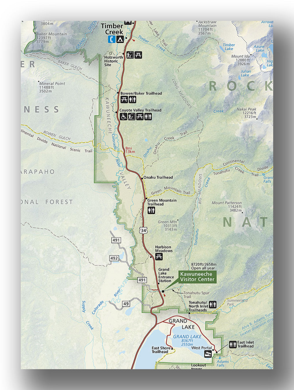
Grand Lake and Timber Creek area map, courtesy of the National Park Service
The southwestern part of Rocky Mountain National Park is a bit quieter than the Estes Park side. While there isn’t as many things to do, there is more than enough to keep you busy for a couple of days. Trail Ridge Road is also reached from this side of the park as well.
The stops we recommend include:
- Kawuneeche Visitor Center. This visitor center is open all year and is a great entry point into the park to learn about what there is to see and the latest road conditions. There is a park film and exhibits to check out.
-
HIking. Some good trails worth checking out include the following:
- The Cascade Falls Trail is a moderately challenging 7.4-mile (round-trip) hike. It can be a bit long for young kids, but it’s not too hard as it follows along a river before climbing into the mountains (650 feet elevation gain) and finally arrives at a waterfall. Moose frequent this trail. The trailhead begins at the North Inlet Trailhead on the north side of Grand Lake.
- The Adams Falls Trail is the most popular one in this part of the park. It is 0.8-miles (round-trip) and heads to Adams Falls with little elevation gain. The trailhead begins on the east side of Grand Lake.
- For something on the moderate side, the Green Mountain Trail is a good option and has minimal elevation gain. It’s 3.5-miles (round-trip) and heads though pine and aspen. There is a large meadow at the end with views all around. The trail begins 3 miles north of the Kawuneeche Visitor Center.
- The Coyote Valley Trail is an easy, very peaceful trail. At 1.0-mile (round-trip) it isn’t long, but you’ll travel along the Colorado River about 10 miles from where it starts (so it’s very small!). It is also wheelchair accessible. The trail begins 6.3-miles north of the Kawuneechee Visitor Center.


LONGS PEAK AND WILD BASIN AREAS
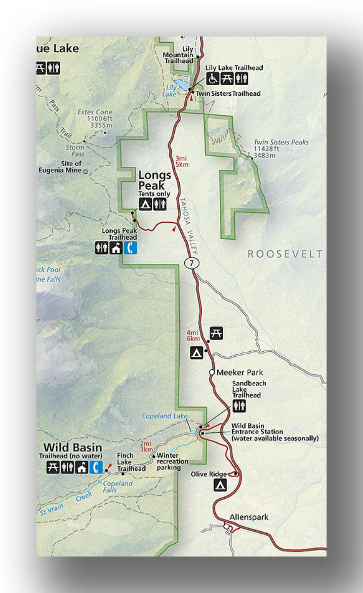
Longs Peak and Wild Basin area map, courtesy of the National Park Service
The Longs Peak and Wild Basin areas are a bit out of the way and not accessed by the main park entrances. However, they can still get busy, with the parking lots filling up by mid-morning.
-
Hiking. Hiking is the main activity over here, and there are plenty of options for all skill-levels:
- Ouzel Falls Trail is a moderate difficulty trail that is 5.2-miles (round-trip). The hike has an elevation gain of 900 feet as it heads past Copeland Falls and Calypso Cascades on the way to Ouzel Falls. This is a great trail and quite popular. The trail begins at the Wild Basin Ranger Station, 2.2 miles past the Wild Basin Entrance. You can also just head to Copeland Falls, which is an easy 0.6-mile hike.
- You should consider the Lilly Mountain Trail if you have a dog, as this is one of the few trails where they are allowed. It is pretty steep, and heads up 1250 feet on this 3.8-mile (round-trip) hike. The trailhead starts right before mile marker #6 as you head south of out Estes Park.
- The Twin Sister Peak Trail is a challenging 7.9-mile (round-trip) hike that heads up over 2400 feet in elevation. The last ½ mile is above the tree line, and you’ll be rewarded with great views of Longs Peak, which is over 14,000 feet high. The trailheads Starts at the Lily Lake Visitor Center.
- The moderately challenging Eugenia Mine Trail heads up 500 feet on this 2.8-mile (round-trip) hike. It ends at an old copper and gold mine site that was in operation between 1905 and 1912. The trailhead starts at the Longs Peak Ranger station.
HOW TO GET TO ROCKY MOUNTAIN NATIONAL PARK AND OTHER TRAVEL INFORMATION
Rocky Mountain National Park is situated just 90 minutes from Denver, Colorado. That means that you can fly into a major airport from anywhere in the United States (frequently with a direct flight) and be at the park later on in the afternoon without any issue. That also means that there will be crowds in the park, so picking the right entry point can be important.
- Most visitors come from the Greater Denver Area and enter through the east side of the park through the gateway town of Estes Park, CO. Directions from Denver, CO to Rocky Mountain National Park. This will take about 90 minutes without traffic, but you can expect to hit some when you leave Denver, CO and as you make your way through Estes Park, CO, so allow just over two hours.
- You may be coming from the west if you are also visiting the Utah Parks, so here are the directions from Grand Junction, CO to Rocky Mountain National Park (west entrance). This will take nearly 4 hours, but you can expect to have much less traffic.
Whatever route you take into the park, be prepared for amazing scenery.
WHERE TO STAY IN ROCKY MOUNTAIN NATIONAL PARK
Rocky Mountain National Park Lodging: There unfortunately isn’t in any lodging inside of Rocky Mountain National Park. The best options are to check out Estes Park, CO (which has a ton of lodging options) as well as Grand Lake, CO (on the western side of the park). Be sure to book reservations well in advance.
Camping in Rocky Mountain National Park: There are five campgrounds in Rocky Mountain National Park, with four of them suitable for RV’s and trailers.
BEST TIME TO VISIT ROCKY MOUNTAIN NATIONAL PARK
Rocky Mountain National Park is open all year-round, like most National Parks. However, since the park is so high, it tends to get a lot of snow and the weather in Rocky Mountain National Park can be quite cold. Also, Trail Ridge Road is only open between late-May and mid-October, so access to much of the park is limited.
Most visitors come between June and September, when temperatures are at warm (ish!), with highs in the mid to upper 70s. Nights can be cool, and generally into the 40’s even in the summer.
VISITING ROCKY MOUNTAIN NATIONAL PARK IN THE WINTER
Visiting Rocky Mountain National Park in the winter can be an amazing experience. The number of visitors in an average winter month is about 15% of the peak summer months. While much of the park is inaccessible, areas like Bear Lake are incredible and quite a special experience.
You should be sure you are prepared for the cold, as days do not get above 40 generally. The trails will be snow or ice covered, so be sure to wear snowshoes or micro spikes, even for short hikes.
ARE PETS ALLOWED IN ROCKY MOUNTAIN NATIONAL PARK?
- Pets are allowed in Rocky Mountain National Park, but only in parking areas and campgrounds. They are not permitted on trails. You also need to keep your pet on a leash.
RELATED INFORMATION ON ROCKY MOUNTAIN NATIONAL PARK FROM JUST GO TRAVEL STUDIOS
- Be sure to pick up our Rocky Mountain National Park Itinerary ahead of your trip!
- One of our favorite hikes in the park is covered in our blog, Hiking the Lake Haiyaha, Dream Lake, Emerald Lake and Alberta Falls Loop Trail in Rocky Mountain National Park. We also cover driving the Old Fall River Road in detail and the Best Hikes in Rocky Mountain National Park.
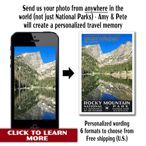
- After your visit to the park, send us a photo and we’ll create a custom, vintage travel poster. We promise you’ll be amazed!