Pacific Coast Highway - Los Angeles to San Francisco
Amy BrahanFor a look at some of California’s most dramatic stretches of coastline, take an exhilarating drive along California Highway 1, also commonly referred to as the Pacific Coast Highway (or even just “PCH”). Repeatedly rated one of the most scenic drives in the world, the Pacific Coast Highway runs between San Francisco and San Diego.
Since many people choose to drive between the two largest cities (Los Angeles and San Francisco), we decided to focus this blog on that route only. This scenic drive winds along the coast for about 400 miles and includes the opportunity to enjoy numerous seaside towns, sandy beaches, state parks and countless photo opportunities along the rugged coast.
Without stops and traffic, the drive would take about 10 hours. So, be sure to allow two to three days (or more!) to explore some of the amazing towns and sights along the way. Driving from south to north, here are some of the best stops and things to do on your Pacific Coast Highway road trip!
BEST STOPS ON A PACIFIC COAST HIGHWAY ROAD TRIP
We’ll provide more details on our coastal route and favorite stops (in bold), but there are many other great places along the way! Here’s a list of locations you may want to consider between LA and San Francisco (listed from south to north):
- Malibu—Visit Zuma Beach, Malibu Pier, Leo Carrillo State Park and Beach
- Ventura/Oxnard—Plan ahead and take a day trip to Channel Islands National Park
- Santa Barbara—Visit Stearns Wharf, Santa Barbara County Courthouse, Old Mission Santa Barbara and Arroyo Burro County Beach Park
- Solvang—Take this worthwhile detour for a taste of Denmark!
- Pismo Beach—Ride the dunes at Oceano Dunes State Vehicular Recreation Area, visit Pismo Beach Pier or stop at Monarch Butterfly Grove (between Oct. and Feb.)
- San Luis Obispo—Visit Avila Beach and “Bubblegum Alley” or hike Bishop Peak
- Los Osos—Visit Montana de Oro State Park
- San Simeon—Visit Hearst Castle, Piedras Blancas Light Station, and the Elephant Seal Vista Point
- Ragged Point (for amazing coastline views of Big Sur)
- Big Sur— Limekiln State Park, Julia Pfeiffer Burns State Park (McWay Falls), Pfeiffer Big Sur State Park (Pfeiifer Beach), Andrew Molera State Park, Point Sur State Historic Park/Point Sur Lighthouse, Bixby Bridge
- Garrapata State Park
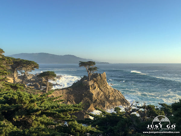
- Point Lobos State Natural Reserve
- Santa Cruz
- Pigeon Point Lighthouse
- Half Moon Bay
- San Francisco—Visit Golden Gate Park, Golden Gate Bridge, Alcatraz, Ghiradelli Square, Pier 39, Lombard Street, Presidio of San Francisco and ride the cable cars
OUR ROUTE—MORRO BAY TO MONTEREY
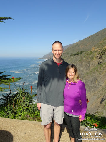
Our winding 120-mile journey up the California coast took us from Morro Bay north to Monterey. This scenic stretch of Route 1 includes a portion of the San Luis Obispo North Coast Byway as well as the Big Sur Coast Highway. Take in endless views of the crashing surf of the Pacific, rugged canyons and cliffsides, towering redwoods and windswept cypress trees.
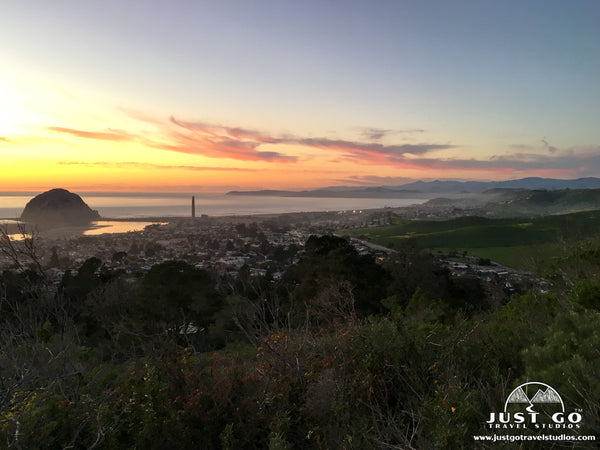
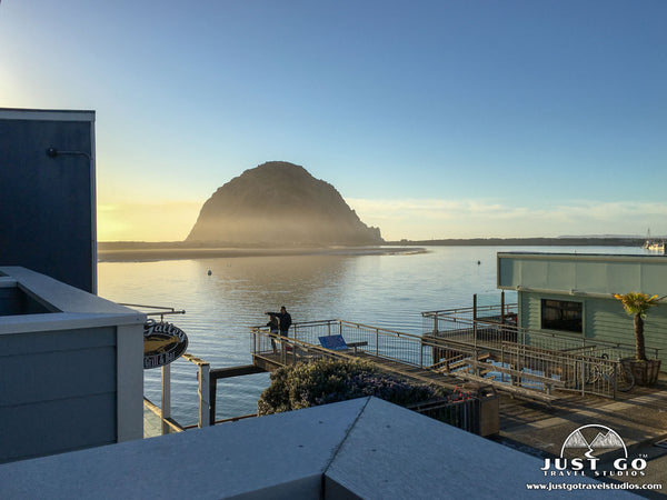
MORRO BAY
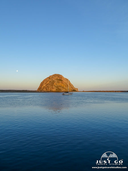
Whether just passing through or looking for a place to stay on a trip up the California’s Central Coast, be sure to stop in the quaint coastal town of Morro Bay. The town is best known for the enormous rock at the end of Morro Rock Beach that can be seen from miles away. Morro Rock is a volcanic plug formed 23 million years ago and is the last of the Nine Sisters, a chain of volcanic mountains and hills which extends from San Luis Obispo to Morro Bay. The rock is a State Historic Landmark and has been designated a bird sanctuary for the peregrine falcons and other species of birds that nest here.
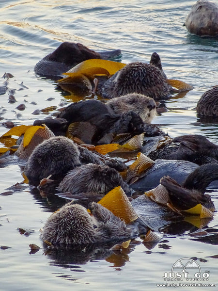
- Make sure to visit Morro Rock Beach to get up close to Morro Rock. We especially enjoyed watching sea otters play, sleep and feed in the kelp beds in the bay. [NOTE: You cannot walk or climb on the rock!]
- Stroll along waterfront and through the downtown area to check out the galleries and antique shops or satisfy your hunger for local eats!
- Take a kayaking adventure around the Morro Bay National Estuary.
- If you have more time, visit Morro Bay State Park which is home to a saltwater marsh, trails, lagoons and the Museum of Natural History, which features exhibits on Native American culture, geology and local wildlife. In the evening, head up to Black Hill and take a quick hike to enjoy stunning sunset views of Morro Bay!
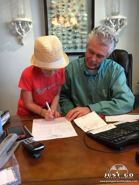
***Morro Bay Lodging recommendation: We stayed at the Anderson Inn in a deluxe room to accommodate our family. This small inn is right on the water, beautifully decorated, exceptionally clean and just amazing all-around! The owners are such great hosts and went out of their way to give us recommendations and make us all feel at home. If I visited again, I wouldn’t even consider staying anywhere else!
SAN SIMEON
San Simeon is located about halfway between Los Angeles and San Francisco on State Route 1. Although the town itself is small, it is home to one of the most popular tourist attractions along the California’s Central Coast, the Hearst Castle and an impressive elephant seal rookery.
- Book a guided tour at Hearst Castle. This hilltop mansion built by William Randolph Hearst in the early 20th century and is now a National Historic Landmark. Guided tours can be booked up to 60 days in advance. We didn’t visit Hearst Castle on our trip up the coast, but we hear both the castle and the gardens are impressive and worth the visit!
 Hearst Castle, courtesy of Teogeorge
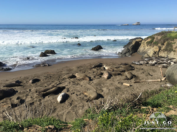
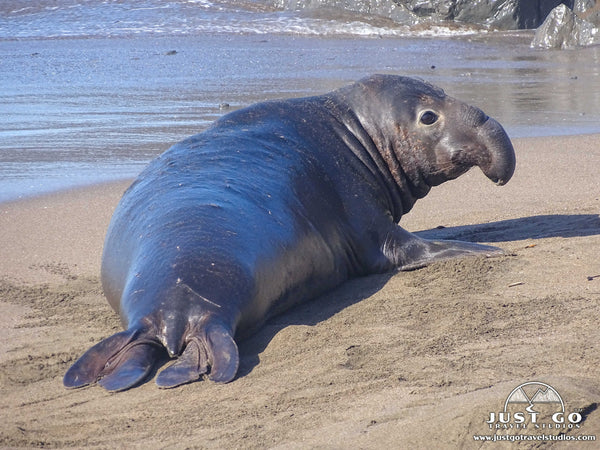
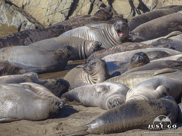
- Stop at the Piedras Blancas elephant seal rookery just 5 miles north of San Simeon on Highway 1 (listed as Elephant Seal Vista Point on Google maps). The viewing areas are free, wheel-chair accessible and open year-round. At times, thousands of elephant seals can be seen on the beach. Northern elephant seals spend most of their time in the open ocean but migrate twice a year to a land-based rookery for giving birth, breeding, molting and rest.
- If you have more time, visit the Piedras Blancas Light Station (book a guided tour for access to the light station grounds) or the William Randolph Hearst Memorial Beach.
RAGGED POINT
The Ragged Point Overlook (about 15 miles from San Simeon) is a must-see and should be your first stop on your drive north on the Big Sur Coast Highway. The viewing platform is often called the “Million Dollar View” and provides expansive views of the stunning Big Sur coastline. Ragged Point is known as the gateway to Big Sur and offers lodging, dining, a convenience store and a gas station. Be sure to fill up if your tank is running low since there aren’t any other options until you get to Carmel.
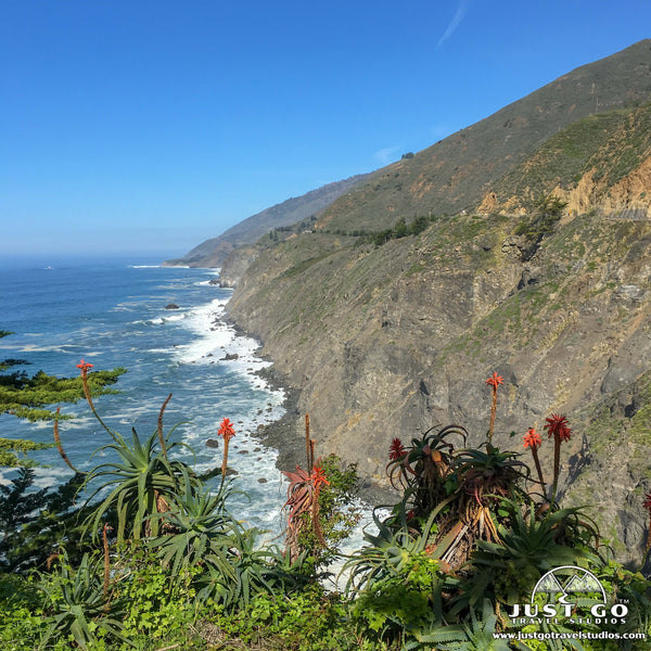
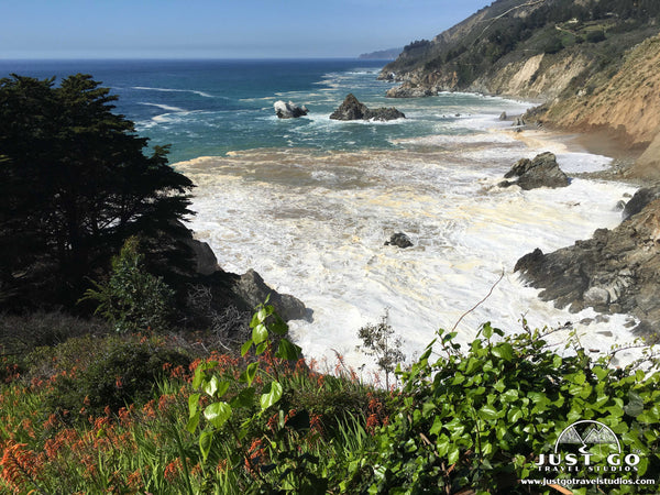
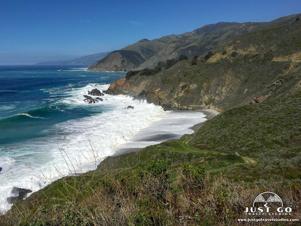
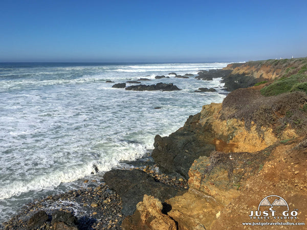
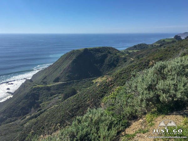
BIG SUR
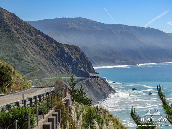
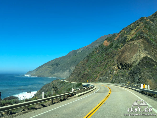
Big Sur is a region that stretches along about 90 miles of rugged and mountainous coastline between San Simeon and the Carmel Highlands. Big Sur Coast Highway winds north past the Santa Lucia range, through redwood forests and along towering seaside cliffs. The area is sparsely populated and offers few services, but the dramatic scenery and recreational opportunities afforded by state parks in Big Sur make this a popular tourist destination. Plan to spend at least a few hours exploring the Big Sur area or stay a few days! There’s plenty to see and do!
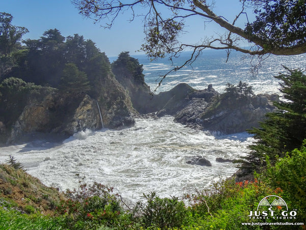
- Make sure to visit Julia Pfeiffer Burns State Park and hike the short Waterfall Overlook Trail to view the dramatic McWay Falls. One of only two tide falls in California, McWay Falls drops 80 feet from the cliffs into the Pacific Ocean. The trail ends at the falls overlook and there is no access to the falls or beach below (trespassing is strictly prohibited). The overlook is also a great spot to watch migrating gray whales certain times of the year. See the website for more information on Julia Pfeiifer Burns State Park day use.
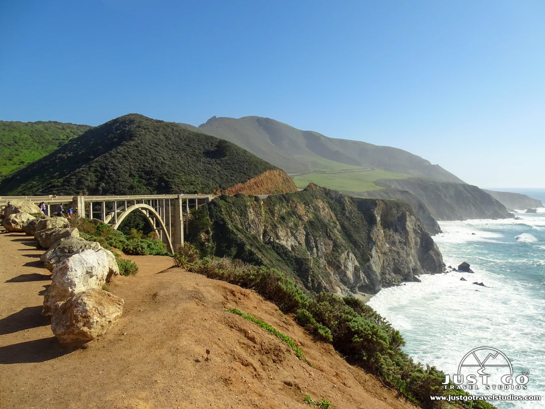
- Photograph the Bixby Bridge, one of the most photographed spots along this stretch of the Pacific Coast Highway. The Bixby Bridge is a single-span concrete arch that spans the Bixby Creek. There are a couple popular places to stop to get a great photo. One is a turnout at the top of hill with a distant view of the Bixby Bridge. The second spot is the turnout just north of the bridge to view the bridge looking south on the ocean side of the road. Due to the overwhelming popularity of this spot, please be a respectful tourist in this area and remember the ‘leave no trace’ principles. Avoid trampling wildflowers on the side of the road, leaving trash behind or standing in the middle of the road to get the perfect Instagram shot.

- If you are looking for a great place to camp, check out Pfeiffer Big Sur State Park. The campground makes a great base camp from which to explore the Big Sur area and, with its location along the Big Sur River, is popular for cooling off during the summer months. Day use areas provide access to picnic areas and hiking trails which include the hike up to Pfeiffer Falls.
- If you are looking for a great beach, check out Pfeiffer Beach, best known for its purple sand and stunning rock formations. Although it is a bit off the beaten path, we hear it is worth a stop!
- If you have more time, take a tour at Point Sur State Historic Park and Point Sur Lighthouse. (NOTE: Due to bridge repairs at Point Sur, there are currently no tours. According to the website, repair is expected to be complete late fall of 2019).
NOTE: Big Sur Coast Highway and other sections of Highway 1 have been closed numerous times due to landslides caused by heavy rains. Be sure to check highway conditions before your visit!
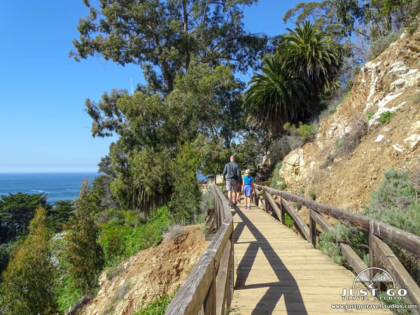
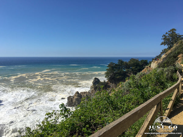
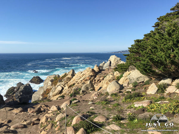
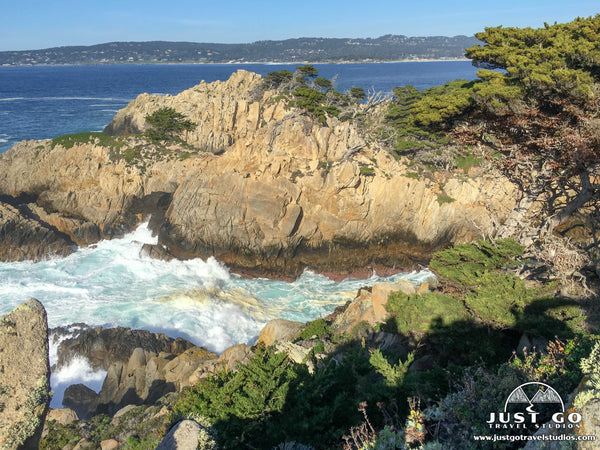
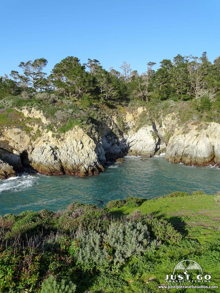
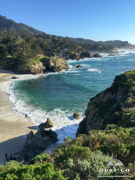
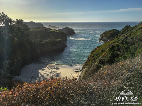
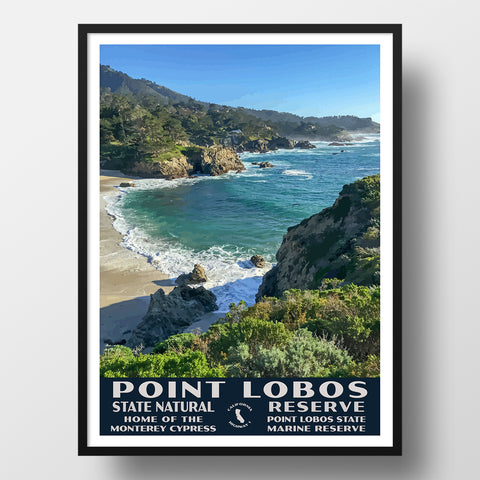
POINT LOBOS STATE NATURAL RESERVE
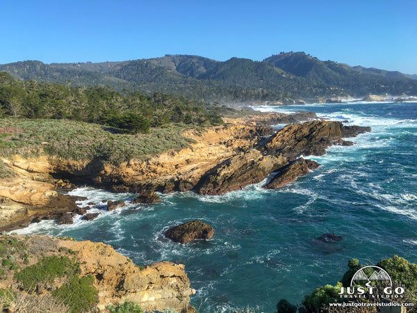
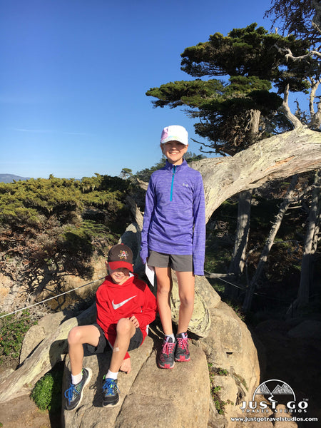
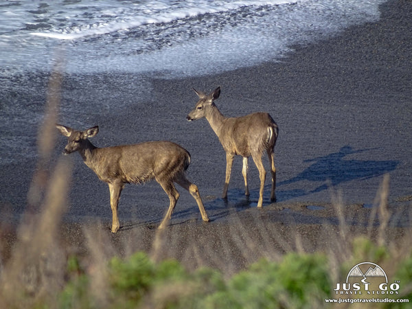
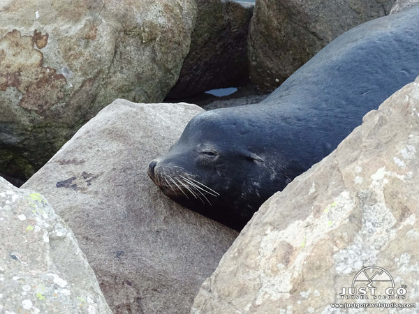
- Explore the Cypress Grove Trail (0.8 miles). If you only have time for a couple short trails, this is one you should not miss! Enjoy amazing views of the rugged coastline, crashing waves and rocky offshore islands. In addition, you also get to walk through a grove of rare Monterey cypress trees! Sea lions and sea otters are commonly seen here; and, in season, you may also spot migrating whales. We were surprised to witness a few deer playing in the surf! Access the Cypress Grove Trail via the Sea Lion Point parking lot.
 The Bird Island Trail (0.8 miles) is another stunning trail in the reserve. Walk this easy trail to see the blue-green waters of China Cove, pristine Gibson Beach and Bird Island. Park at the Bird Island parking lot at the far end of the park (south).

NOTE: Point Lobos is open year-round but gets very crowded during the summer months and on holiday weekends. Parking is limited in the park to 150 vehicles so be prepared to park on the shoulder of the highway and walk in if you arrive later in the morning or mid-day. Best bet for parking and crowds is to arrive before 9:30 AM or after 3 PM. The Vehicle entrance fee for a passenger car is $10. See the Point Lobos Foundation website for more details. Dogs are not allowed in Point Lobos since it is a natural reserve, not a park.
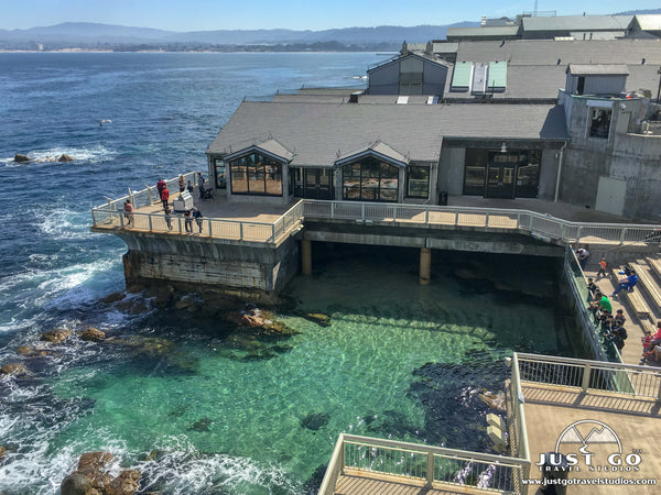
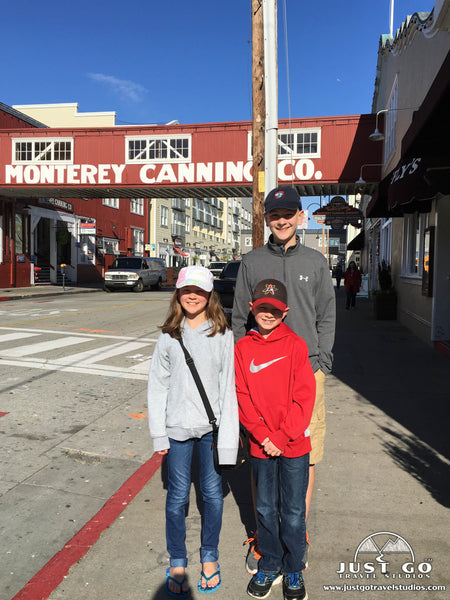
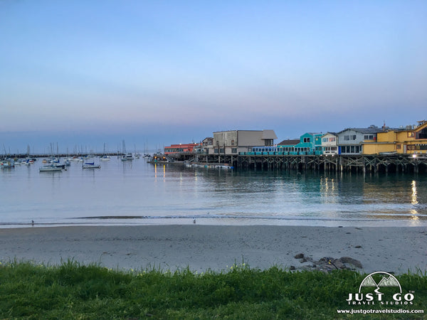
MONTEREY PENINSULA
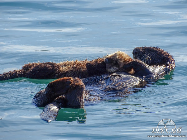
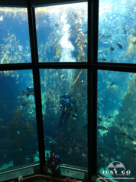
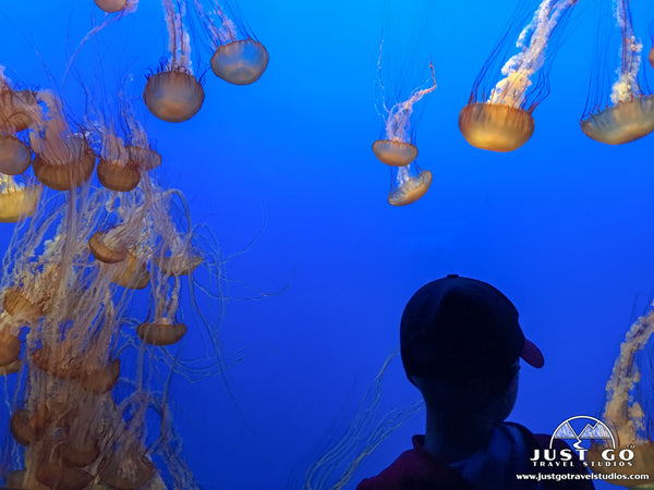
The Monterey Peninsula is located on the central California coast and included the towns of Carmel-by-the-Sea, Pacific Grove and Monterey, plus unincorporated areas of Monterey County that include the resort and community of Pebble Beach. Monterey is best known for its cannery history and its diverse and abundant marine wildlife, including sea otters, harbor seals, sea lions and pelicans.
However, did you know Monterey was also the site of some of California’s firsts (theater, public building and library, printing press and newspaper and publicly funded school)? Monterey is a family-friendly city and there are loads of great things to do and see in the area. So, be sure to allow at least a couple days to explore the Monterey Peninsula.
TRAVEL TIPS FOR A PACIFIC COAST HIGHWAY ROAD TRIP
A road trip along the California coast is enjoyable year-round due to the temperate climate. However, the weather varies by season as do the crowds. Generally, the further south you are, the milder the weather.
We traveled up Pacific Coast Highway in February, which worked well for us. However, winter storms can bring rainy weather that commonly causes landslides and road closures on this specific stretch of the Pacific Coast Highway. It is best to keep an eye on the weather and current road conditions, especially when planning a winter road trip.
In the summertime, wildflowers put on a stunning display, but morning and evening fog are common along the coast. Summer also tends to be the busiest time along the coast, so hotel prices are at their highest and traffic is common. Fall and early spring are probably the best times for a coastal road trip. Fall is a great time to drive the Pacific Coast Highway because days are typically mild and sunny, and the summer crowds have died down.
Early spring (April) is also a great time to go because the coastal grasses and rolling hills are still green. In May and June, coastal clouds may remain all day giving way to some hazy afternoon sunshine—a period known to our California family and locals as ‘May Gray’ and ‘June Gloom’.
No matter when you decide to go, be prepared for wind and damp weather. Bring rain jackets/wind breakers and clothing you can layer since coastal weather varies throughout the day. Morning fog, which is common in the summertime, tends to clear up mid-day, but it is helpful to have a warm/dry outer layer.
I am sure this probably goes without saying but pack a camera! You are going to need it for this drive. Binoculars are great to have for spotting migrating whales and other marine life resting on the beaches below or offshore rocks.
There is a day-use fee of $10 associated with most California State Parks. However, your entrance fee allows access to all California state parks until sundown on the same day.
Some recommend traveling north to south for easier access to outlooks. However, the person on the passenger side of the car is in for a heck of a ride, since they’ll be closer to the cliff’s edge in many places! We traveled south to north since we were visiting family in southern California; and, on the day of our travel, the skies were clear to the north with hazy sunshine to the south. So, we were glad to avoid driving into the sun and glare.
Most importantly, the route is winding and narrow with some steep drop-offs; so be sure to stay alert at all times. Note that portions of the Pacific Coast Highway are not ideal for RVS and oversized vehicles due to the nature of the road.
Have you taken a road trip along the Pacific Coast Highway? If so, tell us about your favorite stops along the California coast and any interesting experiences or travel tips! If you are planning a trip, feel free to ask us any questions about our trip and stops. Happy road tripping!
RELATED INFORMATION FROM JUST GO TRAVEL STUDIOS
- California is full of scenic places to visit that really are awe-inspiring. We’ve written quite a few blogs on California, and only started to scratch the surface of what you can find there. However, be sure to check back frequently on our ever-growing list of blogs on California, as we add one about each month (and other places in the United States and Canada at least once per week).
- Some of our favorite spots to visit nearby this part of the California Coast include Muir Woods National Monument, the Marin Headlands, Channel Islands National Park and Pinnacles National Park. Be sure to check out these amazing places as well!
- We have a large selection of WPA style posters from beautiful places all over the United States and Canada, so be sure to check them out!
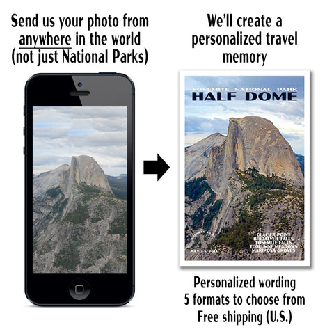
- Our most popular product is our unique, custom, vintage-style travel posters. You can send us a photo from anywhere in the world, and we’ll turn it into a one-of-a-kind memory of your vacation. We’d love to work with you!