Hiking the Ryan Mountain Trail in Joshua Tree National Park
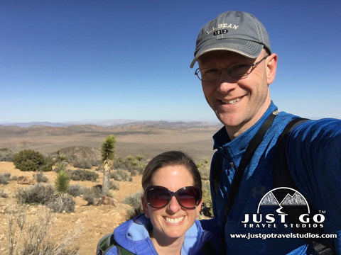
Peter BrahanThere are many hikes in Joshua Tree National Park and sorting through the “must dos” can be challenging. The Ryan Mountain Trail is one of these trails that should not be missed, and after hiking it you won’t have any doubt that it truly is one of the Best Hikes in Joshua Tree.
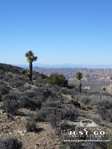
This hike, which is located in the western part of the park, provides a route to the top of Ryan Mountain, awarding those willing to take the challenge with 360-degree panoramic views of the entire park and beyond. Though the exposed trail is a bit challenging to summit on a hot day, it is highly recommended for those who have the time and energy to take it on!
RYAN MOUNTAIN TRAIL DETAILS
- Difficulty: Moderate to hard
- Distance: 4.0 miles (round-trip)
- Trail: Out-and-back
- Elevation gain: 1,409 feet
- Peak elevation reached: 5,468 feet
- Best time of year to hike: Fall through early spring
- To beat the crowds: Arrive before 8:30 am or after 4:00 pm
- Footwear: Sneakers
- Watch out for: Sun exposure
- Restrooms: Located at the trailhead, but not on the trail
- Pets: Not allowed
- Time needed: 2 hours
The Ryan Mountain Trail is one of many hikes and sightseeing activities covered in our 12+ page itinerary for Joshua Tree National Park.
PARKING AND TRAILHEAD FOR THE RYAN MOUNTAIN TRAIL
To access the trail, park at the Ryan Mountain trailhead parking lot, located on Park Boulevard approximately 8.2 mi west of the intersection with Pinto Basin Road and about 12.6 miles east of the park’s western entrance. You should allow about 25 minutes from the Oasis Visitor Center, and slightly less if coming from the western entrance.

Ryan Mountain Trailhead Parking from the National Park Service
Parking is dedicated to this hike and there are just over 50 spots available, depending on the number of campers and larger vehicles present. As this hike is popular, you should be prepared for the lot to be busy and potentially full. You should be able to find a spot if you arrive to the hike early in the day or in the late afternoon. If not, just be patient and a hiker coming off the trail should vacate a spot every 5 to 10 minutes.
Pit toilets are available at the trailhead, and they were very clean and in good repair.
THE HIKE UP RYAN MOUNTAIN
As you stand looking south (which is likely the direction you parked your car), the trailhead starts from the left side of the lot. Immediately after starting out on this hike, you head due south, and remain going in this direction for the entire trek.
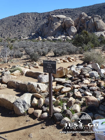
Shortly after starting the hike (about 0.2 miles in), you’ll see another trail intersecting the Ryan Mountain Trail. This is the Sheep Pass Connector Trail, which originates from the Sheep Pass Campground (about 0.8 miles to the east). These trails stay together all the way up to the top of the mountain.
After the intersection, the dirt trail heads steadily uphill. Those that engineered this trail really took care to make the climb even over the length of the hike and did so while maintaining a fairly direct route to the top.
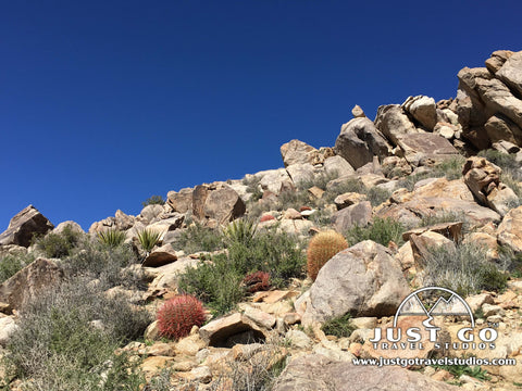
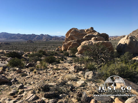
While you are heading up, take time to look around. The rock formations nearby are amazing to see.

The trail is very well maintained. Even though you are climbing up a mountain, sturdy hiking shoes are adequate for this hike. We kept the hiking boots in the car and were more than happy with our decision.
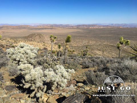
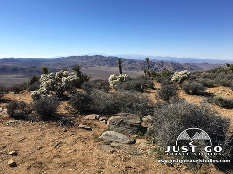
Like other hikes in Joshua Tree, it may appear to be barren and without life, but if you look around you'll be able to see plenty of life, like these barrel cactus, which dot the landscape (in addition to Joshua Trees, of course!).
As you get close to the top, the trail winds slightly before you finish climbing nearly 1100 feet since the start of the trail. At this point, you’ve likely been hiking for over an hour and will be ready for a break at the top!
RYAN MOUNTAIN PEAK AND THE RETURN TRIP
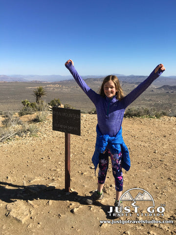
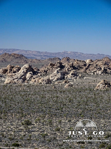
At the top of the mountain, you’ll have great 360-degree views all around you. If you are lucky enough to come on a clear and smog-free day, you’ll be able to see the San Bernardino Mountains to the west and all the way into Arizona to the east. We found it incredible that even though we were in the middle of the desert, we could see snow on the nearby mountains!
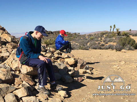
The top can be busy, but it was large enough to accommodate all the hikers when we went and still allow everyone plenty of space. Depending on the weather, you can also expect to have quite a bit of wind while you are enjoying the views and refueling.
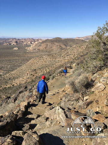
We really liked the hike back down immensely. Of course, the easier walk was nice and went pretty fast. However, the best part was that we had the sun at our backs, which made the views to the north very clear and highlighted the colors of the desert. Make sure you take time to stop and enjoy the views on the way down but be careful to watch your step and not get complacent with your footing!
FINAL THOUGHTS
- This trail is rated as “strenuous” by the National Park Service. The hike is not that difficult at all-the rate of elevation gain is modest compared to many other “moderate” trails in the National Park System. However, what makes this hike difficult is the constant sun exposure (surprise-there is no shade in the desert!) together with the potential for blistering temperatures. If you are not prepared, the combination of the beating sun and the steady incline will prove to be too much to handle. To counteract this, we recommend carrying twice as much water as you think you need (2 liters for this hike is a good amount, even in the wintertime as it can be very dry), plenty of sunblock and allow plenty of time for the hike. You should also make sure you wear a hat.
- For carrying water, we recommend the Platypus pack. While similar to other water packs, this bag can be used with any backpack and is easy to clean. Another great option is this bottle by CamelBak.
- If you can, we recommend taking this hike earlier in the morning or in the later afternoon. This will provide the best views as well as the most moderate temperatures. Other hikes to do in the middle of the day include short ones like the Cholla Cactus Garden. The Hidden Valley hike, which is nearby, is also a great walk and is has some shady spots!
FURTHER JOSHUA TREE NATIONAL PARK INFORMATION FROM JUST GO TRAVEL STUDIOS
- There is a ton to do in Joshua Tree, and the Ryan Mountain Trail is just one of the places we cover in our 12+ page itinerary for Joshua Tree National Park. Our itineraries cover great hikes, places to stay, what to pack and what to do while you are in the area. We also rank each hike based on hundreds of ratings to take away the guesswork of how to spend your time while you are in the park.
- We cover this and many other great hikes in our blog on the Best Hikes in Joshua Tree National Park.
- Another great hike to take in Joshua Tree is reviewed in our blog, Hiking the Fortynine Palms Oasis Trail as well as the short and quick hike in the Cholla Cactus Garden, the Barker Dam Nature Trail or the Hidden Valley Trail.
- For a broad overview of what we did while we were in Joshua Tree, see our extensive blog post on Joshua Tree National Park. We discuss many more of the hikes and places to see while visiting the park. We also have a blog that covers the numerous campgrounds in Joshua Tree National Park.
- Be sure to check out nearby Keys View if you finish hiking within an hour of sunset. The views from here are amazing!
- We’ll work with you to create custom, vintage-style posters, postcards and note cards from your own photos, including those of Big Bend National Park. Check out our process!

OTHER USEFUL LINKS INFORMATION ON JOSHUA TREE NATIONAL PARK
- We always use the National Park Service’s page on Joshua Tree for up-to-the minute information on events and warnings that might be active while in the park.