8 Best Day Hikes in Joshua Tree National Park: Trail Maps, Directions & More
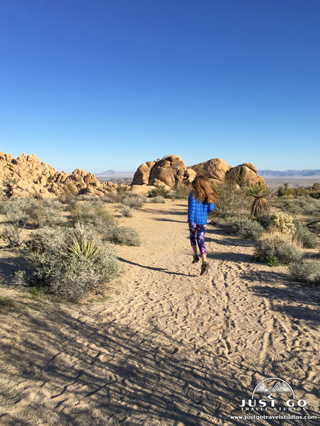
Peter BrahanThere are plenty of phenomenal choices when trying to select the best hikes in Joshua Tree National Park. Though this park is well known for its world-class rock climbing, the park’s hiking trails are also amazing. If you live in southern California, it’s likely that you’re only a few hours from this outdoor wonderland. Even if you can only spare a day, we’re certain you’ll enjoy any of the hikes we have selected in this guide.
While Joshua Tree National Park has a mix of rocky boulders and mountainous climbs, it also has plenty of hikes that are great for those just looking for a quick stroll through breathtaking scenery with minimal elevation gain.
Regardless of your skill level, we invite you to explore one of these great hikes in Joshua Tree National Park!
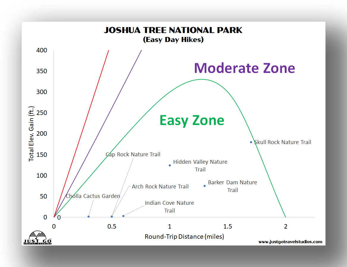
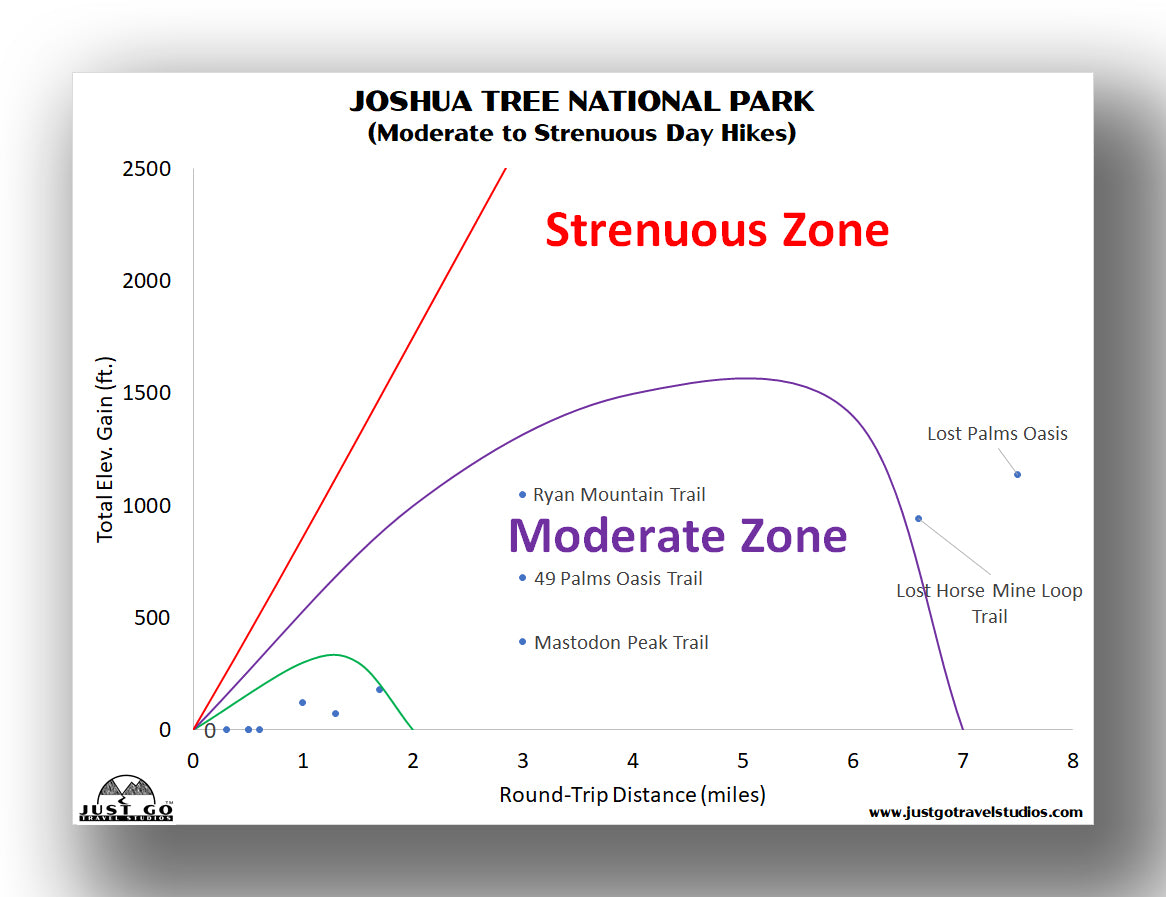
JOSHUA TREE NATIONAL PARK HIKING: DISTANCES AND ELEVATION GAIN
It’s hard to pick which hike is right for you. If you have any doubts about your abilities, we recommend starting with one of the easier hikes to make sure you can handle the elements when you are out on the trail. It can be cold in the winter and extraordinarily hot in the summer!
The charts below may really help you with answering which hike is right for you, as well as the details in the rest of this article.
For easy day hikes, this chart will be useful.
If you are interested in moderate or strenuous hikes, then you can refer to the chart below.
BEST HIKES IN JOSHUA TREE NATIONAL PARK: TRAIL DESCRIPTIONS AND TRAIL MAPS
RYAN MOUNTAIN TRAIL
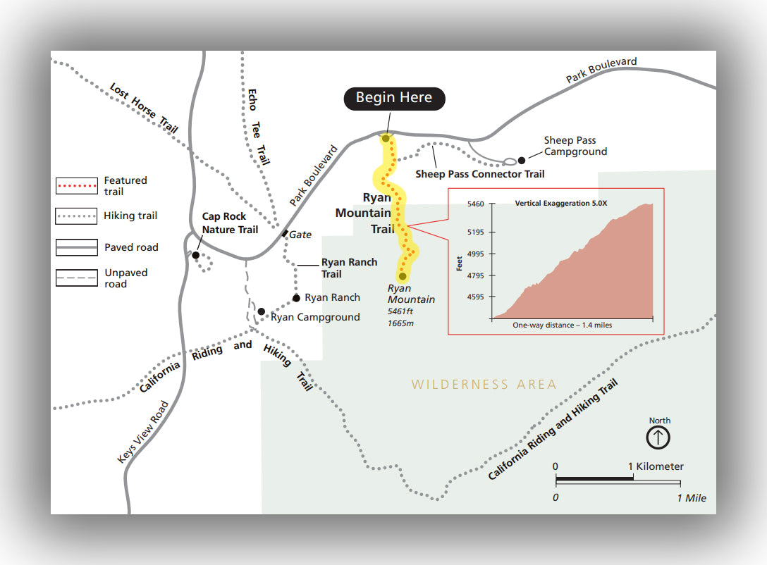
Ryan Mountain Trail map, courtesy of the National Park Service
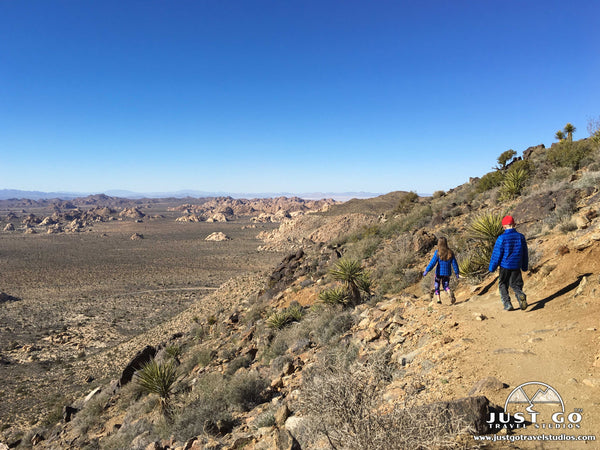
The Ryan Mountain Trail is frequently regarded as the best hike in Joshua Tree National Park. The views are impressive for the entire hike, but the views from the top are unlike any other offered in the park. This 3.0-mile (round-trip) hike is rated as challenging. While that rating may be off-putting to many casual day-hikers, the trail is mainly rated that way due to the steady climb (of just over 1,000 feet total) and its complete lack of shade.
The dirt trail winds its way up Ryan Mountain to a peak that is at 5,468 feet. From the peak, as long as the view is clear you’ll have a great view of the San Bernardino Mountains and potentially be able to see all the way into Arizona!
The Ryan Mountain Trail starts from the Ryan Mountain trailhead, which is located on Park Boulevard and is about 8.2 mi west of the intersection with Pinto Basin Road.
Hike option: The Ryan Mountain Trail intersects with the Sheep Pass Connector Trail about 0.2 miles into the hike. This trail originates at the Sheep Pass Campground, about 0.8 miles to the east from the Ryan Mountain Trail.
49 PALMS OASIS TRAIL
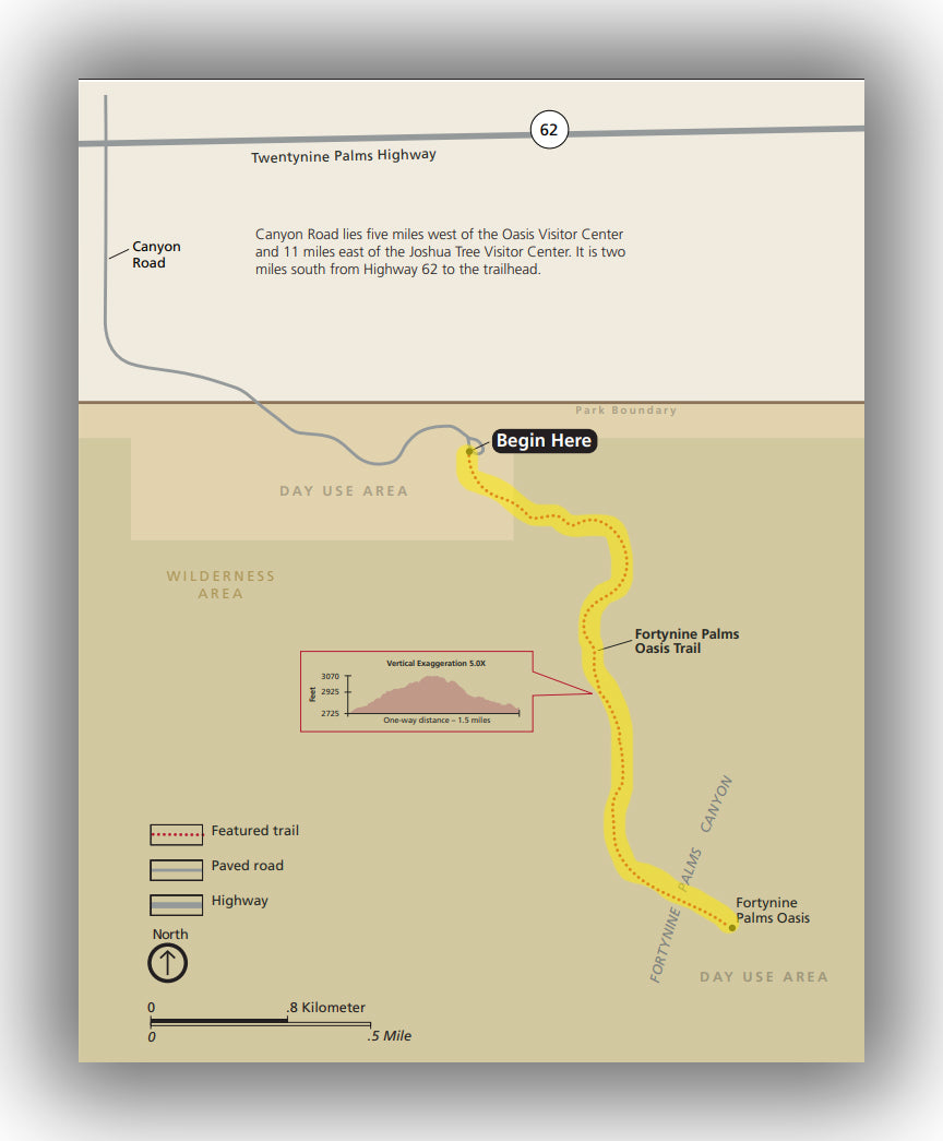
Fortynine Palms Oasis Trail map, courtesy of the National Park Service
If you like to be surprised by what you find at the end of a hike, then check out the Fortynine Palms Oasis Trail. This hike is accessed by traveling outside the main area of the park. Because it is not on the main park road, it is a bit more lightly traveled. However, we found this to be one of the most interesting trails in the park, and our family has never stopped talking about it ever since we left.
This moderate trail is about 3.0 miles long (round-trip) and climbs a total of 600 feet. The elevation gain is a bit different than most hikes, though, as instead of climbing up one way and heading down the other way, the trail is more of a “speed bump” in that the trail goes up 300 feet on the way out before descending 300 feet to the oasis. The climb is quite easy, though, and was more than doable for our kids who were 13, 11 and 9 and essentially ran up the incline even though it was their second hike of the morning!
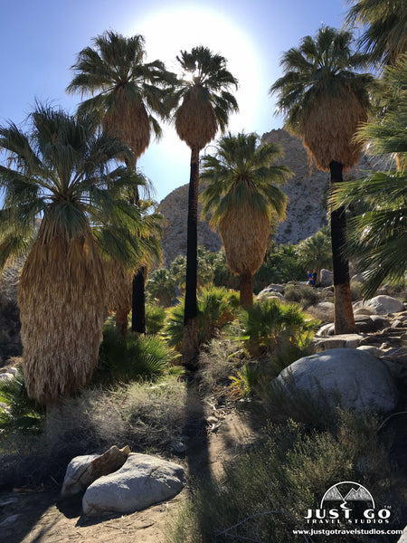
Along the way, there are plenty of interesting plants (and the occasional sun-bathing animal) as well as views of the Morengo Valley.
The oasis is fed from an underground spring that used to be used by local miners as a watering hole. This has resulted in a great place for numerous fan palms to grow. These palms provide great shade, which is pretty rare in Joshua Tree!
The 49 Palms Oasis Trail located on Canyon Road. This connects to Highway 62 and is between the North and West Entrance Stations. It doesn’t require a park entrance fee to hike this trail either, which is nice if you are just passing through.
BARKER DAM NATURE TRAIL
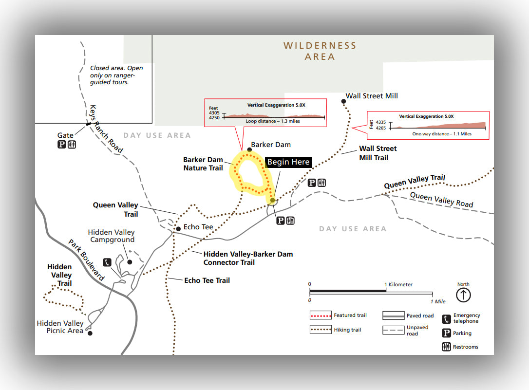
Barker Dam Nature Trail map, courtesy of the National Park Service
As one of the easier trails in the park, the Barker Dam Nature Trail definitely deserves a position as one of the best hikes in Joshua Tree National Park. This 1.3-mile loop (total) climbs only about 75 feet over the entire distance.
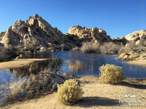
After stepping through a hallway of rocks, the trail opens up and you’ll find yourself walking amidst Joshua Trees. After only about 0.6 miles, the trail happens on an unlikely find-a small body of water created many years ago by local ranchers as a watering hole for cattle. True to the trails name, a dam is what holds the water in.
The blue water against the backdrop of the beige rocks is a photographer’s dream.
If you continue clockwise, the trail makes a loop back to the parking area. This side of the loop includes additional Joshua Trees as well as ancient petroglyphs.
The Barker Dam Nature Trail starts from Big Horn Pass Road, which is about 9 miles west of the intersection of Park Boulevard and Pinto Basin Road.
Hike option: The trail can be shortened to 1.2 miles by just hiking out and back from the dam. There is a small amount of shade on this path, making the hike a bit cooler than if you venture and do the full loop. There are also a number connecting trails, so be sure to watch closely and not take a wrong turn on the way back if you take the entire loop.
KEYS VIEW
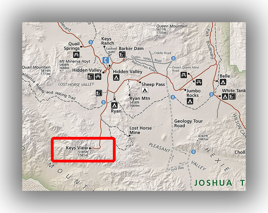
Map of Keys View, courtesy of the National Park Service
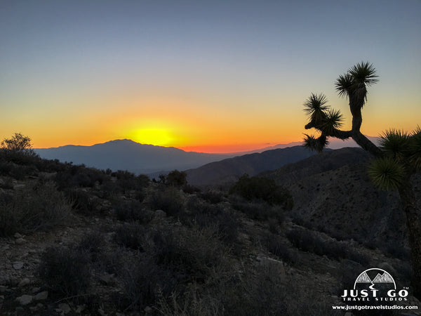
While calling Keys View a hike may be a bit of a stretch, this short (0.2-mile) trail is worth putting on your list of trails to take while you are in Joshua Tree. Keys View is best known for being an amazing place to watch sunsets, but at any time of day this trail is worth checking out for terrific panoramas.
This paved route is wheelchair accessible and leads to a viewpoint of the Coachella Valley and Palm Desert. You can see a number of cities nearby as well, and even the Salton Sea on a clear day.
If you do happen to come here to see sunset, be sure to arrive well before sunset to get a spot.
Keys View is located at the end of Keys View Road, which is about 30 minutes from the main entrance station and visitor center.
Hike option: If you are feeling up for a longer trail, Inspiration Peak can be reached from Keys View by taking a 1.9-mile trail up over 600 feet. From here you’ll find plenty of views without many people, but be sure to bring a headlamp if you end up venturing out here for sunset as you’ll need it to get back safely.
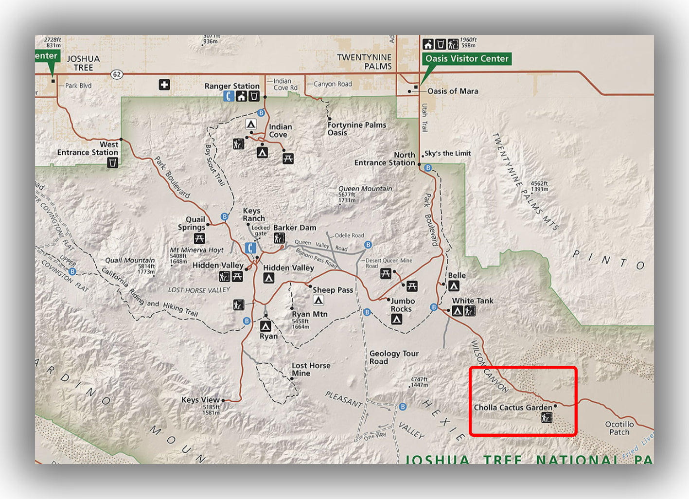
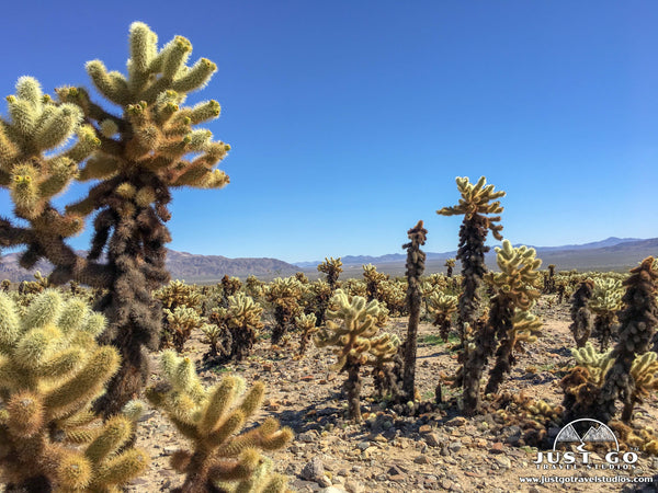
CHOLLA CACTUS GARDEN TRAIL
Map of the Cholla Cactus Garden Trail, courtesy of the National Park Service
The Cholla Cactus Garden Trail is yet another short hike through a unique landscape in Joshua Tree. This 0.3-mile, easy trail heads through part of a 10 acre stand of Teddybear Cholla Cactus. Without any elevation gain, this trail is great for families with kids.
The trail winds its way briefly through the naturally occurring “garden” before it loops around to the beginning. The main attraction of this hike are the cacti themselves. While not living up to their namesake as being “Teddybear like”, they do look very unique and certainly will captivate you for the 20 minutes or so it takes to do the walk.
Make sure you are careful on the hike, though, as these cacti have a tendency to attach to anything that comes within its reach! Attaching onto passersby (usually animals) is the main way this cactus reproduces. This means that you’ll have to really keep an eye on your kids and backpacks as you navigate your way through the maze of cactus.
The plants also flower in the spring as well, making for great beauty but also the presence of bees. Don’t worry, though, as the bees tend to stay very busy with the flowers!
The Cholla Cactus Garden is located 9.8 miles east of where Pinto Basin Road meets with Park Boulevard. It is on Pinto Basin Road.
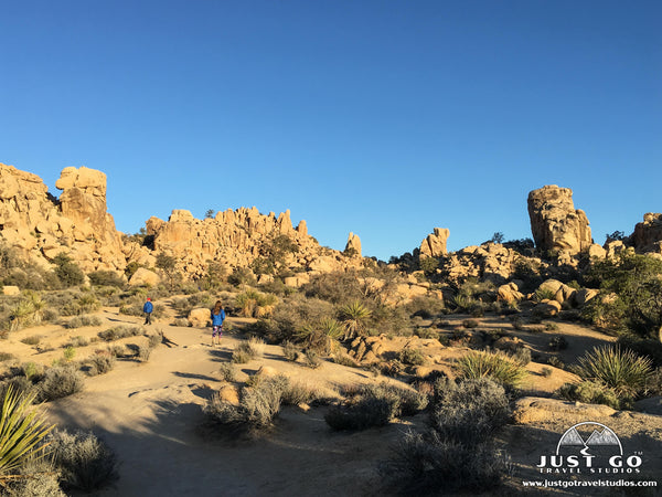
HIDDEN VALLEY NATURE TRAIL
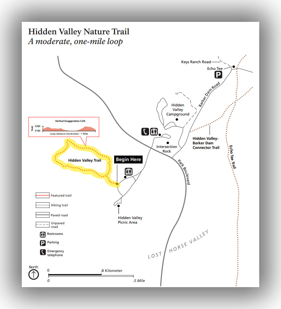
There are a ton of interesting boulder formations that are throughout the park, and the Hidden Valley Nature Trail brings hikers right in the middle of a cluster of rocks. This 1.0-mile trail gains only about 120 feet as you hike around the enclosed rock formations.
This trail is not overly well marked, but there are small signs along the way to help inform you of interesting facts about the trail and the area’s history.
Though there isn’t any water on this trail, it does showcase most of the interesting aspects of Joshua Tree National Park. It is also in a great location, as it is near a picnic area and other great trails such as the Barker Dam Trail. If you only have one trail to do in the park, we recommend this one for its variety and short distance. It is also a great trail to take in the evening if you are staying at the nearby Hidden Valley campground.
The Hidden Valley Nature is located on Park Boulevard approximately 12.4 mi west of the intersection with Pinto Basin Road.
INDIAN COVE NATURE TRAIL
Located near the Indian Cove campground, the Indian Cove Nature Trail (also called the Indian Cove Campground Trail) is an easy 0.6-mile loop with only a few dozen feet of elevation change.
This loop is a terrific trail for families in particular, as it’s not uncommon to see a variety of birds (including hawks!) and rabbits on the trail. In addition, there are a ton of great boulders nearby that are ideal for exploring.
The Indian Cove Nature Trail is located near the Indian Cove Campground. This is a great hike to couple with the 49 Palms Oasis Trail on your way into or out of the park. Similarly, this trail does not require a park entrance fee.
ARCH ROCK NATURE TRAIL
The Arch Rock Nature Trail is a 0.5-mile “stroll” that has very little elevation change, making it a great hike for all ages. This hike leads to a really unique rock formation that is especially great for photography and bouldering.
We recommend taking this trail while the sun is low in the sky, either as it’s coming up or going down, as the colors and shadows are amazing and make for great photos.
Since this is a short walk, it’s fine to do no matter what time of year, though make sure you bring plenty of water if you head here in the summertime.
The Arch Rock Nature Trail is located near the White Tank campground on Pinto Basin Road, about 2.8 miles southeast of the intersection with Park Boulevard.
OTHER USEFUL LINKS ON JOSHUA TREE NATIONAL PARK
- Be sure to check out information from the Joshua Tree National Park website. It’s a great place to start for the latest information on trail conditions in the park and any last-minute updates.
- Erin (from “Bambini Travel”) has a terrific blog on how best to spend time in Joshua Tree with Kids.
- Hiking information on the park is available as well.
- If you are wondering when you should visit, James Kaiser has a great blog on the Best Times to Visit Joshua Tree.
- Visiting Joshua Tree with kids? {510} Families has some tips for planning your week in Joshua Tree and Palm Springs.
- Be sure to check out Little Grey Box For information on how you should spend your time in Joshua Tree. They include a detailed write up as well as an informative video with details on both Joshua Tree and nearby Salvation Mountain.
- If you are thinking about spending a bit of time in Palm Springs, Jessica has a great article on Things to do in Palm Springs with Kids. They also have a ton of great information on RVs that is worth checking out if that is a travel method you prefer or are thinking about.
FURTHER INFORMATION ON JOSHUA TREE NATIONAL PARK FROM JUST GO TRAVEL STUDIOS
- Ahead of your trip, be sure to download a copy of the Joshua Tree National Park Itinerary. We cover these hikes and many more things to see and do in the park.
- We recommend reading through our other blogs on Joshua Tree National Park as well, including How to Spend a Day in Joshua Tree. Finally, for detailed hiking information about specific hikes, read our blogs on Hiking the Ryan Mountain Trail, the Cholla Cactus Garden the Hidden Valley Trail and Hiking the 49 Palms Oasis Trail.
- Our blog on Joshua Tree National Park campgrounds has you covered to help you select a campground if you plan on reserving a campground or getting one of the many first-come, first served options.
- If you are looking for a good way to show you love national parks around your home, then our Joshua Tree National Park posters may be just for you. We have many sizes and styles to choose from.
- Lastly, when you return from you trip, be sure to send us a photo and we’ll work with you to make a vintage travel poster. We’d love to create a great memory from your vacation with you!