Death Valley National Park: Things to Do, Hiking Trails, Maps, Weather & More
Peter BrahanIf you are looking for things to do in Death Valley National Park, be prepared-there are a ton. Covering an area nearly the size of the entire state of Connecticut, Death Valley National Park will keep you busy for days with the amount of exploring there is to do.
From visiting Badwater Basin (which is the lowest elevation in the Western Hemisphere) to the sweeping views offered at the end of a hike to Telescope Peak (the highest point in the park) to everything in between, Death Valley is sure to amaze those who have time to adventure in this incredible, seemingly barren landscape.
If you are limited on time, it can be a challenge to plan out your visit and limit what you see. However, hopefully this guide will help you narrow down your choices to allow you to have the best experience while visiting Death Valley National Park.
Below are what we consider to be the best things to do in Death Valley National Park!
Before you head to Death Valley, make sure you pick up a copy of our downloadable Death Valley National Park itinerary. Not only do we cover the best things to do in Death Valley, we also include details on hiking trails, where to camp in Death Valley, what to pack and where else to visit while you are in the area. We also cover lodging options as well.
FURNACE CREEK AND STOVEPIPE WELLS VILLAGE AREAS
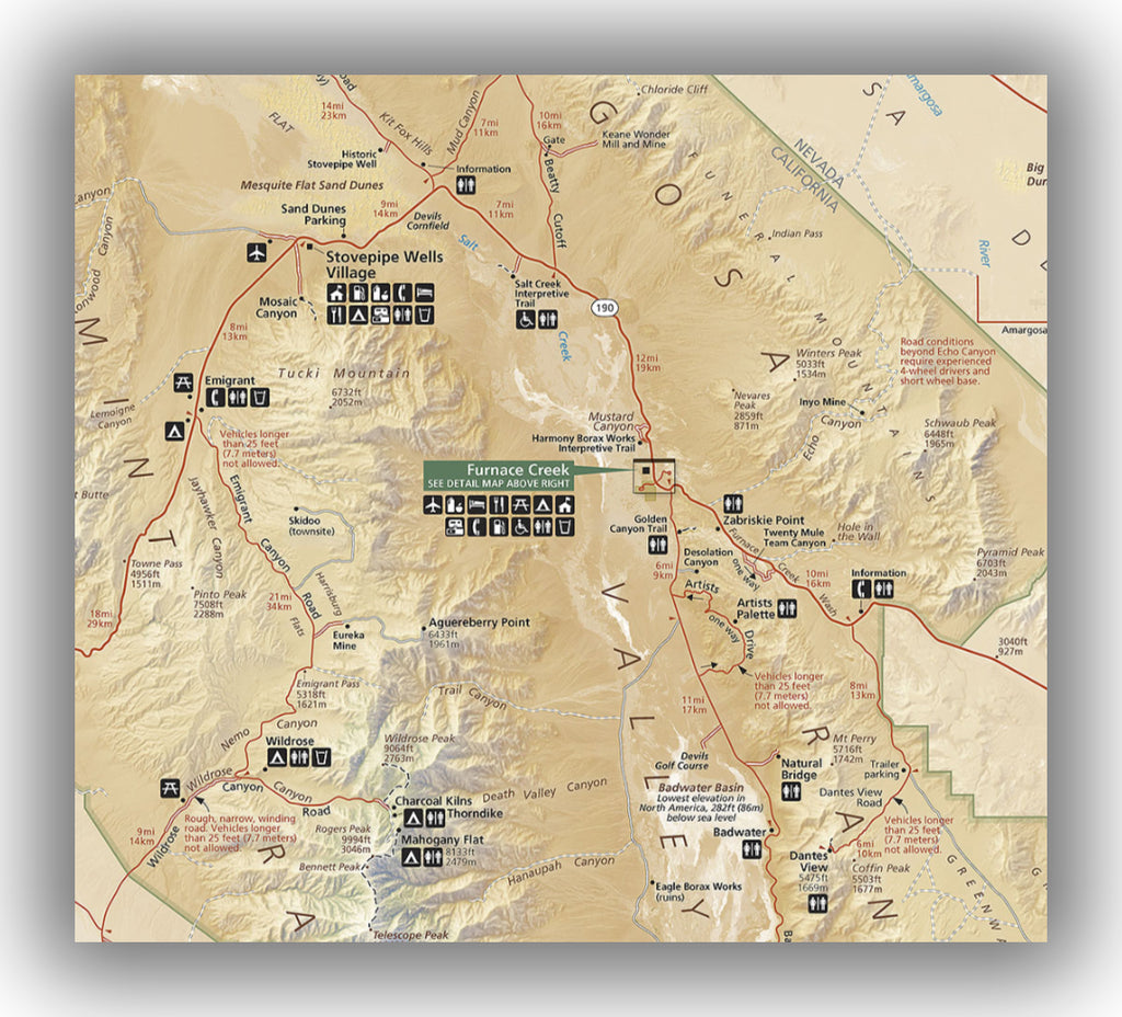
Furnace Creek map, courtesy of the National Park Service
Furnace Creek and Stovepipe Wells are at the center of Death Valley National Park, located along California Highway 190. With the greatest amount of options for lodging, a great visitor center and other services, Furnace Creek (in particular) is a surprising oasis in the desert. While you are here, don’t forget to fill up on gas in either location. Besides the western side of the park (in Panamint Springs), Furnace Creek and Stovepipe Wells are the only places to get gas in the park.
Furnace Creek is not only a great home base for refueling and restocking of supplies, but there is also plenty to see and do in this area. In fact, it would be easy to spend a full day (or more) exploring the area.
When visiting the Stovepipe Wells Village and Furnace Creek areas, our recommendations include:
- Furnace Creek Visitor Center. The Furnace Creek Visitor Center is a great place to begin your journey in Death Valley. With plenty of exhibits and rangers present to help out with any questions you have, you can learn about the local geology and get the latest on what to do in the park. There are also ranger programs offered during peak visitation months (December through March).
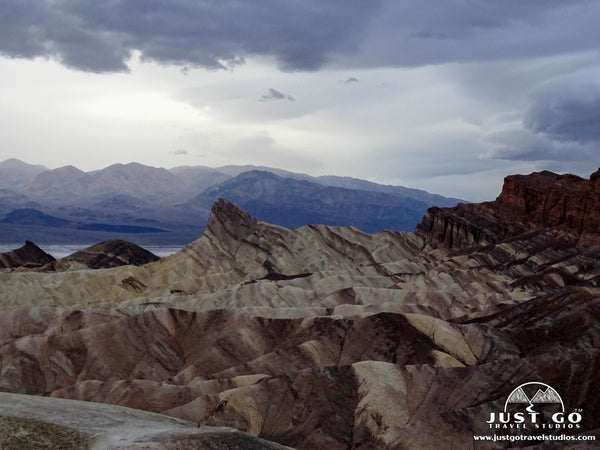
- Zabriskie Point. Of all the viewpoints in the park, this is our favorite. The landscape is stunning. Made from sediments from the Furnace Creek Lake (from 5 million years ago), the panoramic view from Zabriskie Point has more color than you could imagine in a desert. There is a short (100 yard) uphill walk to the viewpoint. It is best to visit in the morning for pictures, but be prepared to arrive early if you want to beat the crowds!
- Dante’s View. Located south of Zabriskie Point, Dante’s View takes a little work to get to, but offers great views from high up above Badwater Basin. Views are present both at the parking lot or from the short hike. The temperatures up here can be about 30 degrees colder than the rest of the park, so just be prepared!

Dante’s View, courtesy of William Warby
- Mesquite Flat Sand Dunes. Located very close to Furnace Creek, these sand dunes are must see. You can walk as far as you want on the dunes. Frequently you can find animal tracks in the soft sand. There are no trails here, but walking on them for a few minutes is really cool.
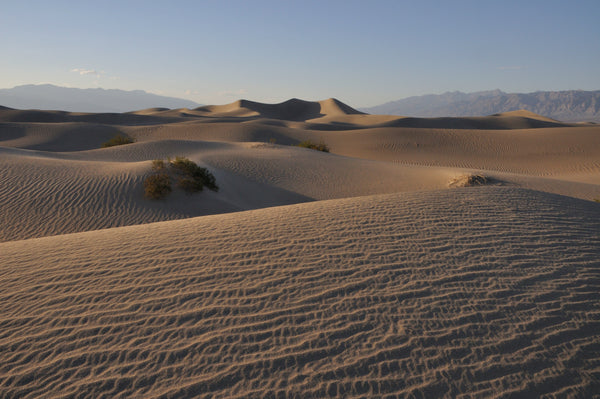
Mesquite Flat Sand Dunes, courtesy of the National Park Service
- 20-Mule Team Canyon. This is a 2.8-mile scenic drive that is a great alternative if you are not able to make the walk up to Zabriskie Point. The colors here are slightly different than Artist Drive but has a similar feel.
- Hiking. You can technically hike anywhere you want in the park-Death Valley is one of the few parks in the U.S. that allows this. However, if you don’t know where you are going, it’s easy to get lost and disoriented. With a place named “Death Valley”, getting lost is not something that most people are willing to risk. We recommend staying on one of the many marked trails. In this area, we recommend the following hikes:
The Mosaic Canyon Trail is a moderately difficult 3.5-mile (round-trip) hike. Starting by passing through a slot canyon, this hike climbs slightly over 1049 ft. over slick rocks on the way to a view of the canyon floor 1000 feet below.
- One of our favorites, the Golden Canyon Trail is a relatively easy out-and-back hike that travels to the Red Cathedral via a slot canyon. The hike is 3.1-miles (round-trip) and climbs approximately 600 feet. The trail can easily be combined with a hike to Zabriskie Point, but we recommend hiking from Zabriskie Point, as it is all downhill.
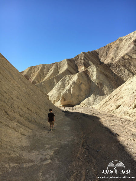
Starting near Furnace Creek, the Gower Gulch Loop Trail is a moderately challenging 4.2-mile hike (round-trip) that includes hiking through the Golden Canyon trail for about 1 mile before splitting off to the east-southeast and looping back to the trailhead. This has stunning landscape and is a favorite of many hikers and has nearly 700 feet in total elevation gain.
- The Salt Creek Interpretive Trail is a quick 0.9-mile loop trail that starts north of Furnace Creek with very little change in elevation. This is mostly a boardwalk, but at the end there is some sand to walk through on your way to Sandy Creek, home of the rare Salt Creek Pupfish (found only in Death Valley). This is a great hike for young families.

BADWATER ROAD

Badwater Road map, courtesy of the National Park Service
Badwater Road travels south from Furnace Creek and ultimately leaves the park through the east. The first 17 miles includes the most well-known spots, but if you get a chance, keep heading south for about 30 miles to soak in the changing landscape. If you are heading out of the park, you’ll travel just over 45 miles (nearly 2 hours) to the town of Shoshone, CA.
Here are a few recommended places to visit along Badwater Road:
- Mushroom Rock. Mile 4.3. This is an eroded rock formation from a past lava flow and is a quick stop.

- West Side Road. Mile 6.0. West Side Road travels the west side of the basin. The road is unpaved and rarely patrolled, so make sure your car is in good shape and you have emergency supplies if you have a break down. The road is nearly 40 miles long and provides access to the west side canyons. All cars can make it, though 4WD is preferred.
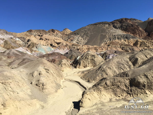
- Artist Drive. Mile 8.6. This is a one-way road (from south to north) that passes through narrow canyons (thus is not suitable for cars with trailers or RVs). The colorful set of rocks is really impressive to see.
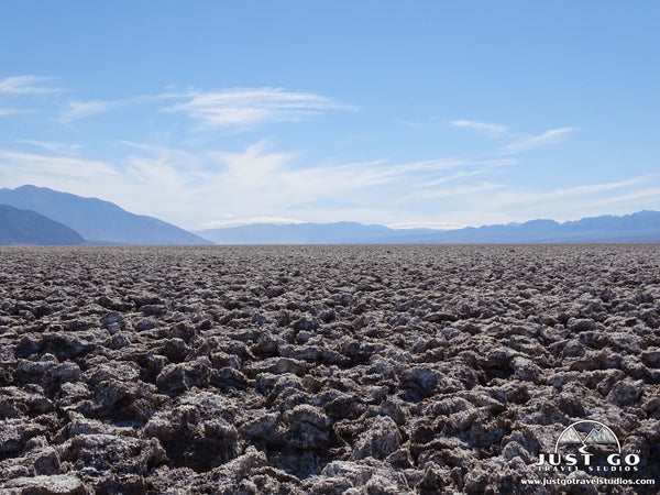
- Devil’s Golf Course. Mile 11. A short distance off Badwater Road, this landscape is full of salt crystals formed from rainwater and wind. You can walk on the “golf course”, but be careful! The salt is as sharp as lava rock and will hurt you if you fall!
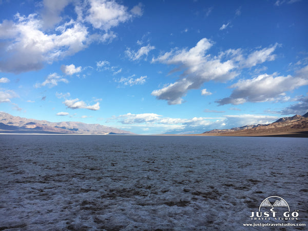
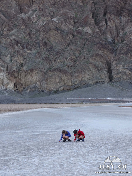
- Badwater Basin. Mile 16.6. The lowest spot in North America and the second lowest spot in the Western Hemisphere, Badwater Basin is a vast expanse that is worth seeing. You can walk out into the basin, though it can be cool in the winter and downright unbearable in the summer.

- Ashford Mill Ruins. Mile 43. This is the site of an old mining camp from the early 1900’s. This drive isn’t overly exciting, but if you drive this far south then you should definitely check it out.
- Hiking. Most of the hiking along Badwater Road is near Furnace Creek, and commented on earlier. However, we do recommend this one hike:
- The Natural Bridge Trail starts 13.1 miles south of Furnace Creek. With 86 ft. elevation gain, this easy trial leads to an arch created by water and wind.
PANAMINT SPRINGS, EMIGRANT AND WILDROSE AREAS
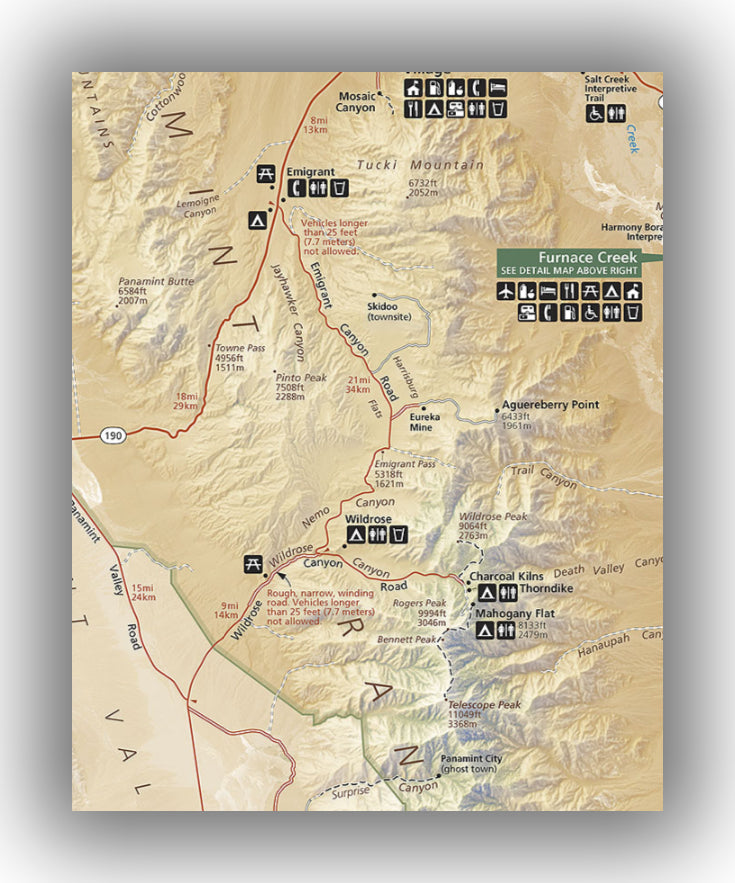 Panamint Springs map, courtesy of the National Park Service
The western side of Death Valley is an amazing drive, especially if this is your first entry into the park. The road climbs to nearly a mile in elevation through the Panamint Mountains before dropping to sea level.
There isn’t a ton to see in this area, but here are a few recommendations:
- Charcoal Kilns. The kilns were used to make charcoal for the area mines. They are shaped like beehives. The road to the kilns is dirt for the last mile and can be reached by cars, but high clearance vehicles are recommended.
- Hiking. There are a couple of hikes worth mentioning in this area:
- The Darwin Falls Trail is a 2.0-mile (round-trip) trail with moderate difficulty. Climbing approximately 460 feet, this trail heads to an unexpected waterfall with green foliage.

Darwin Falls, courtesy of davynin
The Telescope Peak Trail is one of the best trails in the park, but it is quite challenging. Leading up to the highest point in the park, the 12.0-mile round-trip trail climbs over 3,200 feet. If you want to read about this amazing trail, check out the blog from She Dreams of Alpine, hiking the Telescope Peak Trail. This hike will take about 8 hours total, so be prepared and bring plenty of water!
SCOTTY’S CASTLE ROAD
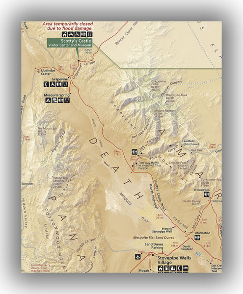
Scotty’s Castle Road map, courtesy of the National Park Service
The 38-mile Scotty’s Castle road leads past sand dunes and to the Ubehebe Crater. Scotty’s Castle, a historic home built in the early 1900’s, is also at the end of the road, but is currently closed. After flood damage recovery on the road, it is open, with the exception of road between Grapefine and the park’s border past Scotty’s Castle. Check the latest road conditions here.
Here are a few recommendations in the area:
- Titus Canyon. The Titus Canyon Road heads one-way from Rhyolite, NV to Titus Canyon in Death Valley. This road is recommended for high-clearance vehicles (or 4x4), with tight turns and a ghost town. It eventually drives through a canyon as you get to the end of the road. There are great views, potential bighorn sheep sightings and a wide variety of scenery, but just be advised that the road is not an easy one and take time!

Titus Canyon, courtesy of the National Park Service
- Ubehebe Crater. Located at the end of Scotty’s Castle Road, this crater is from a volcano with terrific views. You can hike along the crater or go down into the crater. It can be very windy here, so just be prepared!

Ubehebe Crater, courtesy of the National Park Service
- Scotty’s Castle Recover Tour. This guided walking tour covers the exterior grounds of Scotty’s Castle. You can see the damage from the 2015 flood waters as well as the recovery efforts that are underway. Reservations are required.
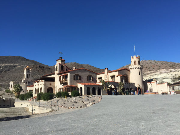
Scotty’s Castle, courtesy of Steve Lyon
HOW TO GET TO DEATH VALLEY NATIONAL PARK AND OTHER TRAVEL INFORMATION
If you are looking for directions to Death Valley National Park, here are a few links that may be of interest:
- The most common airport to fly into for Death Valley is Las Vegas, NV. Flights to this airport are plentiful and usually priced well. From here, it’s easy to get to the park. Here are some simple directions from Las Vegas to Death Valley National Park. The drive will only take about 2 hours and we recommend this route as it passes by Zabriskie Point.
- Another great park to visit while in the area is Yosemite National Park. Here are directions from Yosemite to Death Valley, which will take about 4 hours..
WHERE TO STAY IN DEATH VALLEY NATIONAL PARK
Death Valley National Park Lodging: There are four options inside of Death Valley, including Stovepipe Wells Village. The Inn at Death Valley (formerly the Furnace Creek Inn) and the Ranch at Death Valley are in Furnace Creek, with the Inn at Death Valley being the most posh place to stay in the park. The Panamint Springs Resort is available as well. Be sure to make reservations well in advance.
Camping in Death Valley: There are nine campgrounds inside Death Valley, with two closed during the wintertime. Only the Furnace Creek Campground takes reservations. Ahead of booking anything, we recommend checking out our blog on Camping in Death Valley National Park. Details on campgrounds in Death Valley can be found here.
RELATED INFORMATION ON DEATH VALLEY NATIONAL PARK FROM JUST GO TRAVEL STUDIOS
- In addition to our Death Valley National Park itinerary (which we highly recommend as internet service in the park is non-existent), you should also check out our blogs on 6 Reasons to Fall in Love with Death Valley National Park, Camping in Death Valley National Park and Hiking the Golden Canyon Trail in Death Valley.
- Once you return from your trip, contact us and we’ll work with you to create a custom, vintage travel poster. We look forward to working with you!