7 Best Hikes in Bryce Canyon National Park: Trail Maps, Directions & More
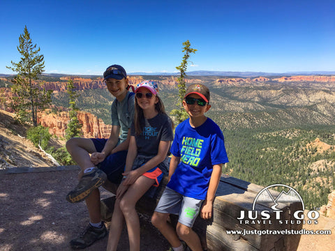
Peter BrahanFew National Parks in the country have as much packed into a small space as Bryce Canyon National Park. To get out and really see the park, though, it’s important to get off the road and get immersed in the Hoodoos.
To help, we’ve put together this guide on the Best Hikes in Bryce Canyon National Park. Though it’s a bit challenging to pick out only a few, we’re confident this list of day hikes will help you out as you plan your trip to Bryce Canyon National Park.
BRYCE CANYON NATIONAL PARK HIKING: DISTANCES AND ELEVATION GAIN
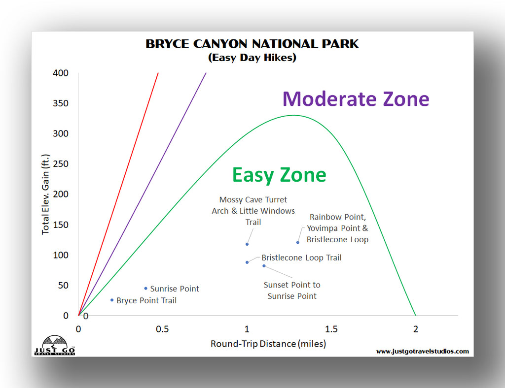
Most of the hikes in Bryce Canyon are relatively short in length, moderate in difficulty and involve some elevation change. However, to help guide you on what hike is right for you, we’ve assembled a few charts to really help you pick the perfect hike!
For easy hikes, this chart can help direct you to a few ideas.
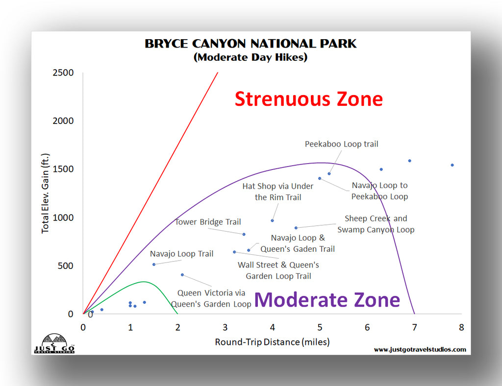
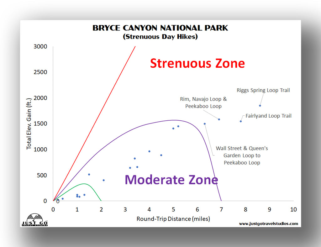
However, if you have a bit more time on your hands and the required energy, there are a ton of moderate and strenuous hikes to consider. The charts below should help out as well!
BEST HIKES IN BRYCE CANYON NATIONAL PARK: TRAIL DESCRIPTIONS AND TRAIL MAPS
QUEENS GARDEN AND NAVAJO LOOP TRAIL
- Difficulty: Moderate
- Distance (round-trip): 2.9 miles
- Elevation gain: 679 feet
- Hiking time (approximate): 2 hours
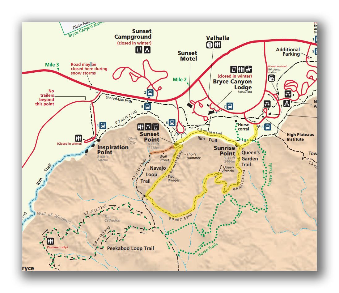
Queens Garden and Navajo Loop Trail map, courtesy of the National Park Service
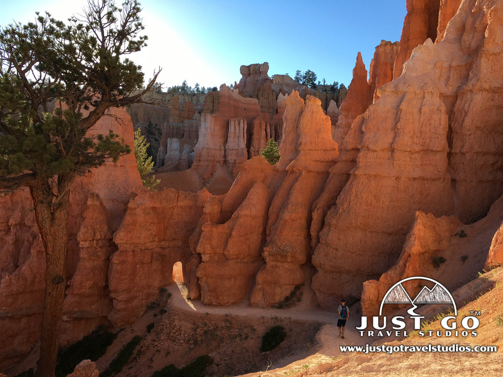
In all the National Park hikes that we’ve done, few hikes have as much reward for such little work as the Queens Garden and Navajo Loop Trail. This hike features good views from the beginning to the end of the trail. The hike itself gets you completely engrossed inside the hoodoos. It is great for families of all ages, as it is relatively short and can be completed within a couple hours without any trouble at all.
The hike starts from Sunrise Point which is close to the Bryce Canyon National Park Lodge. The trail descends into the Canyon about 400 feet over a distance of about a half-mile. You’ll be distracted on the way down with the surrounding beauty.
Once you are down in the Canyon and into Queens Garden, you’ll be surrounded by amazing scenery as you walk along the relatively flat trail. The hike has a nice mix of rock formations along with ponderosa pines, which gives a lovely mix of color. You may even spot a deer in the area!
The trail gets to a spot where you can head up to Wall Street and Sunset Point as it begins to head back up the Canyon walls. It does get a bit steep, so you’ll want to take plenty of breaks to look around at the landscape. Eventually you’ll be up at Sunset Point and you’ll love the view from up here as well!
Without heading through Wall Street, the hike has a total distance of 2.9 miles with an elevation gain of 679 feet. You can expect to have this hike done in about 2 hours, and that includes breaks for stops.
The trailhead is located at Sunrise Point, near Bryce Canyon National Park Lodge. The parking area is large, though you may have to walk a bit to the hiking trail if you are here when it’s crowded.
HAT SHOP TRAIL
- Difficulty: Moderate / Hard
- Distance (round-trip): 4.0 miles
- Elevation gain: 1400 feet
- Hiking time (approximate): 2.5 to 3 hours
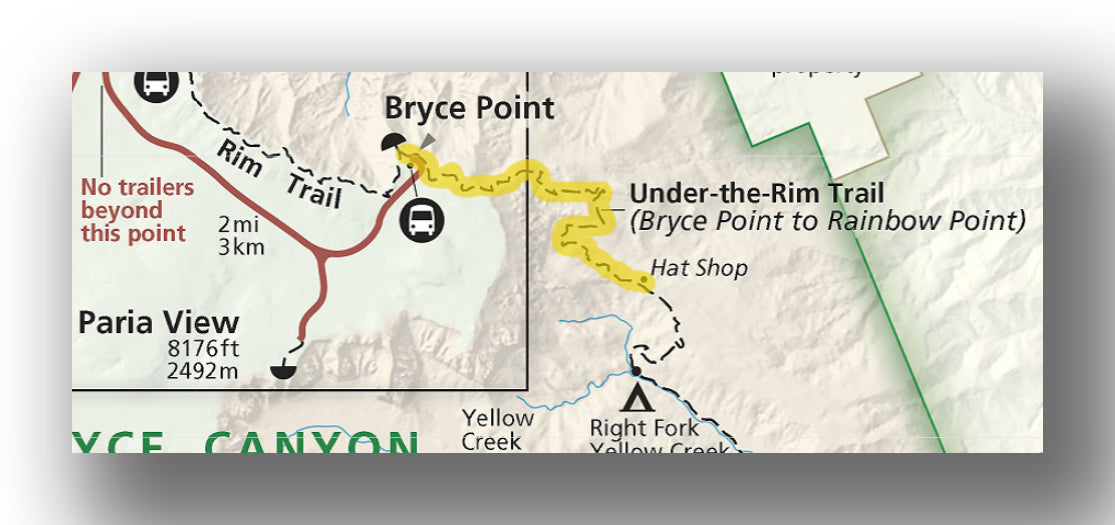
One of the more challenging day hikes in Bryce Canyon National Park is the Hat Shop Trail. While not long, it is steep and you should be ready to take on the steady uphill climb out of the canyon!
Starting at Bryce Point, the trail descends into the Amphitheater and continues down to an area known as the “Hat Shop.” This is a group of balanced rocks on Hoodoos. While they are not large, it is still a pretty cool area to see.
The hike back can be quite difficult, as there is plenty of climbing. The trail is about 4 miles long and has an elevation change of about 1400 feet.
The trailhead for the Hat Shop trail starts at Bryce Point at the end of Bryce Point Road. The parking area is not large, but since there is a mix of hikers and sightseers that stop here, you should be able to get a spot fairly quickly.
TOWER BRIDGE TRAIL
- Difficulty: Moderate
- Distance (round-trip): 3.0 miles
- Elevation gain: 980 feet
- Hiking time (approximate): 1.5 to 2 hours
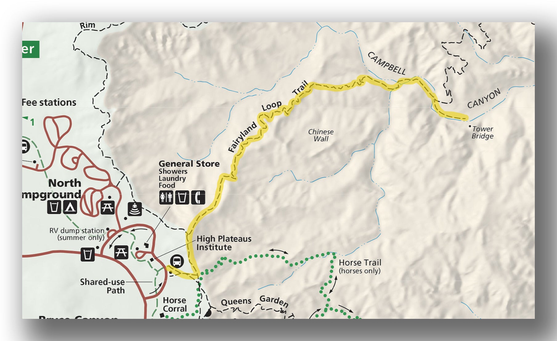
Another moderate trail that is worth checking out is the Tower Bridge Trail. It heads down into the hoodoos before ending at a really cool view.
The trail starts on the rim at Sunrise Point and heads down the Fairyland Loop Trail and into the Amphitheater. There is a lot of variation in landscape and wonderful color as you wander in the Canyon.
The grade continues down until you get a view of Tower Bridge, which is an impressive landmark. While on this trail you may not see any spectacular sweeping views, it’s a very nice trail to hike and gets you up close and personal to the hoodoos!
Bring plenty of water, as the trail is exposed the entire time and it can get quite hot if you hike in the middle of the day.
The total distance is about 3 miles, and you’ll experience just under a thousand feet of elevation gain (all on the way back).
The trailhead for the Tower Bridge Trail starts at Sunrise Point.
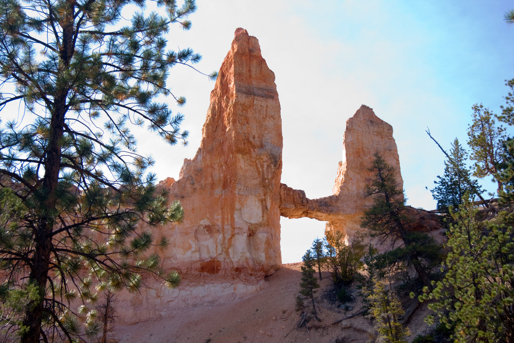
Tower Bridge, courtesy of Ronnie Macdonald
PEEKABOO LOOP TRAIL
- Difficulty: Moderate / Hard
- Distance (round-trip): 5.5 miles
- Elevation gain: 1600 feet
- Hiking time (approximate): 3 to 4 hours
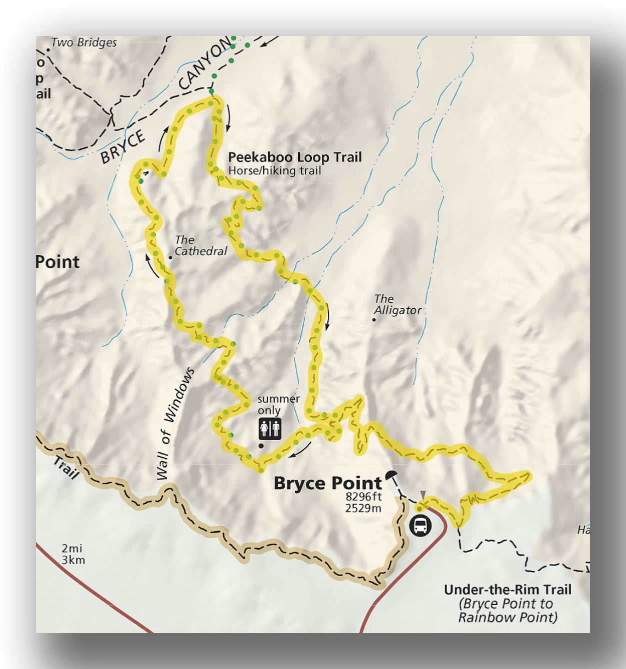
Peekaboo Loop Trail map, courtesy of the National Park Service
If you have a few hours, the Peekaboo Loop Trail is a great option to consider. One of the best hikes in Bryce Canyon National Park, the Peekaboo Loop really winds around for miles and has amazing view after amazing view.
The hike starts at Bryce Point and descends continuously for nearly 3.5 miles before increasing in elevation again. Throughout the entire hike you will love the views-it really is beautiful. If you have time to explore this hike, we recommend doing it in the morning or late afternoon hours to avoid too much exposure / heat.
This is a loop trail, which makes it nice! Be advised that the route is shared with horseback / mule riders, so you’ll need to be sure to give them room.
The hike is about 5.5 miles in total distance with around 1,600 feet in total elevation gain.
The trailhead for the Peekaboo Loop Trail starts at Bryce Point.

Peekaboo Trail, courtesy of Al_HikesAZ
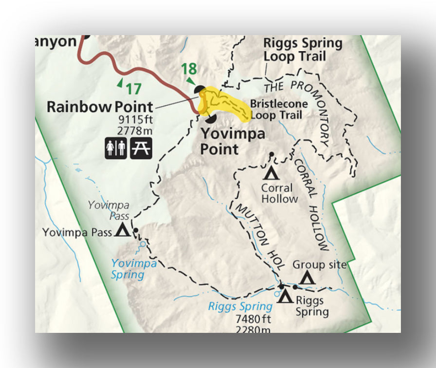
RIGGS SPRING LOOP TRAIL
- Difficulty: Moderate / Hard
- Distance (round-trip): 8.6 miles
- Elevation gain: 1800 feet
- Hiking time (approximate): 4.5 to 5 hours
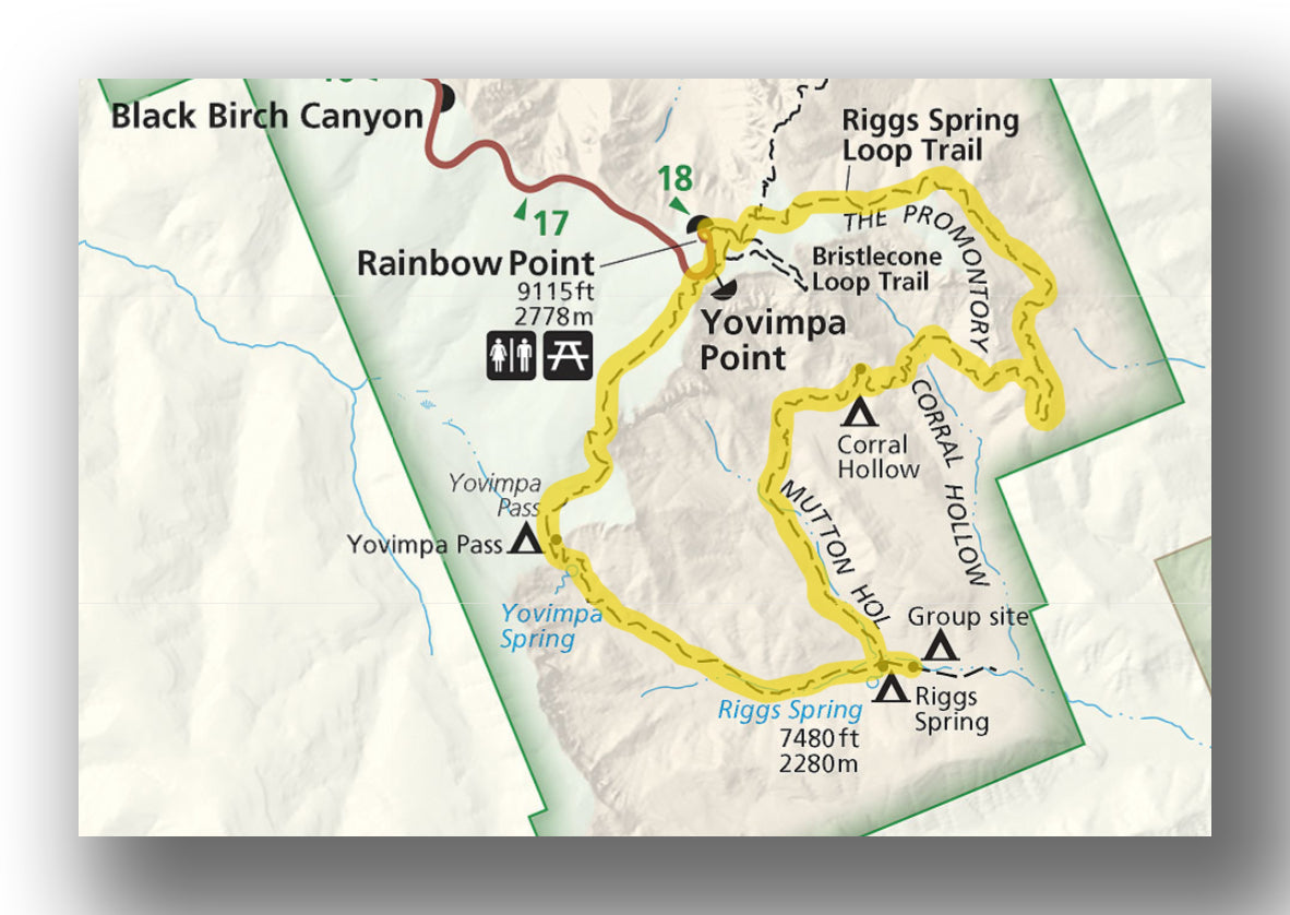
Riggs Spring Loop Trail map, courtesy of the National Park Service
The longest of the recommended day hikes in Bryce Canyon National Park, the Riggs Spring Loop Trail explores the southernmost parts of Bryce Canyon National Park and again offers a variety of scenery and is less crowded than most of the other hikes.
The trail leads from Rainbow Point and steadily drops down into the Canyon. Most hike the trail in the clockwise direction, as this is a bit easier on the knees (the slope is steeper coming back up to Yovimpa Point to the west).
There is nothing “direct” about the path you’ll take on this trail, as it hugs the landscape down past the Corral Hollow Campsite before reaching Riggs Spring. Near the spring (and on the western side of the trail on the way back) there is shade near the water.
The hike back up is not overly steep, but take it slow as it does climb quite a bit! As usual, bring plenty of water on this trail.
The trail is 8.6 miles in length with a total elevation gain of just over 1800 feet.
The trailhead for the Riggs Spring Loop Trail starts at Rainbow Point. The parking lot is not too large, but there are many people that come and go so if you have a challenge getting a spot, just wait a bit and one will open up.
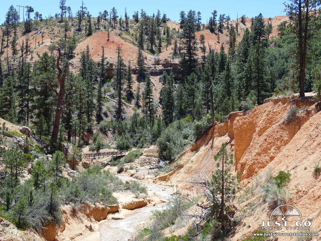
MOSSY CAVE TRAIL
- Difficulty: Easy
- Distance (round-trip): 0.8 miles
- Elevation gain: 118 feet
- Hiking time (approximate): 30 minutes
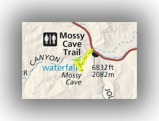
Mossy Cave Trail map, courtesy of the National Park Service
In the “remote” Water Canyon area of the park, the Mossy Cave Trail is a quick hike with a few water features that is worth checking out. This part of the park really isn’t that far away, and only takes about 15 minutes from the main Bryce Canyon Visitor Center.
Leaving from the parking area and heading west, the Mossy Cave Trail climbs steadily and slowly. There is water flowing alongside the trail the entire way. About 0.4 miles into the hike you’ll get to Mossy Cave. The cave is created by an underground spring. While you can’t go in, you can peer into it and feel the cold air. In the winter months it’s cold enough to produce icicles!
Keep hiking on the trail and you’ll come upon a small waterfall which is neat to see and is a good place to relax.
This is a very easy trail. At only 0.8 miles in length and climbing only 118 feet, this is a good hike no matter what part of the day you are traveling by.
The trailhead for Mossy Cave Trail is on Utah’s Highway 12 on the way to Tropic. The parking lot is small, but the area is typically not very busy.
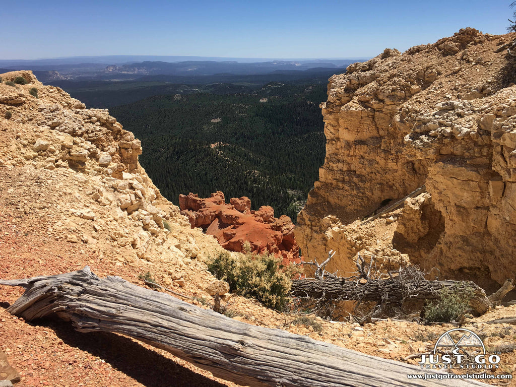
BRISTLECONE LOOP TRAIL
Bristlecone Loop Trail map, courtesy of the National Park Service
If you are looking for a quick and easy family hike (for all ages!), then the Bristlecone Loop Trail is definitely one you should check out.
The trail starts at Rainbow Point. The hike is nearly flat and leads to views from the rim to the east, south and west, providing a different perspective than most of the viewpoints in the park, as well as the beautiful Bristlecone Pines, which have very unique and twisting trunks!
Be sure to keep an eye on the kids, as there aren’t any railings to rely on and the drop-offs are pretty steep.
The trail is 1.3 miles total, with an elevation gain of just over 120 feet.
The trailhead for the Bristlecone Loop Trail begins at Rainbow Point at the end of Bryce Canyon Scenic Drive.
BRYCE CANYON NATIONAL PARK HIKING PERMITS
For overnight stays in the backcountry or for hiking the Under-the-Rim Trail (over 22 miles), you’ll need to get a backcountry permit. For details on how to obtain a permit, when it is required and any limitations for backcountry hiking, check out the website from the National Park Service on how to obtain a wilderness permit in Bryce Canyon National Park.
FURTHER INFORMATION ON BRYCE CANYON NATIONAL PARK FROM JUST GO TRAVEL STUDIOS
- Be sure to get a copy of our downloadable itinerary for Bryce Canyon National Park. It is packed full of information and sample itineraries to help you plan your visit!
- Read our additional blogs on Bryce Canyon National Park, including What to See and Do in Bryce Canyon National Park, the Bristlecone Loop Trail, Mossy Cave Trail and our favorite, Hiking the Queens Garden and Navajo Loop Trail. If you like to camp, then our blog on Campgrounds in Bryce Canyon National Park will be helpful.
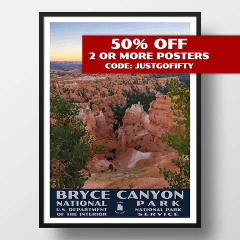
- Browse our collection of Bryce Canyon National Park WPA posters.
- If you love vintage posters, why not make your own? Let us turn one of your photos into one of our custom, vintage-style posters, postcards and note cards that are personalized and made just for you!