
Avalanche Lake Trail in Glacier National Park
Peter BrahanThe Avalanche Lake Trail (via the Trail of the Cedars) is one of Glacier National Park’s most popular hikes-and for good reason. Coming in at 4.6 miles (round trip) and with less than a thousand feet of elevation gain, this hike is very doable for most school aged children and active adults. Additionally, the trail contains waterfalls, hiking in the forest and amazing views of the lake and surrounding mountains.
If you are looking for a great hike for your family to really get a sense for what it’s like in the interior of Glacier National Park, then the Avalanche Lake hike is definitely for you!
AVALANCHE LAKE TRAIL DETAILS
- Difficulty: Moderate
- Distance: 4.6 miles (round-trip)
- Trail: Out-and-back (or loop)
- Elevation gain: 821 feet
- Peak elevation reached: 3,969 feet
- Best time of year to hike: Early summer to late fall
- To beat the crowds: Arrive before 8:00 am or after 3:30 pm
- Footwear: Hiking boots
- Watch out for: Mosquitoes, bears
- Restrooms: Located at the trailhead and on the trail
- Pets: Not allowed
- Time needed:5 hours
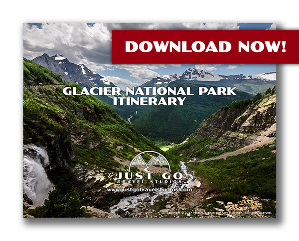
Our 16+ page Glacier National Park itinerary gives you everything you need to know ahead of your trip to Glacier National Park. We include great hikes (like the Avalanche Lake Trail) and rank them so you can make sure you spend time wisely. We also cover where to stay, what to do in different areas of the park, what to pack and what to see nearby.
PARKING AND TRAILHEAD FOR THE AVALANCHE LAKE TRAIL


Avalanche Lake Maps, courtesy of the National Park Service
The Avalanche Lake Trailhead is not accessible by car directly. Instead, you must access the Trail of the Cedars before staring on the Avalanche Lake Trail. Don’t worry-the way you get here is very straightforward.
The parking area for the Trail of the Cedars is right near the Avalanche Creek campground and picnic area. From the West Entrance to Glacier, take the Going-to-the-Sun Road east for approximately 15.5 miles (directions from the west entrance can be found here) and about the same distance from the Logan Pass Visitor Center. Allow about 30 minutes from either location, as the speed on the Going-to-the-Sun Road averages only about 30 miles per hour.
There is parking for approximately 100 cars, but the parking area is shared with the very popular Trail of the Cedars, Avalanche Campground and the picnic area. There are always people heading to their cars, but as this is an extremely busy area, you can expect plenty of people trying to find a parking spot as well. If you are patient, you will find a spot. However, the best thing to do is to arrive early, shortly after lunch or during the early evening if you want to have the easiest time finding a spot. When we went, we arrived before 7:45 am. While there were plenty of others parking their cars, there were plenty of spots available.
There are restrooms on the west side of the Going-to-the-Sun Road. Also, if you stay on the southwestern side of the Trail of the Cedars while you are walking to the Avalanche Lake Trailhead, there are restrooms there as well, and these tend to be less busy than those right on the Going-to-the-Sun Road.
HIKING TO THE AVALANCHE LAKE TRAILHEAD ON THE TRAIL OF THE CEDARS
Once you leave your car and find the Trail of the Cedars trailhead, you’ll have two options. The first option is to head left (the eastern side of the loop). The eastern side of the loop is a bit unique and picturesque, with much of the trail traveling over boardwalks. The western loop is wider and still very pretty, though it doesn’t have the same type of closed in, “special” feeling that the eastern side has.

Both routes are about the same length, with the western loop being slightly longer. And as stated earlier, the western loop has the advantage of the restroom right before heading up on the Avalanche Lake Trail.
HIKING TO AVALANCHE LAKE
The Avalanche Lake trailhead is well marked, starting with a large map.

The trail turns from being a nice, level and paved path to a dirt trail with an immediate incline. The incline is not steep, but it does continue for the next 1.5 miles. The initial climb in the first 0.5 miles is the hardest before it starts to level out (and even drops in elevation slightly along the way before reaching the lake).
After being on the trail for only about one-tenth of a mile, you’ll have an up-close view of Avalanche Creek and the top of the Avalanche Gorge. Avalanche Creek drops in elevation rapidly in this area, creating a loud, rushing river and a number of small waterfalls. This part of the hike is even a great destination by itself!

Make sure you take the time to take in the scenery around the gorge (either on the way out or on the way back), but stay on the side of the creek, as injuries occur here regularly for those that get too close to the rushing water.
After leaving Avalanche Gorge, the trail passes through an area of devastation. True to the name, the cause of these large number of downed trees was a series events by mother nature. In 2010, an avalanche (appropriately enough!) from Mt. Cannon went through this area. As if that wasn’t enough, a microburst from a passing thunderstorm appeared in 2011 and finished the job. What’s left is an amazing display what nature can do, and some incredible views of Logan Pass.


The rest of the trail heads through the forest. While there isn’t anything in particularly notable about the hike through the forest, it is beautiful and peaceful. The only thing to be on the alert for (besides bears!) is the occasional roots that seem to try to trip passersby. Being from New Hampshire, this wasn’t anything new to us, but we did have to watch our step.

AVALANCHE LAKE
After hiking for a total of 2.2 miles and gaining over 740 feet in elevation, the trail meets up with the northern end of Avalanche Lake. While there are plenty of people that hang out at the lake after their hike, there is a lot of room here on the course-sand beach.

From here it was easy to see the waterfalls that originate from Sperry Glacier (on the other end of the lake). One of the best things about hiking in Glacier National Park is that you are never far from a waterfall, and you can almost always hear water rushing on every hike.
Most people stop here and return back to the parking lot, but we continued further south to the end of Avalanche Lake.

This extended the hike by about 0.6 miles more (just over 1.2 miles round-trip). This was a much quieter part of the trail and allowed us to get a view of Avalanche Lake with the sun behind us (which was much better for photos). There was also a great place to relax before returning to our car.


HIKING BACK TO THE PARKING LOT VIA THE AVALANCHE TRAIL AND TRAIL OF THE CEDARS
The hike back to the Trail of the Cedars went quickly. As we had started early in the morning, we were able to beat most of the crowds. The trail really picked up around 9:30 AM as we encountered plenty of people hiking to Avalanche Lake on our way back-far more than we saw on the way out.
If you didn’t stop and see Avalanche Gorge on the way in, stopping on the way back is a good time to do so. Also, we recommend taking the part of the Trail of the Cedars that you didn’t take on the way in, just to see the full loop.

FURTHER INFORMATION ON GLACIER NATIONAL PARK FROM JUST GO TRAVEL STUDIOS
- We have a large (and constantly growing) number of resources to help you with your trip planning in Glacier National Park. Our best resource is our 16+ page, downloadable itinerary for Glacier National Park.
- We wrote a blog that is an overview of Glacier National Park, 10 Reasons Why You’ll Love Glacier National Park.
- Another great hike (though longer and more difficult) is the Iceberg Lake Trail. This was a wonderful trip to another secluded lake (but with icebergs!). You will also want to review details on the Trail of the Cedars, which is part of the Avalanche Lake Trail hike. Finally, be sure to check out our blog on the hike to Hidden Lake.
- Our son Andrew wrote about his experiences in his post, Ask Andrew: Glacier National Park.
- We cover details on what to pack in our article, What to Pack for your trip to Glacier National Park and camping information in our blog Glacier National Park Campgrounds. And if you need an airport to fly into, then check out our blog on the Best Airports Near Glacier National Park.
- When you get back from your trip make sure you send us a photo so we can make a custom, vintage-style travel poster for you!

OTHER USEFUL INFORMATION ON GLACIER NATIONAL PARK
- Kari (from “Get Inspired Everyday”) covers the nearby Snyder Lake hike in her blog, Snyder Lake in Glacier National Park. This hike is quite long and challenging, but it is a good hike to consider if you are up for the 9-mile trek with over 2,000 feet in elevation gain!
- We loved Kalispell, Montana (and perhaps want to move here someday!). We went through here on our way to Glacier. Matt (from “XpatMatt”) wrote up a great blog on the cool things to do in Kalispell, Montana.

