
13 Best Hiking Trails in Pictured Rocks National Lakeshore: Trail Maps, Directions & More
Peter BrahanWhile spending time in the water is certainly something that you should do when coming to the Great Lakes, you definitely need to get out and do some hiking in Pictured Rocks National Lakeshore! The landscape that adorns Michigan’s Lake Superior coastline is nothing short of spectacular, and hiking is one of the best ways to really see it.
While there are a ton of great hikes to do along Lake Superior, we thought that putting together a list of what we thought were the best hikes in Pictured Rocks National Lakeshore would help you plan out your time. Warning-there are a ton of hikes here that are worth doing!
In this guide, we’ll cover all you need to know about hiking in Pictured Rocks, including how to be prepared as well as information covering each hike. We’ll discuss distances, elevation gain, time you should allow for your hike, trailhead information, and a bit of detail about each hike.

Before your download a copy of our itinerary for Pictured Rocks National Lakeshore! We cover all you need to know about visiting the park and include maps, hikes and more!
HIKING IN PICTURED ROCKS NATIONAL LAKESHORE: PREPARATION
The hikes in Pictured Rocks are fairly flat and the temperature is rarely super hot, which makes preparing for hikes here pretty easy. Still, there are a few things that we recommend you bring with you before you head out on the trails:
- Check on the weather ahead of heading out. The heat here is generally not too much of a factor, but thunderstorms can be.
- Mosquitoes can be quite rough in the park, so be sure you bring bug spray if you are hiking in June or July. By August they have usually calmed down a bit.
- Many of the hikes have pretty heavy tree cover for a good portion of the trail, but most also have direct sun exposure. Plus, since you will likely want to spend some time taking in the views along the water, you need to be sure to bring a hat and sunblock.
HIKING TRAILS IN PICTURED ROCKS NATIONAL LAKESHORE: TRAIL DESCRIPTIONS AND TRAIL MAPS
CHAPEL / MOSQUITO LOOP TRAIL
- Difficulty: Moderate
- Distance (round-trip): 10.2 miles
- Elevation gain: 752 feet
- Hiking time (approximate): 6 to 8 hours
- Trail type: Loop
- Potential hazards: Bugs, sun exposure, falls from the cliffside
- Restrooms: Pit toilets located at the trailhead. No restroom facilities are available on the trail.
- Recommended footwear: Hiking shoes
- Pets: Not allowed

Chapel / Mosquito Loop Trail map, courtesy of the National Park Service
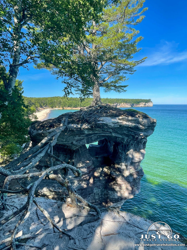
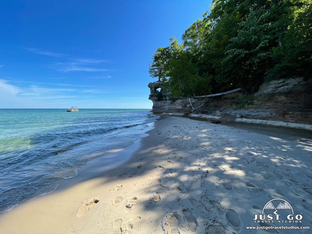
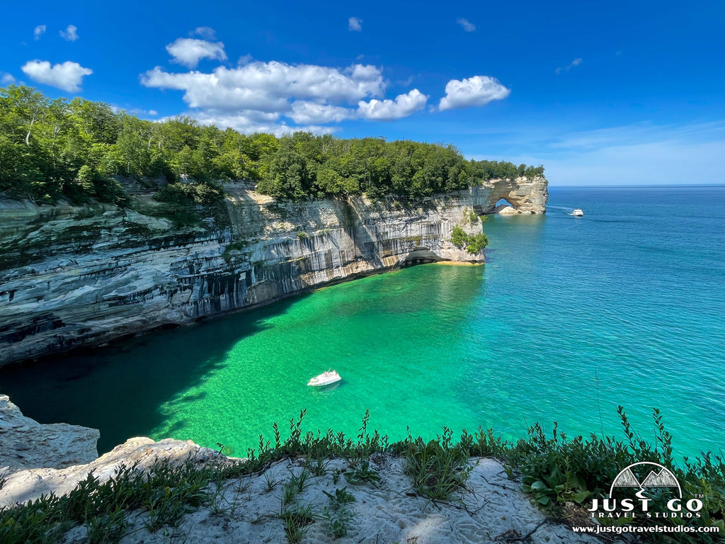
Trail DescriptionFor those seeking a long day hike with epic views, we highly recommend the Chapel/Mosquito Loop! Although there are several different trails and loop hike options from the Chapel Basin/Mosquito area, those who hike the full loop get to experience Chapel Rock, two waterfalls, two beaches AND a stunning 4-mile trail section that winds along the edge of the Pictured Rocks cliffs. We hiked the loop in the counterclockwise direction. Follow trail signs to Chapel Falls and then continue north until reaching the coastline at Chapel Rock (3.2 miles) and Chapel Beach (3.3 miles). Then, hike west along the coastline for 4.3 miles to Mosquito River and Beach. Head back inland via the outer loop trail which leads past Mosquito Falls (9 miles) on the return to the parking area. This trail was by far our favorite trail at Pictures Rocks and a MUST DO for any avid hiker!
Chapel / Mosquito Loop Trail Highlights- Natural Scenery: You are bound to be in awe by the beauty along the Chapel / Mosquito Loop Trail! Your hike will include amazing cliffs, Chapel Falls and amazing views of Lake Superior that are really hard to beat.
- Variety of Landscape: There is a lot of diversity on this trail. It’s not common that you’ll have lush forests right on the edge of rocky and sandy beaches! It’s no wonder why this hike attracts ecologists.
- Crowds: Even though the trail is quite long, there are plenty of people to content with. The good thing is that many only go part way, so after you get about 3 miles into the hike you are likely to have a bit more privacy.
- Bugs: Be prepared by bringing plenty of bug spray to help you out, since you are not far from the forest pests that tend to find you and make your hike a bit more miserable!
The trailhead starts at the Chapel / Mosquito parking area, at the end of Chapel Road (Note: Chapel Road is a rough, backcountry road which sees a lot of congestion in the summer. Expect the trip to be slow going due to deep potholes and washouts). Due to limited parking at the trailhead, we recommend getting an early start since the parking lot fills between 9 and 10 am during busy summer months. Pets are not allowed on any of the trails in this area. Be sure to allow 6-8 hours for this hike and bring a map (or take a photo of the map posted at the trailhead).
MINERS FALLS TRAIL
- Difficulty: Easy
- Distance (round-trip): 1.2 miles
- Elevation gain: 155 feet
- Hiking time (approximate): 30 to 45 minutes
- Trail type: Out-and-back
- Potential hazards: Sun exposure
- Restrooms: Pit toilets located at the trailhead. No restroom facilities are available on the trail.
- Recommended footwear: Closed-toed shoes
- Pets: Allowed, but must be kept on a 6-foot leash at all times

Miners Falls Trail map, courtesy of the National Park Service
Trail DescriptionIf you only have time for an easy, family-friendly hike while visiting Pictured Rocks, check out the Miners Falls Trail. This out-and-back hike follows a gently rolling, dirt and gravel path through the forest to Miners River, where the 50-foot waterfall drops over a sandstone outcrop. Be sure to take the stairs down to the lower platform for an up-close view of Miners Falls.
Miners Falls Trail Highlights- Great Reward with Little Effort: The hike is short, but it’s super easy to navigate. It’s well maintained and easy for families with young children or those that aren’t up for one of the longer hikes in the park.
- Beautiful Waterfall: Who doesn’t like a waterfall hike! Miners Falls drops off over a standstone cliff, and the viewing platforms provide excellent vantage points.
- Crowds: Surprise! This trail is very popular since it’s so accessible. Be prepared for lots of people, which you can avoid by getting here early in the morning.
- Small Viewing Platforms: Though the viewing platforms offer terrific views, they can get crowded. Just wait your turn and be courteous, and you’ll get your time to view this terrific site.
The trailhead is located at the end of Miners Falls Road, which is a right run off Miners Castle Road about 3.7 miles north of H-58. Leashed pets are allowed on this trail. Allow 30-45 minutes for this hike.
MINERS CASTLE TRAIL
- Difficulty: Easy
- Distance (round-trip): 0.5 miles
- Elevation gain: 84 feet
- Hiking time (approximate): 30 minutes
- Trail type: Out-and-back
- Potential hazards: Sun exposure
- Restrooms: Pit toilets located at the trailhead at the trailhead. No restroom facilities are available on the trail.
- Recommended footwear: Closed-toed shoes
- Pets: Allowed, but must be kept on a 6-foot leash at all times
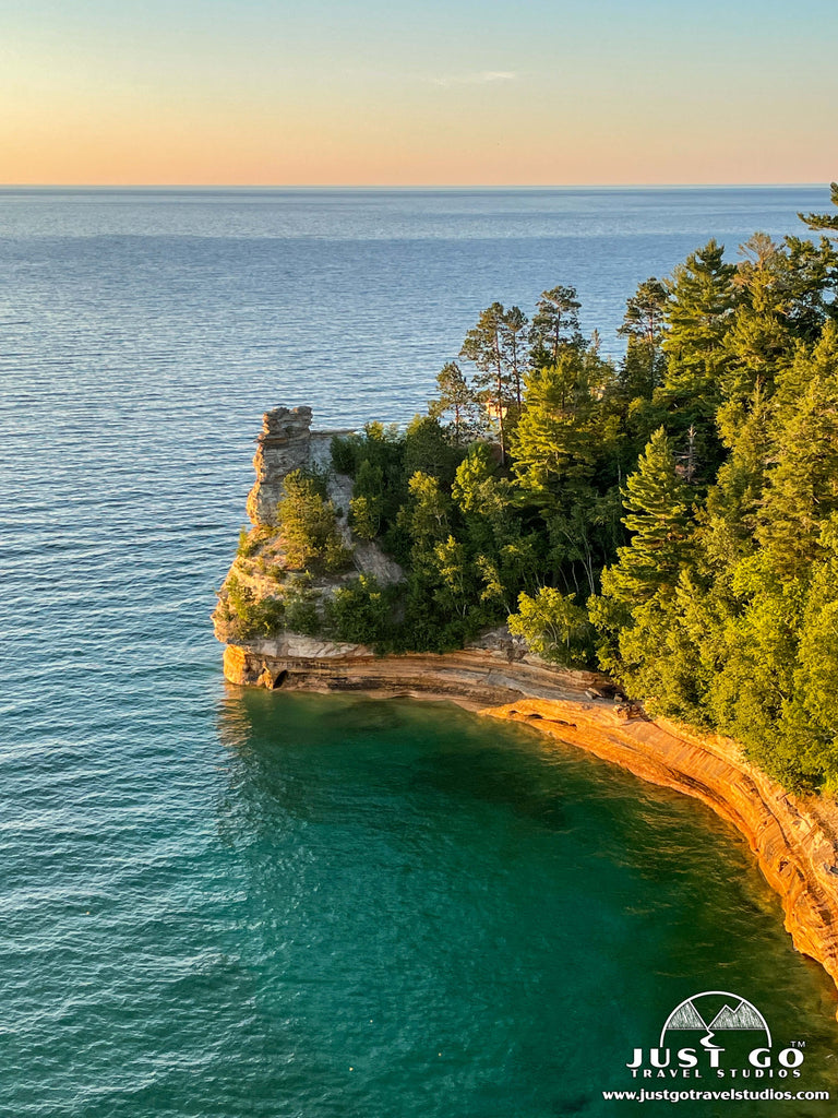
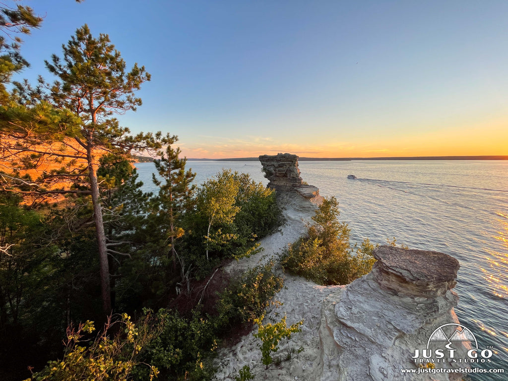
This is one of the more popular trails in the park. Miners Castle is a formation left in the sandstone, and this is the only view of the cliffs accessible by vehicle in the park. The trail heads down from the parking area to a small lookout with absolutely stunning views. There is a wheelchair accessible lookout that’s only a few hundred feet from the parking area, which is an option as well. This hike is great for sunsets in particular, but be advised that you’ll have plenty of company, and the platform area is not that large.
Miners Castle Trail Highlights- Accessibility: At only 0.5 miles (round-trip), this trail is extremely accessible. It’s well maintained and super easy to do.
- Great Views: Not only can you see Miners Castle (have your camera ready!), you also get some incredible views of Lake Superior.
- Crowds: This hike, being easy and close to the Visitor Center, gets quite crowded. Be prepared to see a lot of people on the trail.
- Short: If you are like us, when you get ready to go on a trail, there is great joy out of the struggle to get to an amazing view. Since this trail is so short it seems a bit more like a walk-a walk worth doing, but not quite a hike that you may be craving.
The trailhead starts at the end of Miners Castle Road, north of H-58.
MUNISING FALLS TRAIL
- Difficulty: Easy
- Distance (round-trip): 0.4 miles
- Elevation gain: 50 feet
- Hiking time (approximate): 30 minutes
- Trail type: Out-and-back
- Potential hazards: Sun exposure
- Restrooms: Flush toilets are available at the trailhead.
- Recommended footwear: Closed-toed shoes
- Pets: Not allowed
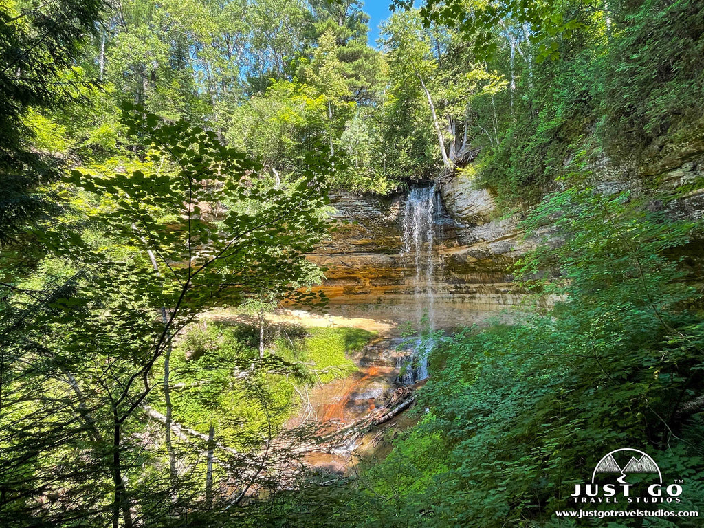
This popular hike heads uphill slowly on a mostly paved trail. At the end are two separate staircases that allow you to get up and close to Munising Falls. This 50-foot waterfall is breathtaking. While this can be busy, it’s a must do as it is short and doesn’t take up much time at all.
Munising Falls Trail Highlights- Accessibility: Once again, this is another trail that is short with little elevation gain that offers great views!
- Waterfall Views: Who doesn’t like a hike that leads to a waterfall? This is once again a gorgeous hike with a great waterfall at the end.
- Educational Information: Along the hike you’ll get to see signs that give information about the local flora and fauna.
- Crowds: Once again, this hike gets quite crowded, so be prepared for people to contend with as you hike to the viewpoint.
- Limited Parking: Parking can be a bit of an issue, so just be prepared to look around for a spot. Be patient, as since the hike is so short, spots do open up regularly.
The trailhead starts at the Munising Falls Visitor Center.
MINERS CASTLE AND MINERS BEACH TRAIL
- Difficulty: Moderate
- Distance (round-trip): 2.0 miles
- Elevation gain: 258 feet
- Hiking time (approximate): 2 hours
- Trail type: Out-and-back
- Potential hazards: Sun exposure
- Restrooms: Flush toilets located at the trailhead
- Recommended footwear: Closed-toed shoes
- Pets: Allowed, but must be kept on a leash at all times.

Trail Description
Instead of driving from Miners Castle to Miners Beach, take a hike! Follow the trail to Miners Castle before backtracking and heading east on the North Country Scenic Trail, which travels downhill to cross Miners River before reaching Miners Beach. Enjoy the beach before returning to the Miners Castle area (2 miles roundtrip) or have a friend pick you up at the Miners Beach parking area to avoid the steep climb back uphill!
Miners Castle and Miners Beach Trail Highlights- Great Views: You won’t be disappointed by the terrific views of Lake Superior and Miners Castle!
- Beautiful Beach Walk: Since you are on Miners Beach for a portion of the hike, it’s great to also take a break and swim in the lake.
- Crowds: Like many of the other easy / moderate trails, this hike is quite busy.
- Parking: Parking is very limited. Since this hike is a bit longer that some of the other easy hikes, it can take a bit of time for a spot to open up.
The trailhead starts from the end of Miners Falls Road on the east side of Miners Castle Road, about 3.7 miles north of H-58. No pets are allowed on this section of trail (since it is part of the North Country Scenic Trail); however, pets are allowed at both Miners Castle and Miners Beach. Allow about 2 hours for this hike.
SPRAY FALLS TRAIL (FROM LITTLE BEAVER LAKE)
- Difficulty: Medium
- Distance (round-trip): 8.2 miles
- Elevation gain: 502 feet
- Hiking time (approximate): 5 hours
- Trail type: Out-and-back
- Potential hazards: Bugs, sun exposure
- Restrooms: Pit toilets located at the campground near the trailhead. There are no restroom facilities on the trail.
- Recommended footwear: Hiking shoes
- Pets: Not allowed

Spray Falls Trail map, courtesy of the National Park Service
Trail DescriptionThis trail starts by heading downhill through a forest to the beach, which is reached at the 1.4-mile point. The trail then heads west along the shore until you get to the 70-foot Spray Falls. This waterfall drains right into Lake Superior. While it is best viewed from the water, it’s still quite interesting to see, and the hike provides amazing views along the water throughout the hike.
Spray Falls Trail Highlights- Scenic Beauty: The stunning views of the shoreline and surrounding forest are incredible as you walk to the falls. Of course, Spray Falls pouring into Lake Superior is quite beautiful as well!
- Seclusion: This trail is a bit quieter than some of the more popular trails in the park, which allows you to get out in nature and experience the solitude!
- Trail Difficulty: Whie the trail itself is not overly difficult in elevation gain, it is rugged and some areas lack in maintenance. Be prepared for it to be a bit uneven and muddy.
- Limited Facilities: The trail does not have any restrooms or water, so come prepared with your own supplies.
The trailhead starts at the end of Little Beaver Lake Road, north of H-58.
SAND POINT MARSH TRAIL
- Difficulty: Easy
- Distance (round-trip): 0.5 miles
- Elevation gain: Minimal
- Hiking time (approximate): 30 minutes
- Trail type: Out-and-back
- Potential hazards: Bugs, sun exposure
- Restrooms: Pit toilets located at the trailhead.
- Recommended footwear: Closed-toed shoes
- Pets: Allowed, but must be kept on a leash at all times.
This short loop trail is on a boardwalk that travels around wetlands. This is a good spot to see birds, particularly early or late in the day.
Sand Point Marsh Trail Highlights- Educational: This interpretive trail gives plenty of information about the local ecology, including the wildlife and plant life. It’s entertaining for even small children to learn about what’s around the area.
- Wildlife: This is a great trail to spot animals. Those that frequent the area include amphibians and birds. Just keep your eyes out and see what you can find!
- Limited Variety of Scenery: The trail is beautiful, but since it’s a marsh and stays a marsh for most of the trail, it’s not as exciting as some of the other hikes.
- Buggy: Be prepared for plenty of bugs (mosquitoes, in particular) to join you while you are out on the trail.
The trailhead starts at the end of Sand Point Road, on the right side across from Sand Point Beach.
SABLE FALLS TRAIL
- Difficulty: Easy / Moderate
- Distance (round-trip): 0.6 miles
- Elevation gain: 100 feet
- Hiking time (approximate): 30 minutes
- Trail type: Out-and-back
- Potential hazards: Bugs, exhaustion from climbing back up the stairs
- Restrooms: Flush toilets located at the trailhead.
- Recommended footwear: Closed-toed shoes.
- Pets: Allowed, but must be kept on a six-foot leash at all times.

Sable Falls Trail map, courtesy of the National Park Service
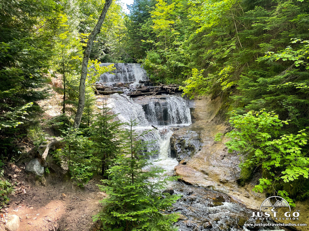
Trail DescriptionVisitors to the eastern end of the national lakeshore won’t want to miss seeing the 75-foot Sable Falls as it tumbles over a slope of sandstone. From the Sable Falls parking area, the Sable Falls Trail leads to a staircase of 168 steps down to the base of the falls. Continue past the falls along Sable Creek to a beautiful and mainly rocky beach on Lake Superior (0.5-miles roundtrip). Sable Falls Beach has great views of the Grand Sable Dunes towering over the shoreline. Although the stones covering the beach are beautiful, remember that collecting stones is not permitted within the national lakeshore.
Sable Falls Trail Highlights- Amazing Waterfall: The waterfall is the star of the show here. It cascades down a series of rock formations. Seeing this along the banks lined with greenery is breathtaking.
- Boardwalk and Stairs: Though some don’t like climbing stairs, the fact that they are there provides a nice, predictable path down to the viewing area. This much better than having to trek down challenging, wet rocks!
- Crowds: The trail is short. While it’s a bit steep, it can be quite crowded. Be ready, though…the hike back up takes a bit of time!
- Bugs: Since there is the presence of water here, there are quite a few bugs. Just be prepared!
Trailhead Directions
The trailhead starts at the Sable Falls parking area off H-58, about 2.8 miles west of Grand Marais. Picnic tables and a restroom with flush toilets are available near the parking area. Leashed pets are allowed on the trail to Sable Falls, as well as on Sable Falls Beach.
GRAND SABLE DUNES TRAIL
- Difficulty: Easy
- Distance (round-trip): 0.6 miles
- Elevation gain: 80 feet
- Hiking time (approximate): 30 minutes
- Trail type: Out-and-back
- Potential hazards: Sun exposure, exhaustion from walking in the sand
- Restrooms: Flush toilets located at the trailhead.
- Recommended footwear: Hiking shoes
- Pets: Not allowed
The best place to view the dunes is from the 0.6-mile (roundtrip) Grand Sable Dunes Trail which begins at the Sable Falls parking area. Be prepared for some uphill hiking in soft sand as you approach the dunes.
Grand Sable Dunes Trail Highlights- Unique Landscape: Climbing on the dunes is a rare opportunity that many of us visiting from outside the area don’t get a chance to do often! Have your camera ready.
- Panoramic Views: The views from the top of the dunes are incredible. This is a great place to watch the sunset!
- Trail Difficulty: This is a relatively short hike and not overly challenging, but walking in the sand can be a challenge if you are not ready for it!
- Sun Exposure: The trail does not provide any opportunity for shade. Wear a hat, but also take care to bring plenty of water and sunblock.
Stay on the trail to avoid crushing the fragile dune vegetation. Walking or sledding on the dunes is not permitted. No pets allowed.
AU SABLE LIGHT STATION TRAIL
- Difficulty: Easy
- Distance (round-trip): 3.5 miles
- Elevation gain: 35 feet
- Hiking time (approximate): 1.5 hours
- Trail type: Out-and-back
- Potential hazards: Bugs, sun exposure
- Restrooms: Pit toilets located at the trailhead.
- Recommended footwear: Hiking shoes
- Pets: Allowed, but must be kept on a six-foot leash at all times.

Au Sable Light Station Trail map, courtesy of the National Park Service
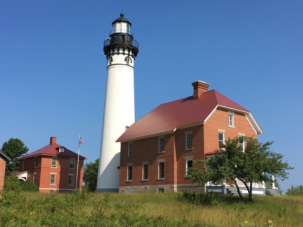
Trail DescriptionEnjoy an easy hike (3-miles roundtrip) along the shore of Lake Superior to this isolated lighthouse. The out-and-back trail to Au Sable Light Station heads east from the Hurricane River Campground as it follows an old, gravel access road (also part of the North Country Scenic Trail). Although the trail itself isn’t overly exciting, the historic 1874 lighthouse and exposed shipwreck remains along the shore make this hike worthwhile. For a small fee, guided tours of the lighthouse are offered during the summer.
Au Sable Light Station Trail Highlights- Learn About the Past: The Au Sable Lighthouse has tours, but also give you a chance to learn about navigation on the Great Lakes in the 1800’s. It’s quite interesting even if you aren’t a history buff! Along the trail there is also informational exhibits to help you learn about the area and its past.
- Great Coastal Views: This trail has great views along the entire way to the lighthouse.
- Limited Accessibility: The lighthouse isn’t too convenient to get to and requires walking to get there. Just be prepared to hike your way in and know that the lighthouse isn’t right near the trail!
- Access to the Lighthouse is Limited: The lighthouse is open for tours, but only during certain times of the year. Check to be sure it’s open before you go if you want to go inside the lighthouse.
The trailhead starts just off H-58 at the Hurricane River Campground, about 12 miles west of Grand Marais, MI. Be advised that the stable flies in this area can be fierce in the summer—especially on hot, humid days with a south wind. Consider wearing a long-sleeved top or lightweight jacket and loose-fitting pants since bug repellants are ineffective with these biting flies. Pets are allowed on the access road to the light station and light station grounds. Allow about an hour and a half for this hike (or more to take a lighthouse tour).
LOG SLIDE OVERLOOK TRAIL
- Difficulty: Easy
- Distance (round-trip): 0.5 miles
- Elevation gain: Minimal
- Hiking time (approximate): 20 minutes
- Trail type: Out-and-back
- Potential hazards: Sun exposure
- Restrooms: Pit toilets located at the trailhead.
- Recommended footwear: Closed-toed shoes
- Pets: Not allowed
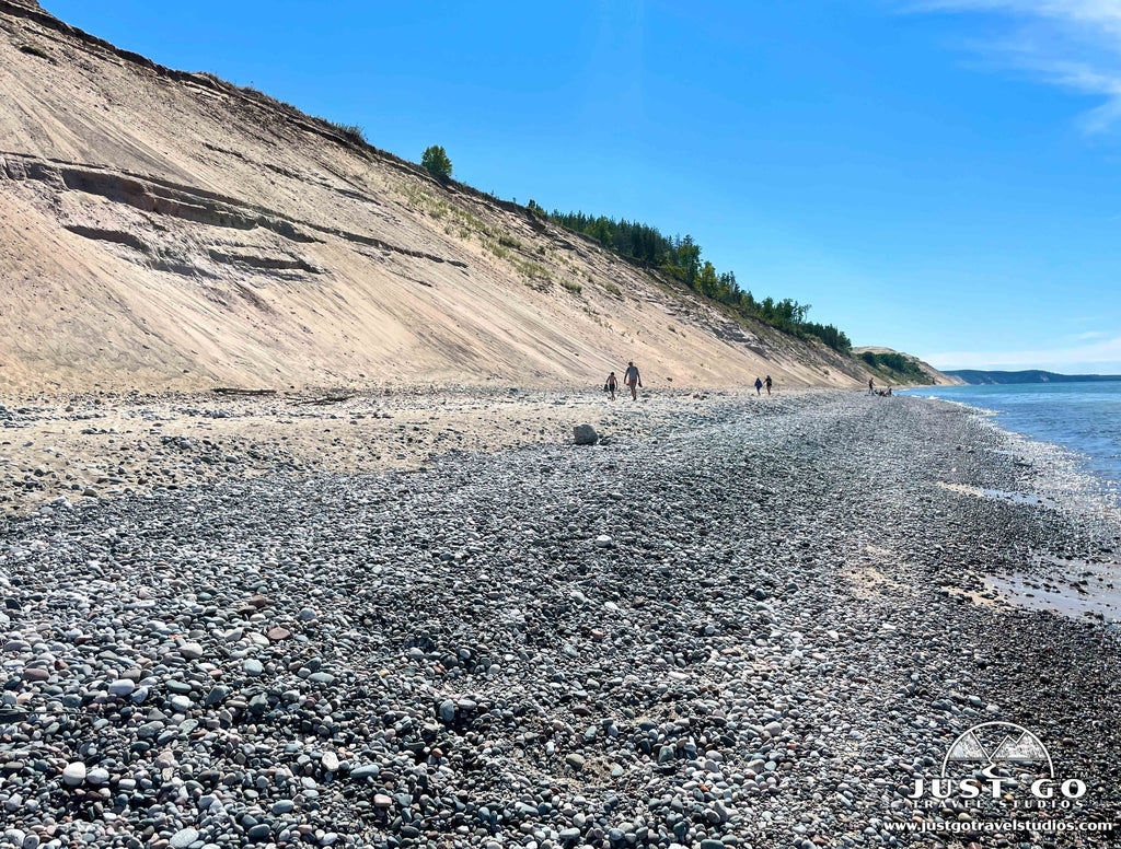
The Log Slide Overlook Trail leads to the site of a former log slide, where logs were sent down to the lake’s edge via a wooden chute. The chute no longer exists, but a short out-and-back trail (0.25-miles roundtrip) leads to the Log Slide scenic overlook on the western edge of the Grand Sable Dunes. From the overlook, you can see the Au Sable Light Station in the distance and a panoramic view of Lake Superior.
Log Slide Overlook Trail Highlights- Scenic Views: This short hike leads to amazing views of Lake Superior from the overlook. You can also see the rockfaces along the shores of the lake.
- Historical Significance: It’s interesting to learn about how they used this area for logging. Jus the process that was used here is incredible to learn about!
- Crowds: This trail is short, and therefore draws a good number of people. Just be prepared for that! It’s great to come here in the evening as the sun goes down to avoid the busiest time of the day.
- Sun Exposure: If you come here during the heat of the day, be sure to protect yourself!
WHITE BIRCH TRAIL
- Difficulty: Easy
- Distance (round-trip): 2.0 miles
- Elevation gain: Minimal
- Hiking time (approximate): 1 hour
- Trail type: Loop
- Potential hazards: Bugs
- Restrooms: Pit toilets located at the trailhead.
- Recommended footwear: Hiking shoes
- Pets: Allowed, but must be kept on a six-foot leash at all times.
Explore the natural history of the uplands adjacent to Lake Superior on this 2-mile self-guided interpretive trail.
White Birch Trail Highlights- Variety of the Scenery: The scenery in the park is beautiful, and this one features great overlooks as well as forests and streams.
- Serenity: This trail is not very crowded, and is a great way to get away from other fellow tourists. You can also have the opportunity to see some of the small mammals that frequent the area!
- Overgrown Trails: If you come here in the summertime you may find that the trails are a bit overgrown and not as well maintained. You’ll still have a good time, but just be prepared.
Park at the day-use area for the Twelvemile Beach Campground and walk through the campground to Site 6, where the trail begins. The trail ends on the campground road, a quarter mile east of the trailhead. Leashed pets allowed.
GRAND SABLE FOREST TRAIL
- Difficulty: Easy
- Distance (round-trip): 2.0 miles
- Elevation gain: Minimal
- Hiking time (approximate): 1 hour
- Trail type: Out-and-back
- Potential hazards: Bugs
- Restrooms: Pit toilets located at the trailhead.
- Recommended footwear: Closed-toes shoes
- Pets: Not allowed
This trail, a segment of the North Country Scenic Trail, connects the Grand Sable Visitor Center and the Sable Falls parking area. Walk through a maple forest, along Sable Creek and through an old farm field before reaching the Sable Falls area. This trail is best when combined with the Sable Falls Trail or the Grand Sable Dunes Trail.
Grand Sable Forest Trail Highlights- Forest Setting: You get to experience a northern hardwood forest as well as towering trees. The trees dampen a lot of noise, so the forest is very quiet!
- Easy: This hike is not overly short, but it’s very easy to do and well maintained.
- Limited Views: Most of the hikes in Pictured Rocks National Lakeshore offer grandiose views, and this hike does not. While still beautiful, it’s just less striking, making it more interesting for most hikers to spend the time on other trails.
Park at the Grand Sable Visitor Center. No pets allowed.
THE BEST FAMILY-FRIENDLY HIKES IN PICTURED ROCKS NATIONAL LAKESHORE
If you are like us, you’ll be traveling with kids. While kids tend to be full of energy, they don’t necessarily like to have that energy directed toward hiking! While we are firm believers that kids can hike a lot more than they think they can, there are a few trails in particular in Pictured Rocks that are well suited for families. Our recommendations include:
- Munising Falls Trail (short with a good payoff)
- Sable Falls Trail (while there are stairs, the ability to end at the beach is great!)
- Miners Castle and Miners Beach Trail (while this hike will take over an hour, part of the hike is along the beach, offering a good distraction or break for the kids!)
ARE PETS ALLOWED ON THE TRAILS AT PICTURED ROCKS NATIONAL LAKESHORE?
Pets are allowed on the Munising Falls Trail, Miners Falls Trail, Miners Beach Trail, White Birch Trail and Sable Falls Trail. All other trails are closed to pets. Pets must be kept on a six foot leash at all times, and you are required to clean up after your pet.
WHEN IS THE BEST TIME OF YEAR TO HIKE AT PICTURED ROCKS NATIONAL LAKESHORE?
Without a doubt, the best time of year to hike in Pictured Rocks National Lakeshore is in the summertime. The trails are snow-free and you can enjoy the clarity of the water like no other time of year. Plus, as it doesn’t get overly hot here, you can generally hike for a long time without the risk of heat exhaustion.
The only issue with the summertime is the bugs. They are especially bad in the early part of the summer through the end of June. Once you get into mid-July and August, they really start to die down and it become incredible. Some of the hikes will still be a bit buggy, but in general it’s not bad at all.
BACKPACKING AND BACKCOUNTRY HIKING IN PICTURED ROCKS NATIONAL LAKESHORE
Backpacking in the park is a great way of seeing nature and staying in it for two days or more. Most of the backcountry campgrounds are located along the North Country Trail, and there are campsites usually every two to five miles.
You can go to recreation.gov to obtain a backpacking permit if you plan on staying out in the wilderness for at least one night.
HIKING IN PICTURED ROCKS NATIONAL LAKESHORE IN THE WINTER
The winter is a special time at Pictured Rocks. The crowds diminish greatly, and you get a chance to see waterfalls that are frozen and ice climbers scaling them. The trails are very quiet. However, you do need to be prepared to go trekking in the winter.
Every trail requires either snowshoes or ice traction. You may be tempted to skip this step, but you’ll find yourself with wet feet, snow in your boots and making deep track for others to navigate around.
You also need to be prepared for freezing temperatures and winds off Lake Superior that bring the wind chill down significantly. We highly recommend hiking in the winter, as long as you come prepared!
FURTHER INFORMATION ON PICTURED ROCKS NATIONAL LAKESHORE FROM JUST GO TRAVEL STUDIOS
- In addition to this article, we have another must read article on Things to Do in Pictured Rocks National Lakeshore and our blog on Camping in Pictured Rocks National Lakeshore.
- When you get back from your amazing trip, send us a few photos so we can make a custom, vintage-style poster using your photo and customized wording!


