Oregon Coast - Things to Do
Amy BrahanThe Pacific coastline is known for some amazing stretches of road, and the Oregon Coast is no exception. Drive along Highway 101 to experience hundreds of miles of scenic viewpoints, sandy beaches, charming seaside towns, forested headlands, sea stacks and historic lighthouses.
We’ve visited coastlines up and down the Atlantic and Pacific coasts, but the Oregon Coast is one of a kind. With public access to every mile of Oregon’s beautiful coastline and numerous state parks, the opportunities for coastal adventures and exploration are endless!
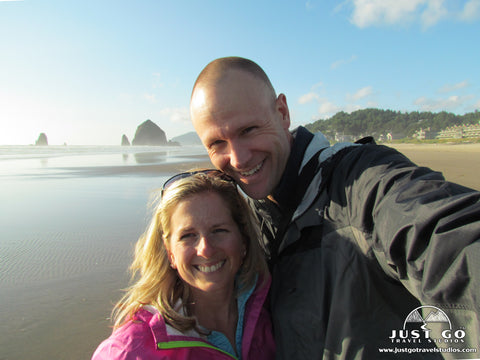
An article in a magazine about Cannon Beach is what initially inspired our travel to the Oregon coast—a detour on a family road trip to visit national parks. After a bit of research, I decided the Oregon Coast deserve far more time than a stop to see Haystack Rock. We spent four amazing days exploring the coastline between Florence and Astoria.
We didn’t have time to drive the entire Oregon Coast, but we’d still love to share what we think are some of the best Highway 101 attractions and things to do along the Oregon Coast! We’ve listed our suggestions from north to south since Portland is an ideal place from which to start if you happen to be flying into Oregon.
NORTH COAST
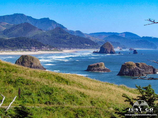
The North Coast stretches between the Columbia River and Neskowin, Oregon. This part of the coast has long stretches of pristine sandy beaches, forested headlands and sea stacks punctuating the coastline. Cannon Beach is the area that attracts the most tourists to its famous sea stack, Haystack Rock. However, there are actually three Haystack Rocks along the Oregon Coast and numerous stunning locations that also deserve your attention!
ASTORIA (MILE 3)
The historic town of Astoria sits near the mouth of the Columbia River. Astoria is the oldest American settlement west of the Rockies and offers museums and landmarks that will satisfy any history buff.
- Make sure to visit the Columbia River Maritime Museum and the Astoria Column.
- If you have more time, ride the Astoria Riverfront Trolley or visit Fort Stevens State Park to check out the Peter Iredale

The 4-mile Astoria-Megler Bridge carries traffic between Oregon and Washington over the Columbia River. It is the second longest continuous three-span, through-truss bridge in the world! If you start your trip in Astoria, Highway 101 is already at milepost three since the Oregon state line is closest to the Washington side.
SEASIDE (MILE 20)
We didn’t spend much time in Seaside; however, Oregon’s first coastal resort town is a popular year-round destination. Walk Seaside’s Promenade, visit the Seaside Aquarium, or rent bicycles to explore the downtown and beach areas. This is also a popular area for razor clamming along the Oregon Coast. Be sure to check the Oregon Department and Fish and Wildlife clamming report for current regulations.
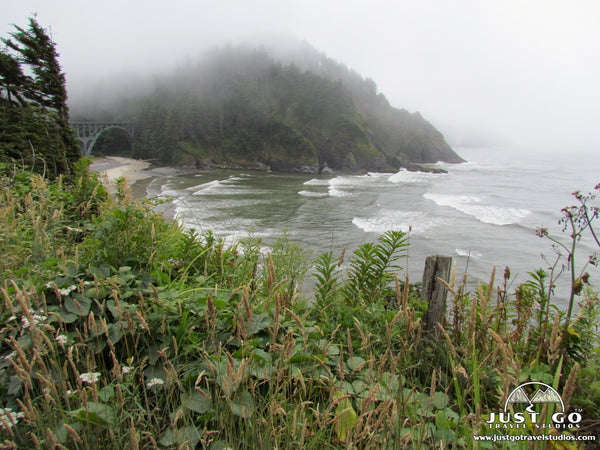
ECOLA STATE PARK (MILE 28)
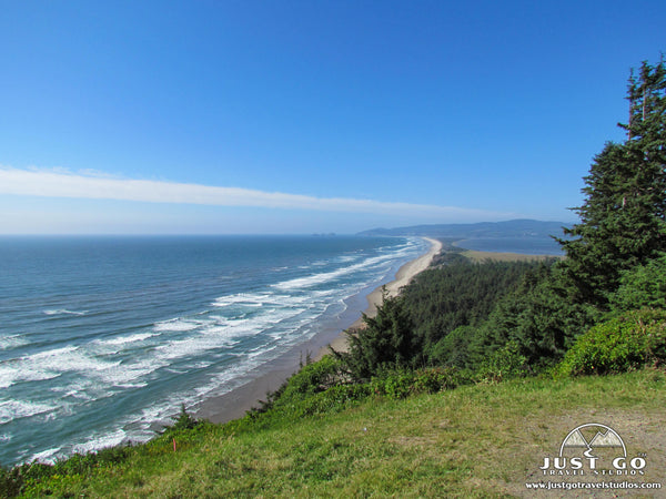
Located just 28 miles from the northern Oregon state line between Seaside and Cannon Beach, Ecola State Park is a must-do on any coastal Oregon road trip! The 1,300-acre park offers dramatic ocean views, access to two beautiful beaches and a network of trails that includes an 8-mile segment of the Oregon Coast Trail.
Stop at Ecola Point for a picnic and for views of the sea stacks to the south at Cannon Beach. Ecola Point also provides access to one of our favorite hiking trails in the park—the Indian Beach Trail. Unfortunately, part of the trail washed out in the spring of 2017 and you can’t currently hike all the way from Ecola Point to Indian Point. However, you can still hike partway on this trail which provides access to lookouts with incredible views, including sights such a Sea Lion Rock Arch.

Finally, drive a winding road through coastal rainforest to visit Indian Beach. Watch the surfers, explore the tidepools at low tide or hike an interpretive trail and trace the route used by an expedition party from Lewis and Clark’s Corps of Discovery.
CANNON BEACH (MILE 28)
Although Cannon Beach is one of Oregon’s most popular beach towns, it is also one of the most picturesque and charming. The sidewalks of town are full of character with numerous art galleries, boutiques and restaurants—most with shingle siding and window boxes that overflow with colorful flowers in the summertime.
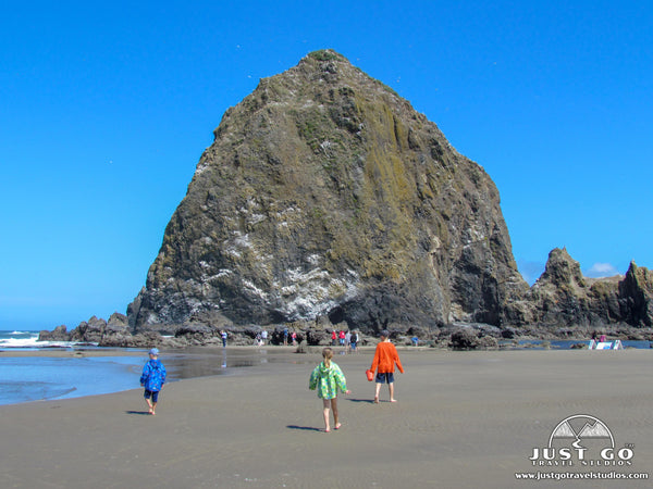
Cannon Beach is best known for its long, sandy beach and impressive Haystack Rock that lies just offshore. Haystack Rock is part of the Oregon Islands Wildlife Refuge and is home to a variety of wildlife, including many species of nesting birds. At low tide, you can get up close to the rock, but disturbing the birds or marine life in the tidepools is strictly prohibited. By day, our kids thoroughly enjoyed running and playing on this expansive beach; and, an evening stroll to enjoy the Pacific Coast sunset was the perfect way to end the day!

HUG POINT STATE RECREATION SITE (MILE 33.7)
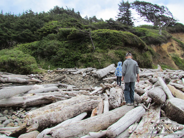
Just five miles south of Cannon Beach, Hug Point State Recreation Site is a gem along the Oregon Coast. The park provides easy access to a sandy cove beach, sea caves carved into sandstone cliffs, and a seasonal waterfall beyond Hug Point. We met some of the nicest locals on this beach and our kids enjoyed exploring the caves and playing by the waterfall.
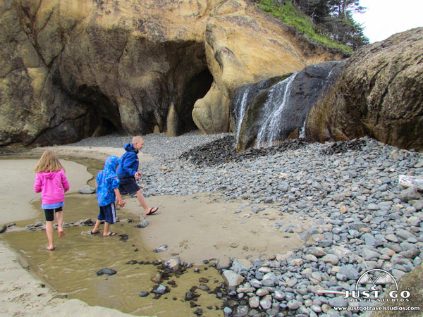
The state park also has some interesting history! Hug Point was named after a trail that was originally carved into the headland by stagecoaches. Before modem highways were built, the original travelers to the area had to travel by stagecoach along the beach. Even at low tide, stagecoaches traveling around this headland had to hug the point to avoid being swept into the ocean. At low tide, wheel ruts worn into the rock can still be seen in some locations.
Please be aware of the tide when exploring the beach and sea caves of Hug Point State Park! It is possible to become stranded by the incoming tide, so check the tide chart and keep an eye on the time when visiting.
OSWALD WEST STATE PARK (MILE 39)
We didn’t have time to stop here but have heard great things about Oswald West State Park. Take a short hike through old-growth forest and cross a swaying wooden bridge to reach Short Sands Beach. You can also hike 2 miles to the summit of Neahkahnie Mountain for some amazing views. We may have missed it, but don’t think you should!

Oswald West State Park map, courtesy of Oregon State Parks
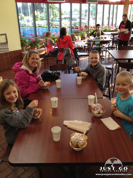
TILLAMOOK CREAMERY (MILE 63.9)
Tillamook is home to the Tillamook Creamery, the most visited tourist attraction on the Oregon Coast. Check out the new 38,500-square foot visitor center, take a self-guided tour to see how cheese is made or enjoy lunch at the Dining Hall. Although we love cheese, it wasn’t what drew us to the factory. Having heard rumors about ice cream flavors like Marionberry Pie and Huckleberry, we decided to indulge and have ice cream for dinner! It still makes my mouth water thinking about that ice cream. Though we can’t find Tillamook products here on the east coast, we seek out Tillamook cheese, yogurt and ice cream whenever we are out west!
THREE CAPES LOOP (MILE 65.1; NORTH END OF LOOP)
Highway 101 travels along the coast for much of the trip, but this 38-mile scenic byway is not to be missed! The Three Capes Loop passes through Cape Meares, Cape Lookout and Cape Kiwanda before returning to Highway 101.
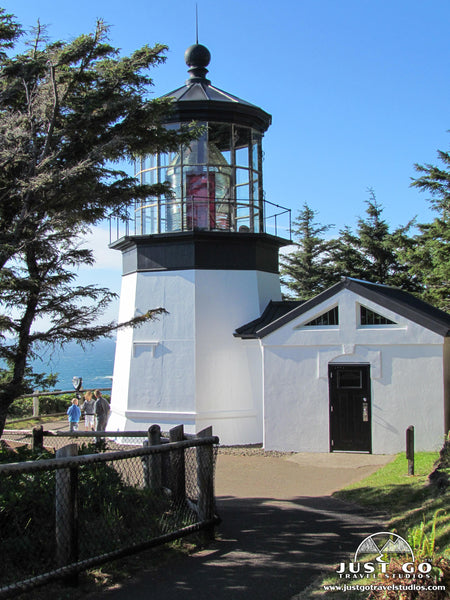
- Cape Meares State Scenic Viewpoint is home to Oregon’s shortest lighthouse, Cape Meares Lighthouse, at only 38 feet high, and the Octopus Tree. Trails provide access to interesting viewpoints, including sights of the Three Arch Rocks National Wildlife Refuge just off-shore.

Cape Meares map, courtesy of Oregon State Parks
- Cape Lookout State Park is popular for camping, hiking and beachcombing. Explore miles of sandy shores along the Netarts Spit or hike the 2.3-mile Cape Trail to the tip of Cape Lookout.

Cape Lookout map, courtesy of Oregon State Parks
- Cape Kiwanda State Natural Area is known for its stunning sandstone formations and another Haystack Rock. This particular Haystack Rock has protected the soft sandstone cliffs and prevented their destruction from the sometimes-harsh Oregon Coast weather. I can’t remember why we didn’t stop here, but this is another location you’d shouldn’t miss!
CENTRAL COAST
The Central Coast stretches between Lincoln City and Florence (the southernmost city which we visited). This part of the coast still has some sandy beaches but also has several prominent lighthouses, massive headlands, sea cliffs and rocky shorelines.
DEPOE BAY (MILE 127.2)
Depoe Bay is a beautiful little coastal town with a rugged coastline and cozy harbor. It has a couple claims to fame—it has the world’s smallest navigable harbor and is also the whale watching capital of the Oregon Coast! Due to its proximity to the ocean, whale-watching and fishing charters can be on the open sea in a matter of minutes.
- If you are looking to go deep-sea fishing, Dockside Charters is known to be one of the best Oregon fishing charters. They also offer whale watching and sight-seeing cruises.
- Whale Research EcoExcursions offers eco-friendly and educational whale-watching excursions on Zodiac boats.
- If you prefer to view whales from land, the Whale Watching Center is one of the best sites in Oregon for spotting gray whales which reside off the coast between March and December.
NEWPORT (MILE 141)
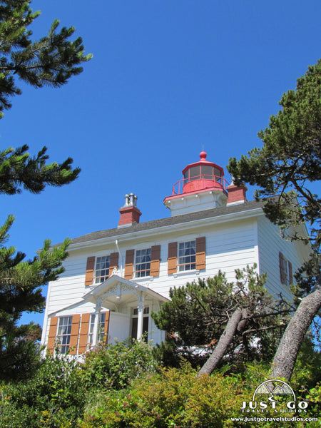
If you enjoy seafood, Newport is a fishing town and a great place to stop to for lunch while driving along the coast. It is best known as the Dungeness crab capital of the world. However, if you aren’t hungry, Newport offers plenty of great options for other types of activities! Newport is home to two historic lighthouses; plus, there are numerous opportunities for outdoor recreation and learning about marine life.
- Yaquina Head Lighthouse sits on a rocky headland just north of Newport and is part of the Yaquina Head Outstanding Natural Area. This historic lighthouse, built in 1873, is Oregon’s tallest lighthouse at 93 feet tall. The site offers an interpretive center, historical tours of the lighthouse and several miles of trails providing access to viewpoints and tidepools along the rocky shore.

- Agate Beach State Recreation Site (just south of Yaquina Head) is a popular area for beachcombing, surfing and razor clamming. It also has a great view of Yaquina Head Lighthouse just to the north.
- Yaquina Bay Lighthouse is located at the Yaquina Bay State Recreation Site. Built in 1871, it is the only wooden lighthouse on the Oregon coast and believed to be the oldest structure in Newport. The Yaquina Bay State Recreation Site also includes walking trails, beach access and a scenic overlook with views of the Yaquina Bay Bridge.
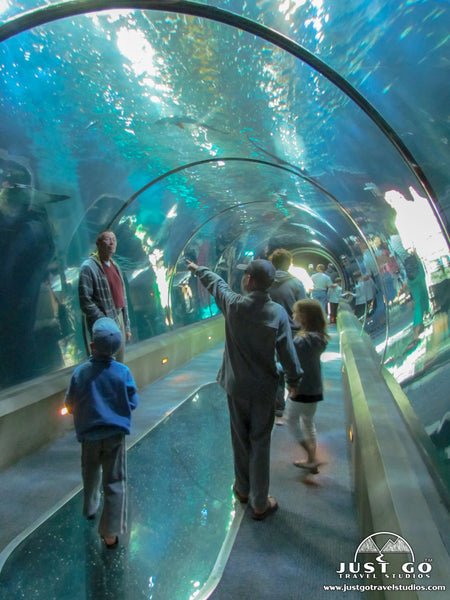
- The Oregon Coast Aquarium was a favorite stop in Newport for our whole family! It is rated as one of the best aquariums in the country and has some amazing exhibits, including Passages of the Deep, the Seabird Aviary and the Sea Otter exhibit.
- The Hatfield Marine Science Center is a marine science research and education center located next to Yaquina Bay. It is smaller than the Oregon Coast Aquarium but offers some great educational exhibits, a touch tank and an estuary trail for viewing shorebirds.
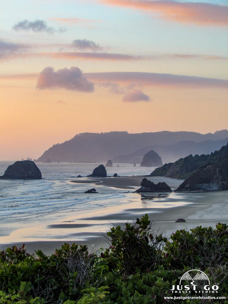
YACHATS (MILE 164.4)
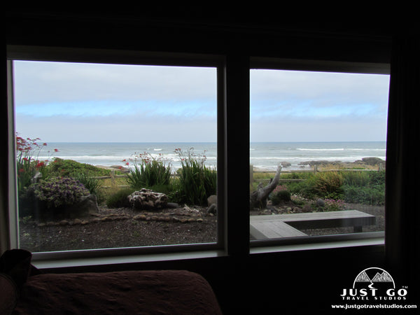
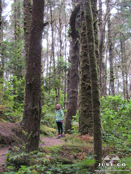
Before we planned our trip to the Oregon Coast, we had never even heard of Yachats, nor did we know how to properly pronounce its name! However, this small coastal town at the mouth of the Yachats River is know as the “Gem of the Oregon Coast,” and, we would agree that it is pretty special! Explore old-growth forests and rocky shores with crashing waves along this stretch of wild and rugged coastline. Later, unwind in town with some amazing local eats. Our favorite was the Ona Restaurant and Lounge--well-worth the splurge! Yachats is a great place to stay for a night or two to explore this section of the coast. We highly recommend the Overleaf Lodge and Spa with spectacular ocean views from every room!
Our favorite place to visit in Yachats was Cape Perpetua Scenic Area, 2,700 acres of coastal beauty in the Siuslaw Forest. The scenic area offers 26 miles of interconnected trails, old-growth forests, tidepools, crashing surf and stunning views. Don’t miss out on these unique features at Cape Perpetua:

Cape Perpetua Scenic Trails map, courtesy of the United States Department of Agriculture
- The Cape Perpetua Headland is the highest viewpoint accessible by car on the Oregon Coast and, on clear days, provides an incredible view down the coast. The headland sits above the protected Marine Garden shoreline. The road to the viewpoint winds upwards from the north side of the Cape Perpetua Campground.
- Devil’s Churn is a narrow inlet created by wave action over thousands of years. During high tide and big swell events, waves that crash to shore funnel to the back of the inlet and the resulting spray can reach hundreds of feet into the air.
- Cape Cove Beach is just a short walk from the Devil’s Churn area. Our kids enjoyed playing on this beautiful little sandy beach.
- Thor’s Well is a natural sinkhole carved into the basalt rock that seems to continuously fill and drain back into the ocean.
- Spouting Horn is just a few hundred feet south of Thor’s Well. As waves roll in to Cook’s Chasm, building pressure forces seawater through a crack in the roof of the cave. Seawater shoots high into to the air like an ocean geyser!
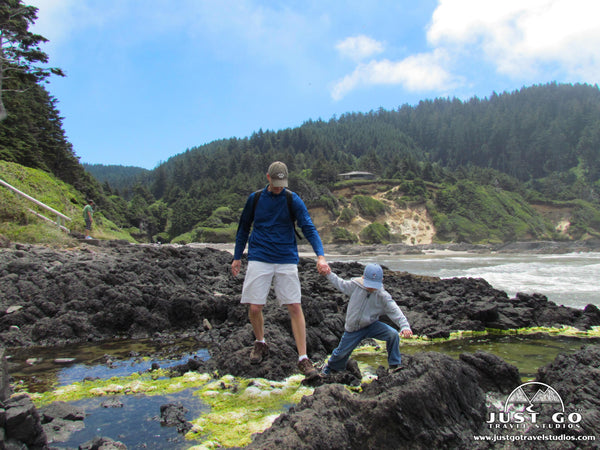
Our favorite Cape Perpetua hike was the Captain Cook Trail which leads through some dramatic wind sculpted trees, around Indian shell middens and down to tidepools, Thor’s Well and the Spouting Horn. This trail can be connected to the Cape Cove Trail, Trail of Restless Waters and Devil’s Churn Trails to create an extended trail along the Cape Perpetua shoreline.

***Although Devil’s Churn, Thor’s Well and Spouting Horn are most impressive at high tide and during winter storms, they are also especially dangerous then. Be aware of sneaker waves and never turn your back to the ocean! Check the tide charts for the Cape Perpetua area before your visit.
FLORENCE (MILE 190)
Florence is located at the southern end of the Central Oregon Coast at the mouth of the Siuslaw River. Old Town, Florence’s riverfront district, has waterfront charm with its offering of interesting shops, galleries and restaurants. Local landmarks like Heceta Head Lighthouse and the Sea Lion Caves can be found to the north. Miles of coastal sand dunes dominate the landscape to the south.
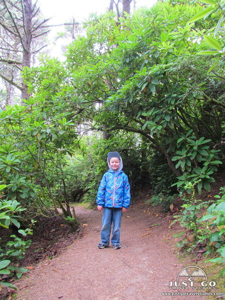
- The Hobbit Trail, located just north of the Heceta Head Lighthouse, is aptly named. From the trailhead on the edge of Highway 101, this magical trail is quickly engulfed by a lush rainforest with walls of rhododendrons and Sitka spruce. Ancient, twisty moss-covered trees line the trail. Travel through a natural tunnel in the foliage before the trail leads to the secluded Hobbit Beach. NOTE: The parking area can be easy to miss since the small parking area is on the opposite side of the highway from the trailhead. Although short, the trail requires a bit of a climb to return to the trailhead.
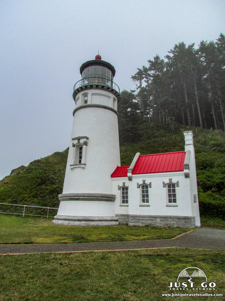
- The Heceta Head Lighthouse State Scenic Viewpoint is located 12 miles north of Florence. A short trail leads to the Heceta Head Lighthouse, the most photographed lighthouse and brightest light on the Oregon Coast. The park also features a sandy beach and a 7-mile network of trails. Sea lions and whales can be seen both from the beach and the lighthouse. Common Murres, which lay their eggs on the bare rocks of wildlife refuge islands, can be seen just offshore.

Haceta Head map, courtesy of Oregon State Parks
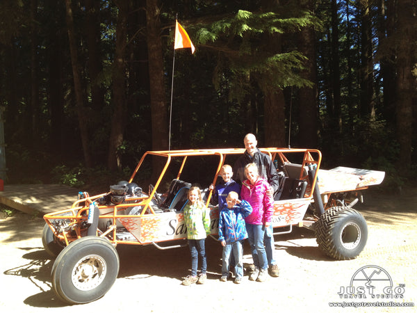
- Experience massive, wind-sculpted dunes at the Oregon Dunes National Recreation Area. This area is largest dune region in North America and provides opportunities for hiking, off-highway vehicle (OHV) riding, paddling and camping. We especially enjoyed a guided sand rail tour through the dunes with Sandland Adventures.
SOUTH COAST
The South Coast stretches from Reedsport to Brookings. The northern portion is dominated by towering sand dunes, a continuation of the Oregon Dunes National Recreation Area. Once you cross Coos Bay, you will have reached the coastal cities of Oregon’s Adventure Coast. Further south, the coast turns more rugged, mountainous and wild. Although we didn’t get this far south on our Oregon Coast road trip, we hear these are some must-do stops along the way!
NORTH BEND (235) AND COOS BAY (MILE 237.5)
The Adventure Coast, also known as the Bay Area, consists of the coastal towns North Bend, Charleston and Coos Bay, which is the largest city on the Oregon Coast. This area is a popular stop for tourists with its many shops, galleries, restaurants and lodging options. There are also numerous opportunities for outdoor recreation--including fishing, crabbing and hiking in one of the area’s state parks.
- Charleston and Cape Arago Highway Drive: To see the best of the Bay Area, detour off Highway 101 to Charleston, a picturesque fishing village at the mouth Coos Bay. Pick up the Cape Arago Highway in Charleston, which leads to several beaches, the Cape Arago Lighthouse Viewpoint and three state parks (Sunset Bay State Park, Shore Acres State Park and Cape Arago State Park).
- Of the three state parks off the Cape Arago Highway, the most notable is Shore Acres State Park. Although the estate of lumber baron Louis Simpson is all but gone, what used to be Simpson’s private garden remains. The botanical gardens draw admirers from March to mid-October when the flowers are in bloom and later in the year for a display of holiday lights. The park is also popular place from which to watch winter storms and take in the view as the waves crash on the cliffs below.
BANDON (MILE 274)
Bandon is a quaint harbor town located at the mouth of the Coquille River. Bandon is known as the Cranberry Capital of Oregon which draws many visitors during its annual Cranberry Festival in the fall. However, its most stunning feature is its spectacular beach with large rocks and coastline dotted by sea stacks.
- Bullards Beach State Park offers campsites, sand dunes, several miles of beach and access to the Coquille River Lighthouse.
- Face Rock State Scenic Viewpoint has stairs that lead down to a beach with beautiful rock formations, including its namesake Face Rock.
- Washed Ashore is a community art project with a mission to exhibit art from trash washed ashore and bring awareness to plastic pollution in our oceans.
PORT ORFORD (MILE 300)
Historic Port Orford is the westernmost incorporated city in the contiguous US and is known for its fabulous ocean vistas. It is one of only a few ports in the world where fishing boats have to be hoisted in and out of the water daily since the jetty at Port Orford offers little protection from storms.
- Cape Blanco State Park is home to the Cape Blanco Lighthouse, Oregon’s southernmost lighthouse and oldest standing lighthouse.
- Humbug Mountain State Park is a popular place to camp. Since surrounding mountains provide protection from cool ocean breezes, the campground has some of the warmest weather on the Oregon Coast. Hiking to the top of Humbug Mountain is another popular activity, as are windsurfing and scuba diving.
- Battle Rock State Park, with its black sand beaches and sea stacks, is said to offer some of the most incredible views along the coast. It was the location of a historic battle between American Indians and explorers.
GOLD BEACH (MILE 328) TO BROOKINGS (MILE 357)
The stretch of Highway 101 between Gold Beach and Brookings is considered to be one of the most scenic drives in Oregon. There are numerous waysides, scenic viewpoints and hiking trails along the way.
Although this stretch of Highway 101 typically has less traffic than the popular North Coast stretch, a massive landslide occurred in February bringing traffic through the area to a halt. Although this section of highway has since been reopened, it is one lane only. Expect delays when traveling through this area until the road has been fully repaired.
- Cape Sebastian State Scenic Corridor offers panoramic views from the parking area 200 feet above sea level. A thick forest of Sitka spruce covers much of the rest of the park and visitors can hike a 1.5-mile trail to the cape.
- Myers Creek Beach Viewpoint is known for its shark fin rock formation and is popular with windsurfers.
- Samuel H. Boardman State Scenic Corridor is a long, narrow park covering about 12 miles of coastline. A scenic byway offers turn-offs with access to viewpoints and trailheads showcasing offshore rock formations and secluded beaches. Spend the day hiking a portion of the Oregon Coast Trail or stop at each parking area to view some of the highlights along the way. View stone formations like Rainbow Rock, House Rock, Natural Bridge and Arch Rock or visit one of several beaches including Whaleshead Beach, Secret Beach and Lone Ranch Beach.
- Harris Beach State Park is home to Bird Island, the largest island along the Oregon Coast. The park also offers sandy beaches and tidepools and is a popular spot for camping along the coast.
TIPS FOR VISITING THE OREGON COAST
- Pack a camera and binoculars—maybe more than one of each if you have kids like we do!
- Bring/wear layers of clothing. Be prepared with a variety of clothing for a variety of weather! July through September tend to be warmer and drier than the rest of the year, but don’t expect to go sunbathing! We had a decent about of morning fog during our July trip, but it generally cleared up mid-day.
- Pack a rain jacket since weather can change quickly on the coast. If nothing else, a rain jacket is a good outer layer on a damp, foggy morning or on a day with a stiff, ocean breeze.
RELATED INFORMATION FROM JUST GO TRAVEL STUDIOS
- One of the most amazing places on the coast is Ecola State Park, home of Canon Beach. Be sure to check out our extensive blog on What to See and Do in Ecola State Park.
- The coast is fantastic, but you may want to head inland and see the beauty of the mountains. A great short hike is the Paulina Falls Trail in Newberry National Volcanic Monument.
- While visiting Oregon, another popular place to visit is Crater Lake National Park. Be sure to pick up our downloadable Crater Lake National Park Itinerary ahead of your trip! You also should read our blogs on Crater Lake National Park.
- We’d love to work with you to take one of your photos and turn them into one of our unique, custom, vintage-style travel posters. If you haven’t tried this yet, we guarantee you won’t be disappointed!
OTHER INFORMATION ON THE OREGON COAST
- Martin (from “Small Town Explorer”) has a blog that you’ll want to check out that goes into detail on 16 Small Towns along the Oregon Coast.
- Kathrine (from “Travel the World”) has a terrific blog covering details on what there is to see and do in Astoria, Oregon.
- Katie and Ben (from “Two Wandering Soles”) cover a ton about the Oregon Coast, but check out their section on Bandon Beach for specific information on what to see thee as well as great places to eat!
If you have been to the Oregon Coast and have favorite spots that we didn’t include in this post, please leave a comment or email us directly. We’re also happy to answer any questions that you might have!