Newberry National Volcanic Monument: Things to Do, Hiking Trails, Maps & More
Peter BrahanLocated in Oregon’s beautiful Deschutes National Forest, Newberry National Volcanic Monument is full of unexpected treasures. Not only does the monument contain the largest volcano in the Cascades, it is packed full of beautiful vistas, a varied and rugged landscape, an impressive waterfall and plenty of places to explore. The landscape is so unique and “otherworldly” that it was once even used as a training ground for astronauts between 1964 and 1966 to help train for the lunar landing!
This little-known National Monument is just about 20 minutes south of Bend, Oregon. Yet despite its proximity to the town known as a home base for some of Oregon’s best outdoor adventures, the monument stays relatively uncrowded.
If you are heading to the Bend area, this is a great place to stop and spend at least a few hours exploring all it has to offer. If you have more time, setting up camp here for a few days will prove to be an incredible experience.
Newberry National Volcanic Monument is split up into three sections: The Lava Lands Area (created from an eruption almost 7,000 years ago), the Lava Cast Area and the largest of the three, the Newberry Caldera Area. Each offers a unique experience, and all are worth visiting.
Even though Newberry National Volcanic Monument was officially designated in 1990, it’s likely you’ve never heard of Newberry National Volcanic Monument, but we hope that this guide both helps motivate you to go and provides you with some tips on what to see and do while visiting!
Ahead of your trip, download our Newberry National Volcanic Monument itinerary. We include the best hikes, what to do in the park, what to see and do in the area as well as 1, 2 and 3 day itineraries for several different “speeds” of travel!

Newberry National Volcanic Monument map, courtesy of the National Forest Service
LAVA LANDS AREA THINGS TO DO

Lava Lands area map, courtesy of the National Forest Service
The Lava Lands Area is the northernmost section of the monument. Though not the largest, it is thought by many to be the main section of the park. It is where you’ll have access to park rangers, exhibits and films as well as the shuttle to the top of the Lava Butte.
Lava Butte is a large cinder cone that stands slightly over 500 feet higher than the surrounding area, so you can see it from quite a distance. It is what’s left of a single eruption.
Since it is only about 20 minutes south of Bend, it is easy to get to and usually a first stop for most visitors.
While visiting the Lava Lands area, our recommendations include:
- Lava Lands Visitor Center. It’s always good to check out the park’s visitor center when you first arrive at a National Park Service site, and this one is especially useful. Stop in to get a good overview of the land and find out first-hand from the rangers what they recommend on the day you are visiting. There are great exhibits on the geology and culture, as well as a few films that you can view. There is also a nearby picnic area and restrooms at the Visitor Center.
- Lava Butte. No trip to the Lava Lands area is complete without a visit to the top of the Lava Butte. The road spirals up to the top of Lava Butte, giving you spectacular views of Oregon and the Cascades in particular. To get to the top of Lava Butte, you have a couple of options:
- Lava Butte Shuttle. The Lava Butte shuttle leaves the Visitor Center every 20 minutes and costs $2 per visitor. The shuttle runs most days between Memorial Day and Labor Day between 10:00 am and 4:00 pm, when the last shuttle departs the visitor center for the Lava Butte.
- Personal Vehicle. It is possible to drive your car up to the top of the Lava Butte, but only when the shuttle is not running. Since parking is limited at the top of the Lava Butte, the park limits the number of cars that can be up there at any one time. They do this by issuing permits on high use days. 10 permits are issued for each 30-minute time period that the park is open.
- Biking or Walking. Visitors can bike or walk up the auto road as well. The road is about 1.6 miles long (one way) and it a challenging trek, since it climbs approximately 500 feet to the top.


Lava Butte Lava Flow, image courtesy of Smithers7
- Hiking. Aside from hiking up the Lava Butte, there are a couple of other trails nearby that are worth exploring:
- The Trail of the Molten Land is an easy, 1.0-mile loop that is a great way to see the local wildflowers. The trail is paved the entire way, making it accessible to all. Along the way are information stations about the area’s history that are really informative. 124 ft. elevation gain. The Trail of the Molten Land is accessed from the Lava Lands Visitor Center.
- The Whispering Pines Trail is an easy hike that is also paved. This 0.4-mile (round trip) trail connects to the Sun-Lava Trail and heads through a pine forest. Minimal elevation gain. The Whispering Pines Trail is accessed from the Lava Lands Visitor Center.
- The Sun-Lava Path is a paved trail that connects the Lava Butte Area to nearby Sunriver Resort. It is 5.5-miles (one way) and is great for biking or a long walk of you are up for the challenge. The Sun Lava Path can be reached on one end from the Lava Lands Visitor Center and the north end of the Sunriver Resort on the other. See the map for details.
LAVA CAST AREA THINGS TO DO

Lava Cast area map, courtesy of the National Forest Service
The Lava Cast Area of Newberry National Volcanic Monument is the smallest of the three areas. In fact, it only covers about 5 square miles. While small, it is certainly worth checking out if you have the time.
The Lava Cast Forest was created by lava flowing and taking over the forest about 6,000 years ago. What is left behind is some amazing scenery, with casts of the old forest still intact. The forest is slowly but surely reclaiming the land. You can read more about it in the U.S. Forest Service guide on the Lava Cast Forest.
To get to the Lava Cast area from Bend, go south for about 15 miles. Take the Sunriver exit and take the Forest Service Road #9720 for 10 miles. Take a right onto #950. The road ends at the trailhead.
You won’t need a full day if you head to the Lava Cast Area-a half day is likely more than enough. However, do explore this amazing forest!
While visiting the Lava Cast area, we recommend the following:

Lava Cast Forest, image courtesy of Rick Obst
- Hiking. Hiking is the main activity in the Lava Cast area. There are two trails:
- The most popular hike is the Lava Cast Forest Trail. This is an easy 0.9-mile loop with only about 60 feet of total elevation gain. This interpretive trail includes signs to explain the sites. The formations of the old forest and the lava flow are incredible. The trail is wheelchair accessible to a point, when a sign directs you to turn around. If you come here in the spring, the wildflowers are incredible. The Lava Cast Forest Trail is accessed at the end of the main access road (on NF-950).
- The Hoffman Island Trail is an easy 0.8-mile round-trip hike. There is minimal elevation gain, and at the end of the trail you will find views of an island of trees that are surrounded by lava. This is the least popular of the two trails, but it is still worth going to if you have the time. The Hoffman Island Trail is accessed from the National Forest Service Road #9720 and is on the right side about 8 miles from Highway 97.
NEWBERRY CALDERA AREA THINGS TO DO

Newberry Caldera area map, courtesy of the National Forest Service
By far the largest of the sections of the monument, the Newberry Caldera area is full of great activities and places to explore. You’ll be shocked at the variety of landscape here-from deep lakes and forest to the Obsidian Flow, you won’t be disappointed with your visit here!
To reach the Newberry Caldera Area it takes a bit of time. From Bend, take Highway 97 south to La Pine. Exit and head east of National Forest Road #2215 for about 12 miles where you’ll reach the Paulina Visitor Center. The road is slow going in parts, so just be prepared to take some time!
Be sure to set aside at least a full day to explore the area-while you can rush through, it would be a shame to have to pick and choose what to cut out of your trip while you are here!
If you can make it to the Newberry Caldera area, there is a ton to do. Our recommendations include:
- Paulina Visitor Center. Even if you stopped at the Lava Lands Visitor Center to the north, the Paulina Visitor Center is also worth a visit. While small, the staff here can provide the latest information on this section of the monument, as well as answer any questions that you may have thought of on the way in. The center is not always open, but is during the day during peak times of year (late May through September).
-
Paulina Peak.
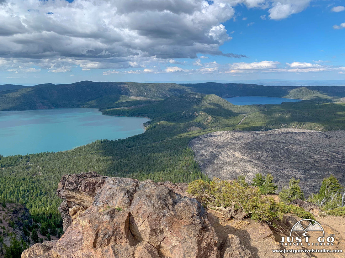
The views from Paulina Peak are absolutely incredible. After driving up a relatively narrow dirt road, Paulina Peak sits at 7,984 ft. above sea level. The views of the Newberry Volcano Area are absolutely amazing. There is a small parking lot at the top and a short walk to several overlooks. Be sure to keep an eye on any small children, as there are some drop-offs that can cause serious injury. We were up here in the evening before sunset, and the colors were amazing.


- Paulina Lake and East Lake. Paulina Lake and East Lake are depressions created from volcanic activity. Both lakes are inside the Newberry Caldera, but are separated by approximately two miles. Paulina Lake is the larger and deeper of the two lakes, at nearly 250 feet deep. East Lake is approximately 180 feet deep, a result of its higher elevation. Both lakes were created and maintained by rain and snowmelt. Both lakes offer great fishing (trout, sockeye and Atlantic salmon) and boating. They are ideal for kayaking, paddle boarding or canoeing as well, since there is a speed limit of 10 mph on the lake.
- Hiking. While there is plenty to see from the comfort of your car, to really experience this part of the park you need to get out and walk. The great thing about the Newberry Caldera area of the monument is that the hiking trails crisscross almost every possible space. This means that if you want to see something, there is a good chance that there is a hiking trail that allows you to do it. While we won’t list out every hike in this part of the monument, a few that we recommend include:
- The Paulina Falls Trail is an easy, 0.5-mile round-trip trail that leads to an impressive waterfall. This waterfall drops about 80 feet. While this trail can be crowded, it really is a pleasant stroll through the woods before leading to an overlook. There are also a few great picnic spots along the way. Minimal elevation gain. rail of the Molten Land is an easy, 1.0-mile loop that is a great way to see the local wildflowers. The trail is paved the entire way, making it accessible to all. Along the way are information stations about the area’s history that are really informative. 124 ft. elevation gain. The Paulina Falls Trail is located at the Paulina Falls Day Use Area. It is about 1 mile east of the entrance booth.

- The Paulina Lake Loop Trail circumnavigates Paulina Lake. This 7.5-mile loop provides a great way to spend a half-day. There are many swimming spots along the way. 425 feet elevation gain. The Paulina Lake Loop Trail is found right across the street from the Paulina Visitor Center. However, you can pick up the trail at any point along the shores of the Lake.
- If you are in for a hike on the longer and more challenging side, the Paulina Peak Trail is a great option. Starting at the visitor center, the trail heads south. After starting off flat, the trail starts to climb gradually and steadily increases in slope as you get to the 2-mile point. This incline continues until reaching the peak after 3 miles of hiking. The only downside is that after you get to the peak, you will have plenty of company (from those that drove up). The entire trail is 6.1 miles (round-trip). 1605 ft. elevation gain. The trail starts from the south side of the Paulina Visitor Center.
- The Big Obsidian Flow Trail is an easy hike that heads through a treacherous lava flow. The 0.6-mile round-trip includes a short hike through the woods before climbing stairs and looping around the obsidian flow, which is essentially a flow of black glass. 197 ft. elevation gain. The Big Obsidian Flow Trail is accessed 2 miles east of the Paulina Falls Day use area on the south (right) side of the road.

NEWBERRY NATIONAL VOLCANIC MONUMENT WINTER ACTIVITIES
Though much of the park is closed an inaccessible, if you are into snowshoeing or Nordic skiing, there are quite a bit of trails that are open in the area. To learn more, visit the Newberry National Volcanic Monument Winter Trail map.
WHERE TO STAY WHEN VISITING NEWBERRY NATIONAL VOLCANIC MONUMENT
Newberry National Volcanic Monument Lodging: There is no traditional lodging inside of the monument. However, if you want to stay in the area, we highly recommend looking at Sunriver, OR or Bend, OR, which are both less than an hour away.
Newberry National Volcanic Monument Camping: There four campgrounds in Newberry National Volcanic Monument, and all are in the Newberry Caldera Area. Each of the two lakes have two campgrounds. You can make reservations for the Cinder Hill campground and East Lake Campground (both on East Lake) as well as the popular Little Crater campground and Paulina Lake Campground (both on Paulina Lake). Don’t expect cell service at any of the campground.
BEST TIME TO VISIT NEWBERRY NATIONAL VOLCANIC MONUMENT
Newberry National Volcanic Monument is open year-round, but the roads to the Newberry Caldera are blocked to traffic for much of the year due to snow. The roads are only open in mid-May through October. The Lava Lands area is open in early May.
We highly recommend going in the summer when the area is fully open, flowers are in bloom and the trails have dried out a bit.
TIPS FOR VISITING NEWBERRY NATIONAL VOLCANIC MONUMENT
- Make sure you fill up on supplies (gas and food) ahead of your visit. There are no stores in the monument and it’s not an easy drive from the Newberry Caldera Area in particular. You can get supplies in either Sunriver (which can be a bit pricey) or in Bend.
- Cell service within the park is essentially non-existent. That means you’ll have to print this guide out ahead of your visit!
RELATED INFORMATION ON NEWBERRY NATIONAL VOLCANIC MONUMENT FROM JUST GO TRAVEL STUDIOS
- Be sure to download your copy of our Newberry National Volcanic Monument itinerary!
- We have a blog dedicated to the Paulina Falls Trail. This is one of our favorite hikes in the monument, as it is short with a great view at the end. Be sure to also check out our blog on the Big Obsidian Flow.
- Nearby Bend, Oregon is Smith Rock State Park and our favorite trail there, the Misery Ridge Trail.
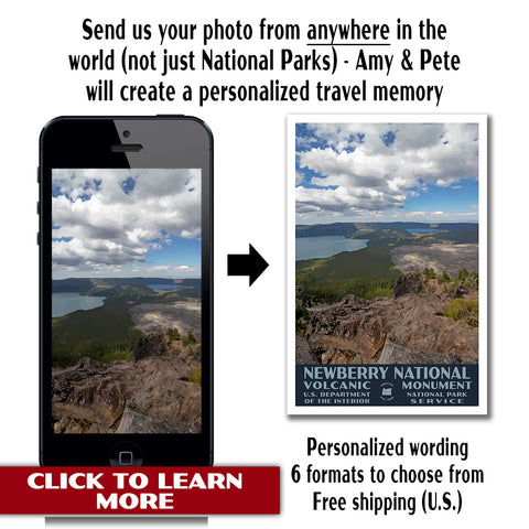
- After your trip, check out our Vintage Style Newberry National Volcanic Monument posters.

- If you like vintage posters, then we can make one for you! Just visit our listing to purchase a custom, vintage travel poster.