Julia Pfeiffer Burns State Park: Things to Do, Hiking Trails, Camping, Maps & More
Peter BrahanLocated along the beautiful Pacific Coast Highway between Los Angeles and San Francisco, Julia Pfeiffer Burns State Park is a small, but amazingly beautiful park. This “must see” location is a great spot to stop for a few hours as you explore Pacific Coast Highway in California.
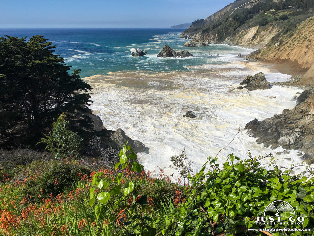
Most known for the breathtaking McWay Falls, this stunning landscape is easy to get to and relatively quick to explore. While most check out the falls and leave, the park also offers some great hiking. You can even camp here, if you are lucky enough to get one of the two spots that are available for adventurous explorers who like to carry in their tent and sleep in one of the most beautiful campsites in the state.
While this small park isn’t too hard to navigate, we hope that this guide helps you decide what to do here and how to best spend your time as you plan for your excursion along the California Coast!
JULIA PFEIFFER BURNS STATE PARK HISTORY
This land was the former 1800’s homestead of Christopher and Rachel McWay. Lathrop and Helene Brown and was later sold to Lathrop and Helene Brown. They lived in the property until 1956, during which time they leased part of the property to Julia Pfeiffer Burns and her husband, John Burns. Julia Pfeiffer Burns grew into a well-respected rancher in the area and a good friend of the Browns.
The Brown family donated the land to the State of California in 1961, and asked that the land be named after their friend Julia.
Julia Pfeiffer Burns State Park was established in 1962 and encompasses 3762 acres of land along the coast.
THINGS TO DO IN JULIA PFEIFFER BURNS STATE PARK
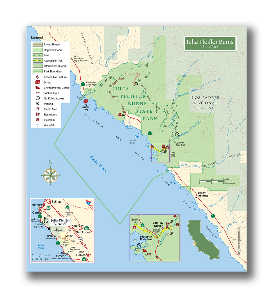
Julia Pfeiffer Burns State Park map, courtesy of the California Department of Parks and Recreation
Julia Pfeiffer Burns State Park has two distinct areas. One is on the western side of Pacific Coast Highway, which is known for the beach views and McWay Falls, and the other is on the eastern side which transitions into an old growth redwood forest with great hiking quicker than you can imagine!
When visiting Julia Pfeiffer Burns State Park, our recommendations include the following:
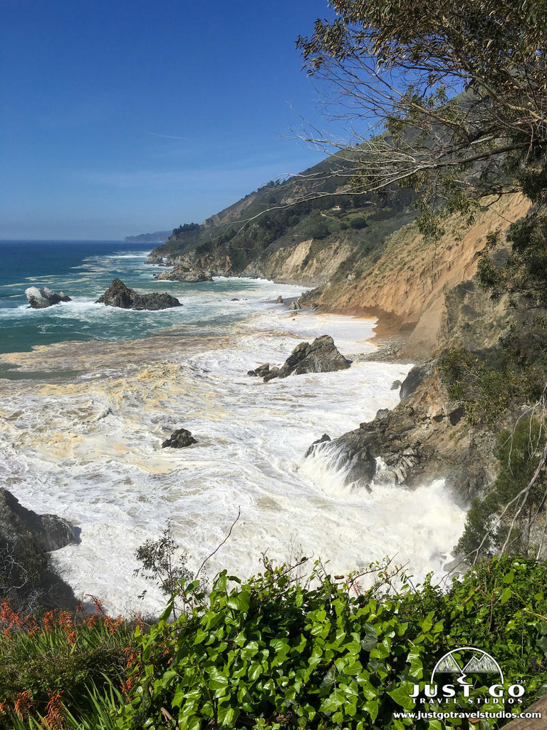
Check out the coastal scenery and McWay Falls
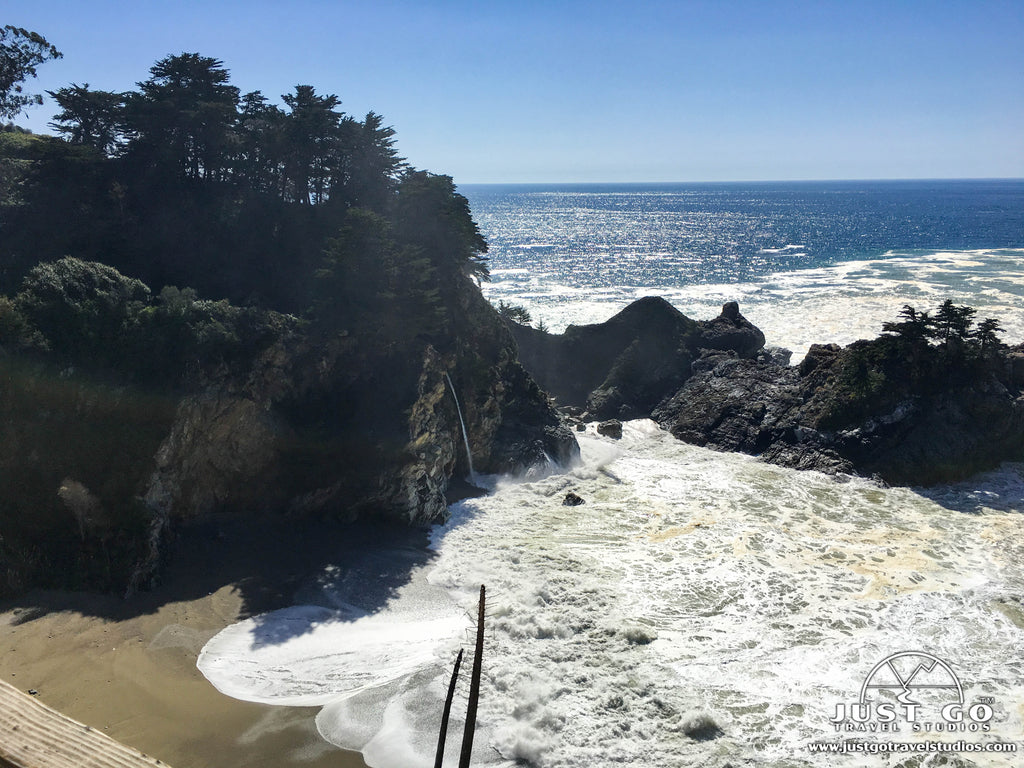
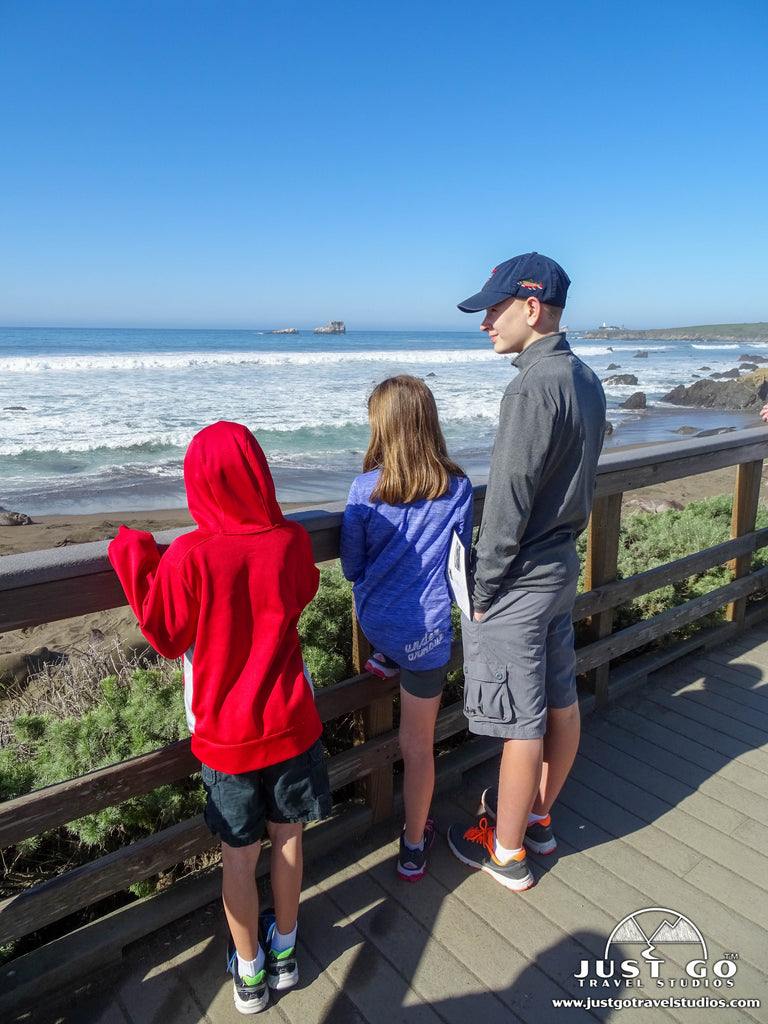
One of the most popular activities in the park is to just gaze out at the scenery. McWay Falls is a must-see. It is a waterfall that drops 80 feet over a granite cliff face. It’s quite dramatic and is one of two tidefalls (which drops right into the ocean during high tide) in California. You can view McWay Falls right from the Waterfall Overlook Trail (see below), which is highly recommended. Though it may seem tempting, there is no access to McWay Cove (the beach below), and you will get cited if you do try to do it.
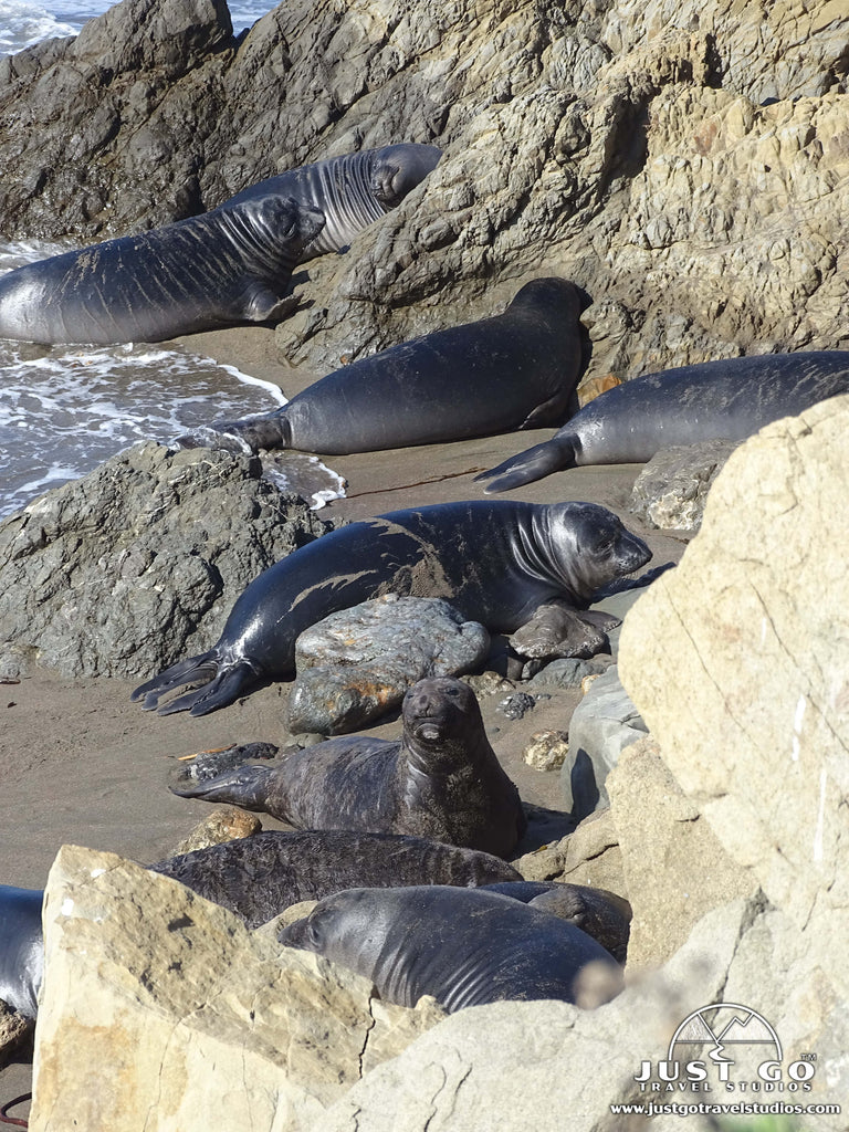
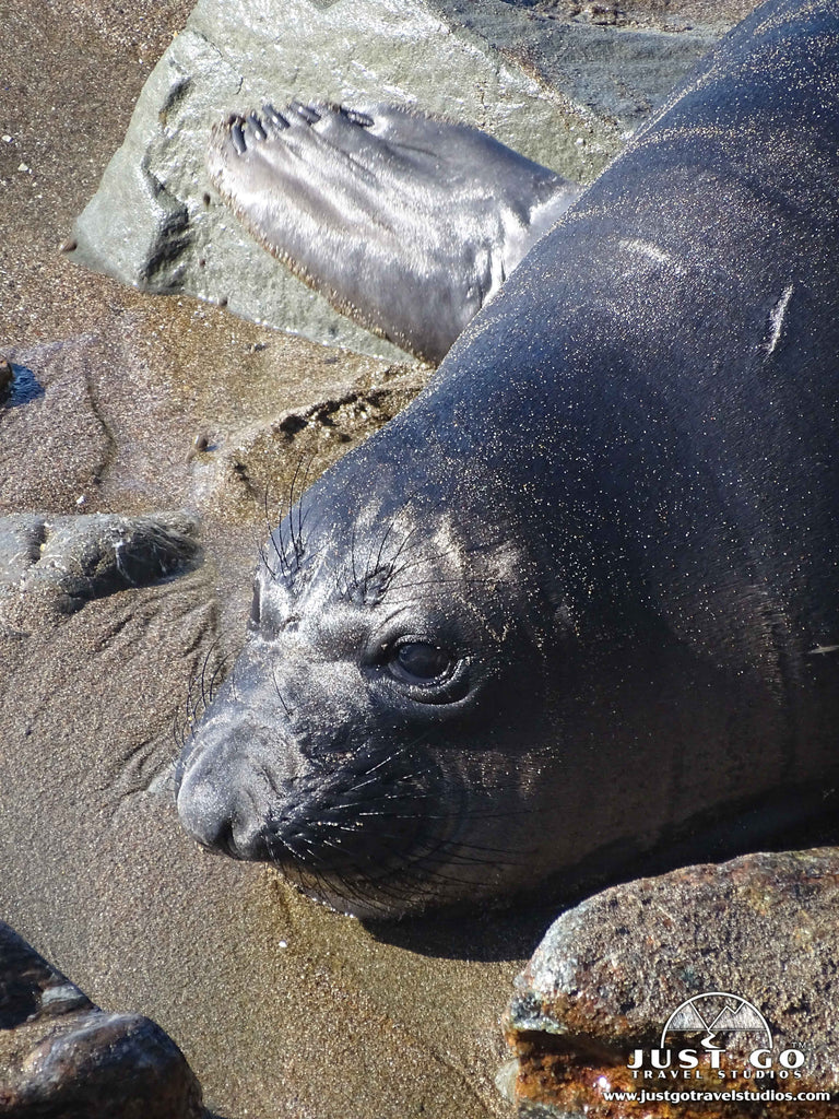
View the wildlife on the beach
Julia Pfeiffer Burns State Park is a great place to check out the wildlife. From the viewpoints you’ll likely be able to see a variety of animals, including elephant seals and even the occasional whale passing by. Of course, if you end up in a situation where you can go down to a beach where they are at, avoid approaching them or disturbing their habitat. You can get a good view of the wildlife on the Overlook Trail, or by heading up to the Vista Point, which is about 1.2 miles north of the parking area for McWay Falls.
Picnicking
The picnic area near the parking lot is an excellent place to have lunch. You won’t find amazing views, but there are facilities that are quite nice.
Hiking
There are quite a few great hiking trails in the Julia Pfeiffer Burns State Park, and we have an entire section below dedicated to it!
HIKING TRAILS IN JULIA PFEIFFER BURNS STATE PARK
While the main attraction in the park may be visiting McWay Falls and checking out the beautiful coastal scenery, there are a few really nice trails here that are worth a look as well! Here are a few that we recommend:
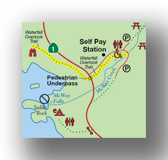
Waterfall Overlook Trail
- Difficulty: Easy
- Distance (round-trip): 0.5 miles
- Elevation gain: 40 feet
- Hiking time (approximate): 30 minutes
Waterfall Overlook Trail map, courtesy of the California Department of Parks and Recreation
By far, the most popular hike to check out is the Waterfall Overlook Trail. This easy trail is 0.5-miles (round-trip), has only about 40 feet change in elevation and is fully accessible. After leaving the parking lot, the trail passes under a bridge as it heads to the footpath that travels along the cliffside. The trail has amazing views and also allows you to see McWay Falls. We recommend bringing a good camera or binoculars if you have them, so you can really see the wildlife!
The trailhead for the Waterfall Overlook Trail starts at the parking lot for the day use area.
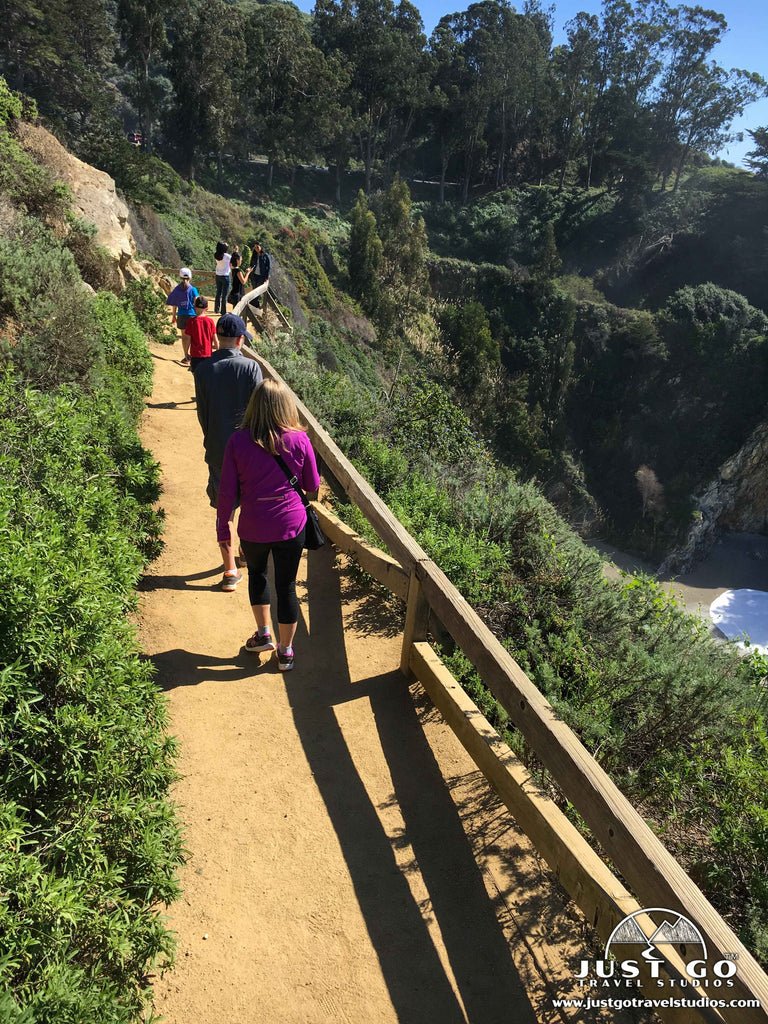
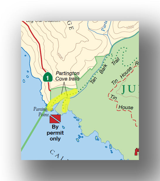
Partington Cove Trail
- Difficulty: Easy / Moderate
- Distance (round-trip): 1.0 miles
- Elevation gain: 350 feet
- Hiking time (approximate): 45 minutes to 1 hour
Partington Cove Trail map, courtesy of the California Department of Parks and Recreation
The Partington Cove Trail is another great hike and is less popular than the Waterfall Overlook Trail. This moderate trail starts on the west side of Highway 1 and is 1.0-mile (round-trip) with 350 feet of elevation gain. The Trail descends down to Partington Cove and has amazing views along the way. The hike back up is a workout, so be prepared!
The Partington Cove Trail begins in the northwest corner of the park, on Highway 1 about 2 miles north of the day-use parking area.
Tan Bark Trail
- Difficulty: Hard
- Distance (round-trip): 6.0 miles
- Elevation gain: 2050 feet
- Hiking time (approximate): 4 hours
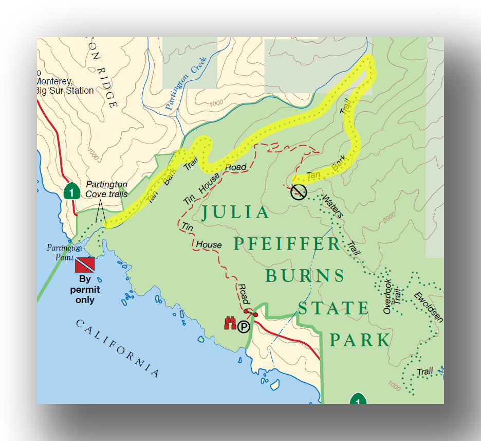
Tan Bark Trail map, courtesy of the California Department of Parks and Recreation
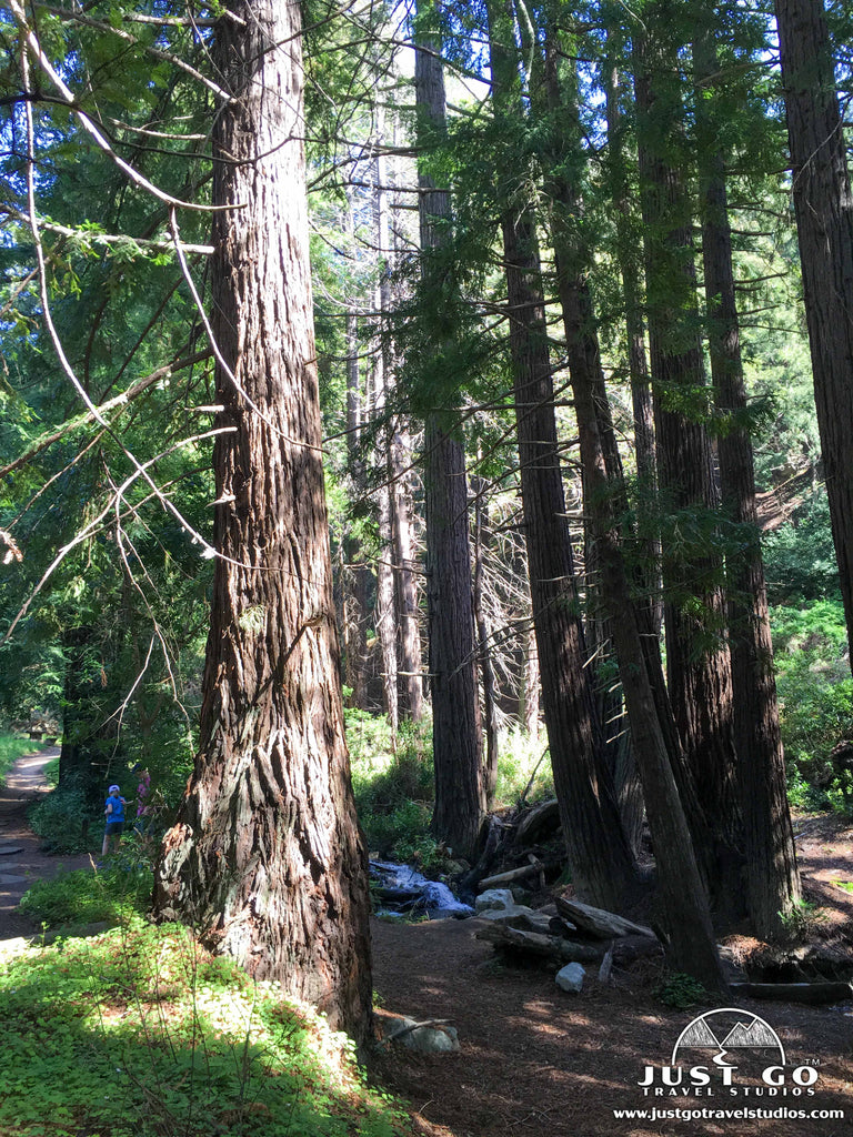
If you want a challenge without many people, then the Tan Bark Trail is for you. This hike is about 6.0-miles (round-trip) with just about 2050 feet elevation gain. The trail starts by climbing from Partington Cove and heads through the old growth redwood forest. As you approach the top, you’ll find both amazing views and the old tin house that was built by the owners of the land but only occupied one night, as the tin made loud creaking throughout the night as the temperatures varied and made it too loud to sleep!
The Tan Bark Trail is accessed at the Partington Cove parking area, about 2 miles north of the day-use parking area. Note: You can also hike back and make this a loop by walking down the old Tin House Road, which is accessible to hikers but not cars.
Additional Trails
There are various other trails in the park, including one of our favorites, the Ewoldsen Trail, which heads deep into the redwood forest. Due to fires, these trails are temporarily closed.
WHAT IS THERE TO DO NEAR JULIA PFEIFFER BURNS STATE PARK?
If you are on Pacific Coast Highway, it’s all about taking in the beaches and beautiful scenery. Some other great areas to explore while in the area include:
- Pfeiffer Big Sur State Park. While this park doesn’t have access to the beach, it has amazing camping, a great forest and cool programs to check out to learn about the area. Pfeiffer Big Sur State Park is located about 12 miles to the north on Pacific Coast Highway.
- Andrew Molera State Park. This park is a great place to access the beach. You’ll also get great views of the ocean here. While here you can visit the Molera Ranch House Museum, which educates visitors about Big Sur pioneers. Andrew Molera State Park is located 18.2 miles north of Julia Pfeiffer Burns State Park on Pacific Coast Highway.
- Point Sur State Historic Park. Here you can check out a lighthouse that was first put into service in 1889. You can take tours of the lighthouse, which are really cool. Point Sur State Park is located 18.6 miles north of Julia Pfeiffer Burns State Park on Pacific Coast Highway.
HOW TO GET TO JULIA PFEIFFER BURNS STATE PARK AND OTHER TRAVEL INFORMATION
Most of the parks and attractions along the Pacific Coast Highway are easy to find-just head out on Pacific Coast Highway and there are plenty of signs along the way to clue you in on amazing stops!
- Here are the directions from Monterey, CA to Julia Pfeiffer Burns State Park. The drive will take about an hour if you head straight there.
- From the south, here are directions from Morro Bay, CA to Julia Pfeiffer Burns State Park. This will take a bit under two hours, if you don’t stop and if the traffic is light.
A couple of tips for travel in the Pacific Coast Highway. First, you will encounter traffic. This is a popular route, and while it isn’t crowded, there are plenty of cars getting out and exploring. Second, expect to stop along the way-like, a lot. You will see so many places you want to get out and see, that the travel along the coast may take you twice as long as you expect. Enjoy it, but just be prepared!
ENTRANCE FEES AND REQUIRED PASSES FOR JULIA PFEIFFER BURNS STATE PARK
There is a self-pay station in the parking area. You can also purchase an annual California State Parks pass online, which we recommend doing if you plan on visiting more than a few of the 280 California State Parks.
WHERE TO STAY IN JULIA PFEIFFER BURNS STATE PARK
Julia Pfeiffer Burns State Park Lodging: There is no lodging inside of Julia Pfeiffer Burns State Park. Camping in the park is an option (see below) but only for those in tents. There are numerous inns and lodges scattered along the Pacific Coast Highway.
JULIA PFEIFFER BURNS STATE PARK CAMPING
There is only one campground inside of Julia Pfeiffer Burns State Park, and there are only 2 sites available that require you to hike in (see below). If you are looking for more options in the nearby area, just about 12 miles to the north is the Pfeiffer Big Sur State Park campground, which has a much larger capacity (nearly 200 sites) and can handle trailers.
Julia Pfeiffer Burns State Park Environmental Campground

Map of the Julia Pfeiffer Burns State Park Environmental Campground, courtesy of the California Department of Parks and Recreation
- Location: The Julia Pfeiffer Burns State Park Environmental Campground is located ont the ocean side (west) of Pacific Coast Highway, just south of McWay Cove.
- Accessible via: Hiking in.
- Reservations: Offered year-round, six months in advance. Julia Pfeiffer Burns State Park Campground Reservations.
- Capacity: 2 sites (tent only).
- Electricity / Water Hookups / Dump Station: No / No / No.
- Toilets / Showers: Pit toilets and no showers.
- Additional details: This campground is one of the most sought-after campgrounds in the state. Bookings start six months in advance, and you need to be quick to snap one up. You will have a tough time finding a better view from a campground!
BEST TIME TO VISIT JULIA PFEIFFER BURNS STATE PARK
Since this is the California Coast, you may think that you can visit at anytime and the weather will be warm and beautiful. The truth is that the weather will likely be quite mild, and you may be surprised to see how cool it can get in the evenings, especially in the wintertime.
Summertime temperatures peak at about 70 during late August and early September, and the nighttime cools down to the low 50’s. So if you come here in the summer, then you still need to bring an extra layer to keep you warm. It can also be quite damp with the ocean humidity.
If you come in the winter, the temperatures are still warm (ish!) with highs in the upper 50’s and lows in the mid 40’s. So while it’s not the freezing temperatures that you’ll see in the mountains, it’s still pretty cool and you’ll want to be prepared if you plan on spending anytime outside of your vehicle.
Bottom line, anytime of year is great, but bring a jacket to protect you just in case!
ARE PETS ALLOWED IN JULIA PFEIFFER BURNS STATE PARK?
Pets are only allowed in the parking area and must be kept on leash. They are not allowed on the trails, day-use area or in the campground.
RELATED INFORMATION ON JULIA PFEIFFER BURNS STATE PARK AND THE SURROUNDING AREA FROM JUST GO TRAVEL STUDIOS
- If you are heading over to California, there are many other State and National Parks that are worth exploring. We recommend checking out our blogs on nearby Channel Islands, Yosemite, Sequoia or Kings Canyon National Parks to see if any of them are right for you!
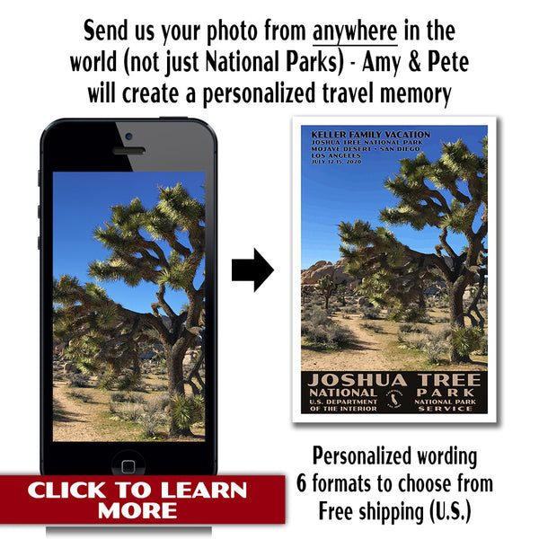
- When you return from your trip, check out our custom, vintage travel poster, where we take a photo that you send to us and turn it into an amazing travel memory!