6 Best Day Hikes in Kings Canyon National Park: Trail Maps, Directions & More
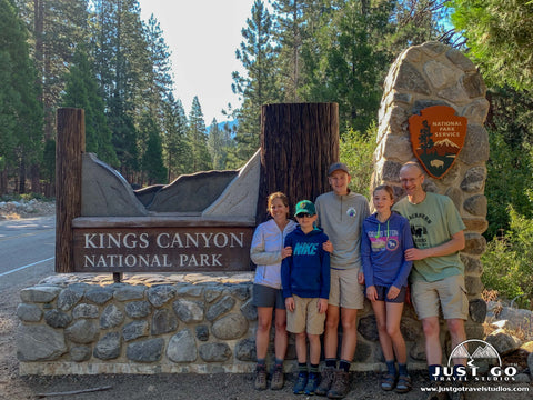
Peter BrahanIf you’re like most people, you’ve never had the pleasure of hiking in Kings Canyon National Park. In fact, even if you’ve been to neighboring Sequoia National Park, it’s more than likely that you skipped entering the main part of Kings Canyon and gotten a taste of what this incredible park has to offer.
Don’t let this happen to you! Kings Canyon is an amazing landscape and reminded us of an untouched Yosemite National Park. While it takes a bit of work to get in here, the drive is incredible and the hikes that await will not disappoint at all.
As usual, it’s hard for us to pick out what we believe are the very best hikes in Kings Canyon National Park-there are so many to choose from. However, we did our best! Let us know what you think by leaving a comment at the bottom of the blog post or by sending us an email!
KINGS CANYON NATIONAL PARK HIKING: DISTANCES AND ELEVATION GAIN
To start off, we thought we’d give an overview of the major hikes in Kings Canyon National Park and let you know the difficulty of each. To help you narrow down what you may want to do, we’ve put together the charts below.
If you are interested in easy day hikes, the chart below will help you get started on picking hikes that may be right for you.

If you are interested in moderate or strenuous hikes, then you can refer to the chart below.

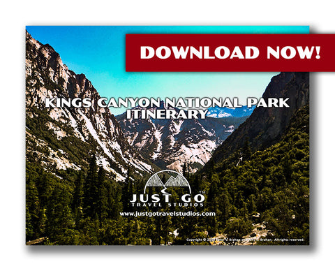
Our Kings Canyon National Park Itinerary helps you plan your trip to this amazing park. In addition to the hikes covered in this blog, we also cover additional hikes that are great for families. In addition, we’ll help you figure out where to stay or camp, what to pack and what else to see when you are in the area.
BEST DAY HIKES IN KINGS CANYON NATIONAL PARK: TRAIL DESCRIPTIONS AND TRAIL MAPS
MIST FALLS TRAIL
Mist Falls Trail map, courtesy of the National Park Service
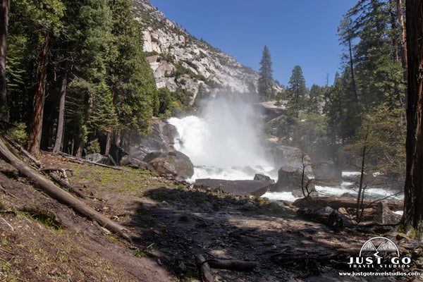
Of all the hikes we ventured out on in Kings Canyon National Park, our favorite was the Mist Falls Trail. Aptly named, this hike features a waterfall that produces an enormous amount of spray that is sure to cool you off. For those seeking a bit more out of the hike, it also can be extended into a 3-day backpacking trip through the backcountry.
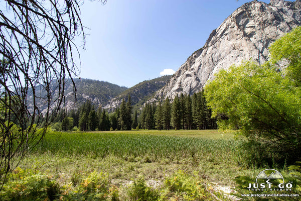
The hike starts by traveling 2 miles through an open meadow and forest. The meadow is surrounded by high cliffs that reminded us of Yosemite Valley (but without the people!). Beware, that as you pass through the forest, it’s dark and the bugs love it. It only takes about 10 minutes to pass through the buggy area, but while you are here, these aggressive bugs can get you right through your shirt!
After surviving the bugs in the mossy forest (don’t worry, it’s not that bad), the hike turns north and travels along the south fork of the Kings River. We were here in early July, and the snow melt created a river flow that was extremely intense. For the most part, the trail is dry, though there are a few parts where runoff from the mountains created a bit of mud that we had to walk through.
Heading along the river, the hike increases in elevation as it travels along to the falls. Along the way are beautiful views to the south in particular, and you’ll want to stop multiple times to look back. Take photos on the way up and way back, as the light changes enough to make quite a difference on the quality of the pictures!
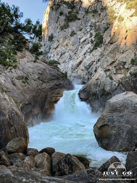
Mist Falls drops approximately 100 feet over a series of rocks and creates a beautiful spray. There are a few places to stop and eat with fantastic views, including near the falls. Be careful, though-you don’t want to fall in the water here as it can be fatal.
The hike is 8.1 miles round-trip and climbs just under 900 feet. While you will be tired at the end, it is a very doable hike for families who are in good shape and are able to stay on their feet for 4 hours or so.
The trailhead is located at the end of Cedar Grove Village road, all the way to the east.
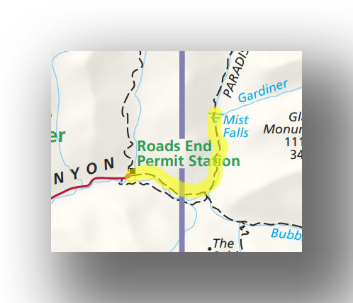
Hike option: If you want to hike past Mist Falls, the Woods Creek Trail meets up with the John Muir and Pacific Crest Trails as it makes a loop approximately 60 miles in length. To do this, you need to obtain a backcountry permit at the Roads End Permit station (see below for details).
ZUMWALT MEADOW TRAIL
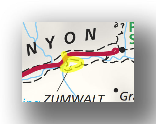
Zumwalt Meadow Trail map, courtesy of the National Park Service
The Zumwalt Meadow Trail is one of the several easy but beautiful hikes in Kings Canyon National Park. Even though flood and landslide damage had altered the trail and landscape significantly, the hike is still worth doing.
After leaving the parking area (which has picnicking available along the South Fork of the Kings River), the trail crosses the river at about the 0.25-mile point. The trail then crosses a suspension bridge before turning east to head along the river and through the boulder field (from the landslide). Along the way, you’ll have great views of the meadow.

While you may see signs that say the trail is wheelchair accessible, much of the trail is closed to wheelchairs as it is quite rocky. Some of the loop is also closed, making this trail and out-and-back experience rather than the round-trip loop that it once was. Though you may be tempted to continue on the closed trail, please respect the park’s direction and turn around at the 1.2-mile point.
The entire trail has a round-trip distance of 2.4 miles (the loop is normally 1.7 miles) with an elevation gain of only 150 feet. The hike can usually be completed in about an hour for the average hiker, but you may want to allow a bit more time if you tend to stop and take photos along the way and really take in the scenery.
From the trail you’ll have great views of the meadow and the nearby peaks.
The trailhead is located 4.5-miles east of the visitor center on Cedar Grove Village Road. Parking is limited, but be patient, as spots open up frequently.
ROARING RIVER FALLS TRAIL

Roaring River Falls Trail map, courtesy of the National Park Service
If you are looking for a short hike, are with small children or want a hike that is wheelchair accessible, the Roaring River Falls Trail is perfect. In addition, this hike will allow you to cool off when the falls are really active, which happens most of the summer.
Leaving the parking lot and heading south, the trail is paved the entire way and stays mostly flat. After only about 0.1 mile, hikers come upon a set of heavy flowing falls. Around the falls are plenty of flat rocks to sit and take in the scenery.
Be advised, that while the falls are wonderful, you will get wet if you linger or get too close and the rocks can be slippery, so watch your step and keep an eye on your children.
This trail is heavily traveled, so if you want to come here and experience tranquility, plan on arriving early in the day. We went here early in the morning before heading to the Mist Falls Trail and had the place to ourselves!
The entire hike is 0.3-miles (round-trip) and will take about 15 minutes in total, depending on how much time you spend near the falls.
The trailhead is 3 miles east of Cedar Grove Village. The parking lot is fairly large, and spots open up frequently.
REDWOOD CANYON LOOPS
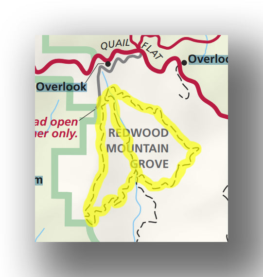
Redwood Canyon Loops Trail map, courtesy of the National Park Service
One of the more challenging day and longer day hikes in Kings Canyon National Park is the Redwood Canyon Loops Trail. This trail consists of two loops, offering a few different options for hiking.
Over the length of the trail, you’ll pass through many sequoia and redwood groves. It really is an amazing experience, and includes great mountain views during the hike as well.
The main downside to this hike is the number of bugs. A head covering (preferably a bug net) and long sleeves is the best defense, though bug spray can also be very helpful as well.
Due to this loop being two connected ovals, you can take one loop (which is just over 6 miles and 1500 feet in elevation gain) or take the entire loop, which is just over 10 miles and over 2100 feet in elevation gain. The climbing is not difficult, but it is a bit of a long hike, making it challenging for families. You can expect to spend between 3 and 6 hours on this trail, depending on your pace.
While there are a lot of bugs, there are few people. In fact, it’s not rare to take this hike and only run into a few other hikers. Both the fact that the trail is remote, long, and the trailhead isn’t shared with a more family-friendly hike tends to keep others away.
The trailhead for the Redwood Canyon Loops trail starts 2 miles down a bumpy dirt road. The road is accessed 6 miles south of Grand Grove Village. Parking is usually not a problem.
BIG BALDY RIDGE TRAIL

Big Baldy Ridge Trail map, courtesy of the National Park Service
The Big Baldy Ridge Trail is a very unique hike. Even though there isn’t much climbing involved, the hike has great views for much of the hike. Since the Big Baldy Ridge Trail heads along a mountaintop for nearly the entire hike, you’ll never be far from a beautiful landscape photo opportunity!
Though the trail starts in the Sequoia National Forest, the hike ends in Kings Canyon National Park.
The hike is 5.5 miles in total (round-trip) with just over 500 feet of elevation gain. Since the hike does not start in any national park, many pass it up, making it a good hike to get away from the crowds. The entire hike should take about 3 hours.
The trailhead for the Big Baldy Ridge Trail is about 8.1 miles south of Grant Grove Village on CA-198 (the Generals Highway).
Hike option: To get to the top you can also start from the Montecito Sequoia Lodge. However, this is “trail” is essentially a fire road, making it a bit less interesting than hiking on the ridge.
GENERAL GRANT LOOP TRAIL
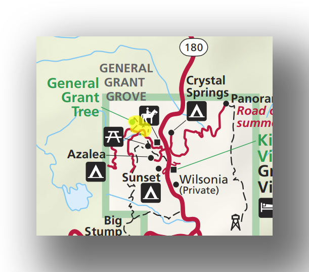
General Grant Loop Trail map, courtesy of the National Park Service
Though not necessarily a “hike”, the General Grand Loop Trail is definitely worth checking out when visiting Kings Canyon National Park.
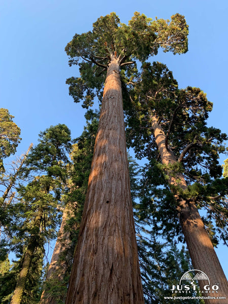
This paved trail is accessible to hikers of all ages and abilities and is a great way to beat the heat. There is minimal elevation gain as the trail passes through a grove of giant sequoia trees. This is the most popular hike in the park, as visitors love to see the second largest tree in the world (the General Grant tree) and walk amidst the giants.
You can also walk through the “Fallen Monarch”, a tree that was used for housing for loggers, a saloon and also as stables for the US Cavalry. Yes, it’s that large!
This 0.5-mile trail has minimal elevation gain and will take about 30 minutes of time once you get on the actual trail.
The trailhead for the General Grant Loop trail is one-mile northwest of the Grand Grove Visitor Center. Parking here can be a bit of a challenge, so bring your patience. However, since the trail is short, spots vacate frequently. To avoid the crowds, come during dinnertime or as dusk approaches. For a magical time without any crowds, get here first thing in the morning.
KINGS CANYON NATIONAL PARK HIKING PERMITS
If you want to stay overnight in the backcountry, there is a good chance that you’ll be required to have a permit. For details on how to obtain a permit, when it is required and any limitations for backcountry hiking, check out the website from the National Park Service on how to obtain a wilderness permit in Kings Canyon National Park.
FURTHER INFORMATION ON KINGS CANYON NATIONAL PARK FROM JUST GO TRAVEL STUDIOS
- A must-have ahead of your trip is our downloadable itinerary for Kings Canyon National Park. We cover what you need to know before your trip, including additional hikes, where to stay and what to do while you are in the area.
- Be sure to check out our blog on the Zumwalt Meadow Trail and What to See and Do in Kings Canyon National Park.
- Check out our extensive selection of National Park posters, including our poster for Kings Canyon National Park.

- If you love vintage posters, why not make your own? Let us turn one of your photos into one of our custom, vintage-style posters, postcards and note cards that are personalized and made just for you!