Sleeping Bear Dunes National Lakeshore: Things to Do, Maps, Fees & More
Peter BrahanLocated on the northeastern shore of Lake Michigan, Sleeping Bear Dunes National Lakeshore is best known for its magnificent dunes and towering headlands. The dunes are most definitely a sight to see, but there’s so much more to this national lakeshore than just sand!
Whether you prefer exploring the park’s diverse natural habitats or learning about the area’s fascinating history, Sleeping Bear Dunes and the surrounding area will keep you busy for days! We hope this guide will help you plan an amazing trip to Sleeping Bear Dunes National Lakeshore!
Before you head to Sleeping Bear Dunes National Lakeshore, make sure you pick up a copy of our downloadable Sleeping Bear Dunes Itinerary. We document the best things to do, including details on hiking trails, where to stay, what to pack and other places to visit while you are in the area.
SLEEPING BEAR DUNES NATIONAL LAKESHORE HISTORY
Long ago, continental ice sheets carved out the deep basins of the Great Lakes and created other features of Sleeping Bear Dunes. The towering headlands are glacial moraines that once protruded further into Lake Michigan. The powerful forces of wind and water further transformed the landscape to create the prominent landmarks we can see today—like the spectacular perched dunes, created when glacial sand was blown to the top of the glacial moraines.
Following the glacial retreat, the area was utilized by prehistoric people for hunting, gathering, fishing, and trapping. The Anishinaabek, people indigenous to Michigan, were living in the area when the first European explorers arrived searching for furs and minerals in the mid-1600s. However, little development occurred until European immigrants began arriving in greater numbers in the mid-1800s.
With increased demand for lumber and the development of commercial shipping on the western Great Lakes, settlements sprang up in what is now Sleeping Bear Dunes National Lakeshore. The first settlement, on South Manitou Island, was established to provide cordwood to fuel the steamships that traveled the Great Lakes. As resources were depleted, cordwood docks were added on North Manitou Island and the mainland. Communities, including Glen Haven and Port Oneida, sprang up around the mainland sawmills.
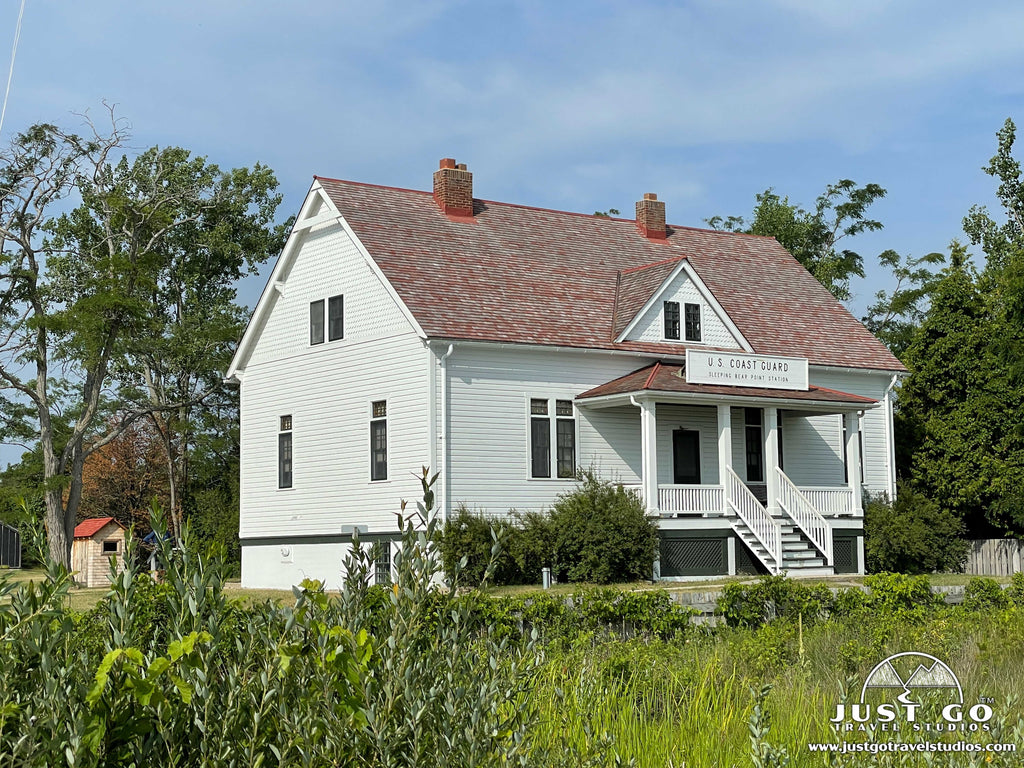
With increased maritime traffic in the Manitou Passage, unpredictable weather and dangerous shoals and sandbars in the area, stranded and wrecked ships were common. Lighthouses were built at strategic points along the mainland shore and islands to help guide ships through the Manitou Passage. The Sleeping Bear Point Life-Saving Station was built in 1901.
By the early 1900s, forests were cleared, and the decline of the lumber industry led to the closure of cordwood docks and sawmills. One businessman, D.H. Day, began investing in fruit orchards when he saw the decline of the lumber industry. Although the core of his business was lumbering, he was an early proponent of agriculture and tourism. He established the Glen Haven Canning Company and shipped cherries and other fruits to various Great Lakes cities. D.H. Day is also known as a pioneer of sustainable forestry and promoted the reforestation movement long before it came to Michigan.
Another well-known name in the Sleeping Bear Dunes area is Pierce Stocking, for whom the Pierce Stocking Scenic Drive is named. Pierce Stocking was a lumberman, who spent his youth working in the forests of northern Michigan. In 1948, he purchased forest land from D.H. Day, where he set up a sawmill and used a charcoal kiln to convert the sawmill waste. Once all the mature trees had been harvested, the mill was closed. Pierce Stocking then put his energy into building a road through his property to the top of the dunes—to share the beauty of Sleeping Bear Dunes with others. He operated the scenic drive, then known as Sleeping Bear Dunes Park, until his death in 1976.
On October 21, 1970, Sleeping Bear Dunes National Lakeshore was established. Senator Philip A. Hart was a key player in the movement to preserve the lakeshore. The Sleep Bear Dunes visitor center, located in Empire, bears his name. Now over a million visitors come to Sleeping Bear Dunes every year to experience all that this stunning national lakeshore has to offer!
NORTHERN AREA OF SLEEPING BEAR DUNES NATIONAL LAKESHORE
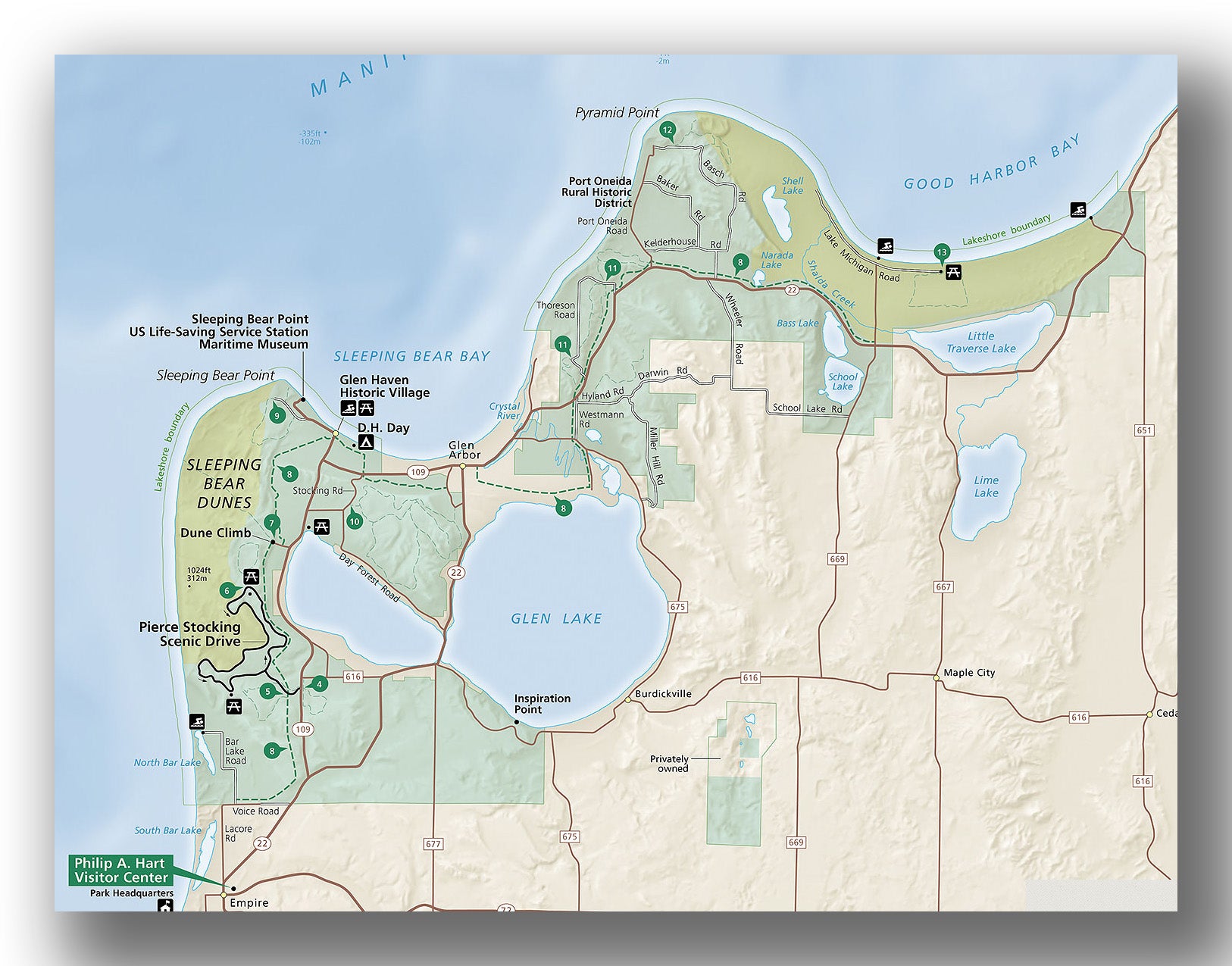
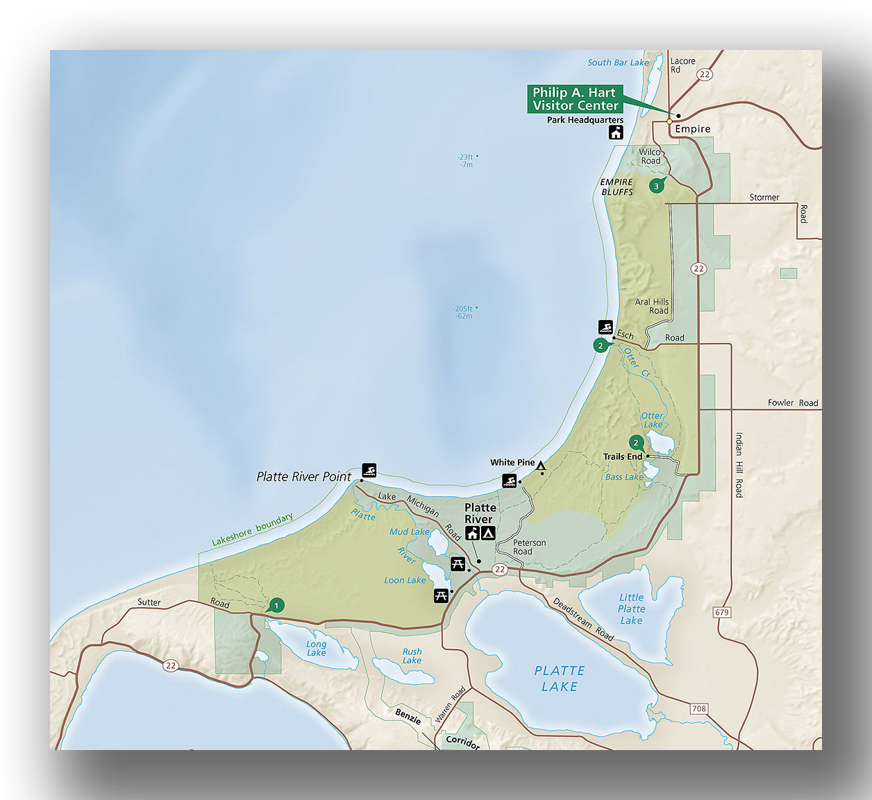
Sleeping Bear Dunes National Lakeshore northern area map, courtesy of the National Park Service
The northern area of Sleeping Bear Dunes National Lakeshore, north of Empire, is home to some of our favorite hiking trails in the park, a scenic drive, and various historic properties. There is plenty to see and do, so plan to spend at least a full day (if not more!) exploring this area of the park.
When visiting the northern area of Sleeping Bear Dunes, our recommendations include:
Pierce Stocking Scenic Drive
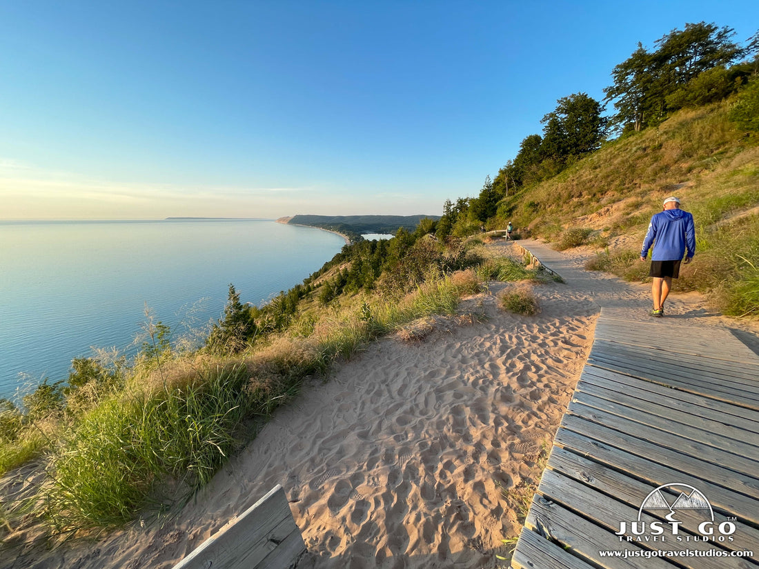
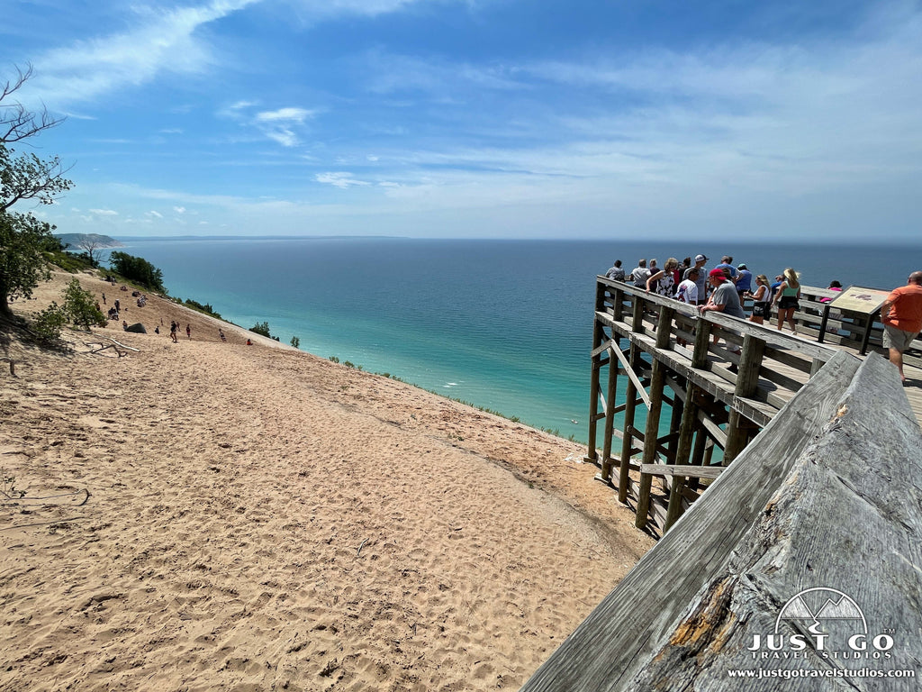
The 7.4-mile Pierce Stocking Scenic Drive winds through wooded areas, a historic covered bridge and sand dunes. Scenic vistas along the way include overlooks of the Glen Lakes, the Sleeping Bear Dunes and Lake Michigan. There is also a hiking trail (Cottonwood Trail) and a couple picnic areas. One of the best views on the scenic drive is the Lake Michigan Overlook (stop #9). Take a short walk (through sand) along the top of the dunes to the viewing platform. The observation deck which extends over the bluff provides spectacular views all the way down to the lakeshore from high above Lake Michigan. We hear sunsets from this overlook are amazing! The Pierce Stocking Scenic Drive is located just north of Empire off M-109. Allow 1 to 1 ½ hours to experience the scenic drive.
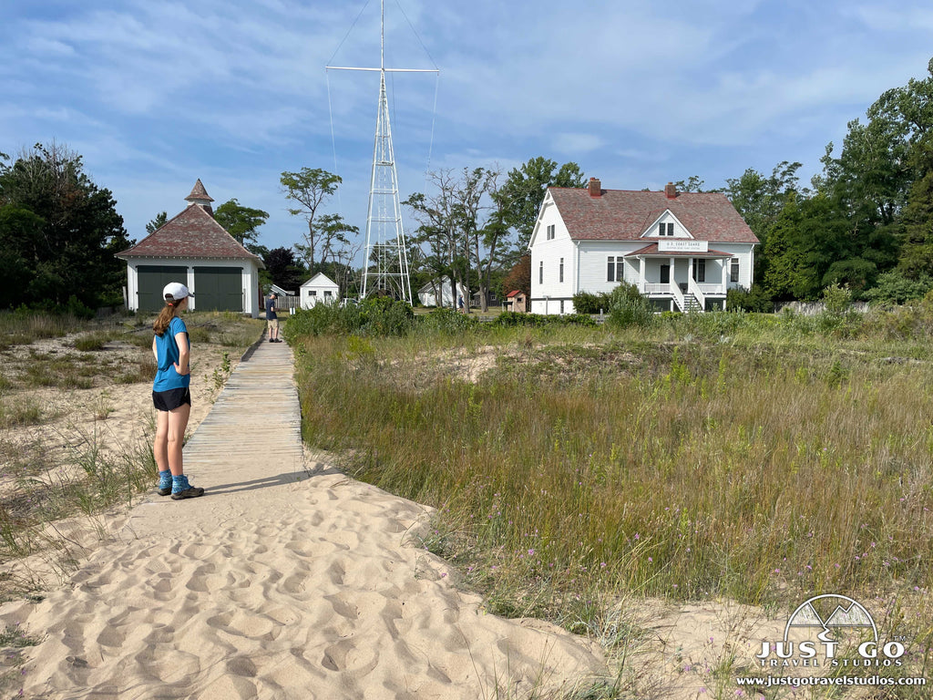
Sleeping Bear Point US Life-Saving Service Station Maritime Museum
Visit the Maritime Museum to learn about the history of life-saving operations and the shipping industry on the Great Lakes. Walk through the boathouse to see the historic rescue boats and displays of other life-saving equipment. There is also access to a sandy beach just past the boathouse. The museum is open during the summer season, 11-5. The Maritime Museum is located just west of Glen Haven at the end of Sleeping Bear Dunes Road. Pets are not allowed on the museum grounds.
Glen Haven Historic Village
Step back to a time when docks and small villages, like Glen Haven, dotted the Lake Michigan shoreline to supply cordwood to fuel ships along the Great Lakes. After the decline of the logging industry, Glen Haven diversified into agriculture, the canning of fruit and tourism. Tour the general store (restored to its appearance in the 1920s), fruit cannery (now a boat museum) and blacksmith shop. The village is open during the summer season, 11-5. The Glen Haven Historic Village is located at the end of Glen Haven Road, just east of the Maritime Museum.
Port Oneida Rural Historic District
Pair a visit to Glen Haven with a quick drive north to Port Oneida Rural Historic District and get a glimpse of what Midwestern farm life was like at the turn of the century. The Port Oneida Farms Heritage Center, located in the old farmhouse of Charles and Hattie Olsen, is a great place to start your visit and learn about the history of Port Oneida. Then hike, bike or drive around the area to explore other farms and buildings in the Port Oneida area. The Port Oneida Farms Heritage Center is open limited hours during the summer season. Check the NPS website for specific days and times.
Swim at North Bar Lake. Enjoy swimming in the shallow, clear water at North Bar Lake. This lakeshore beach is especially popular since it is typically much warmer than the cold water of Lake Michigan. For a unique opportunity, hike over the dune that separates North Bar Lake from Lake Michigan to experience both small and large lakes at Sleeping Bear Dunes! To reach North Bar Lake, take LaCore Road north from Empire to Voice Road and then Bar Lake Road. Pets are not permitted at North Bar Lake.
Bike the Sleeping Bear Heritage Trail
Cruise along this hard-surfaced, 22-mile trail that travels between Empire and Bohemian Road (CR-669). It is an excellent way to see the area, including stops at park attractions such as the Dune Climb, Glen Haven Historic Village and Port Oneida, as well as the town of Glen Arbor along the way. The Sleeping Bear Heritage Trail is the only bicycle trail in Sleeping Bear Dunes National Lakeshore. However, this non-motorized, multi-use trail is also open to walkers, runners, and cross-country skiers in the winter.
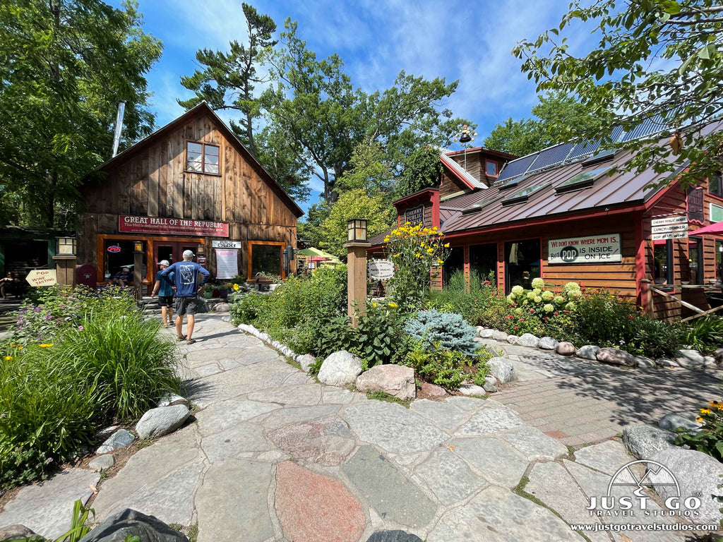
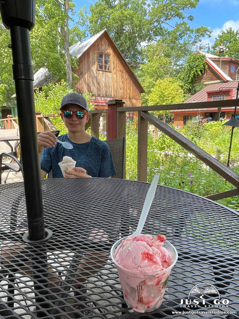
Visit the town of Glen Arbor
While exploring the northern area of the park, be sure to stop in the quaint town of Glen Arbor to check out the shops, taste some wine or get a bite to eat. Cherry Republic is a popular stop for most Glen Arbor visitors (including us!) and the Pie in the Sky ice cream hit the spot on a warm summer day!
Paddle the Crystal River
The Crystal River flows from Glen Lake to Lake Michigan and is a popular area to get on the water in the northern part of the park. Kayaks and canoes can be rented in Glen Arbor.
Hiking
There are miles of trails to explore in the northern region of Sleeping Bear Dunes National Lakeshore—ranging in distance and difficulty. We recommend the following hikes:
- Sleeping Bear Point Trail (moderate, 2.5-miles (round-trip), 300 ft. elevation gain)). This trail heads up and around the dunes with great views of Lake Michigan.
- Pyramid Point Loop Trail (moderate, 2.7-miles (round-trip), 540 ft. elevation gain)). This hike heads through forests and marshes with an amazing overlook to the north of Lake Michigan.
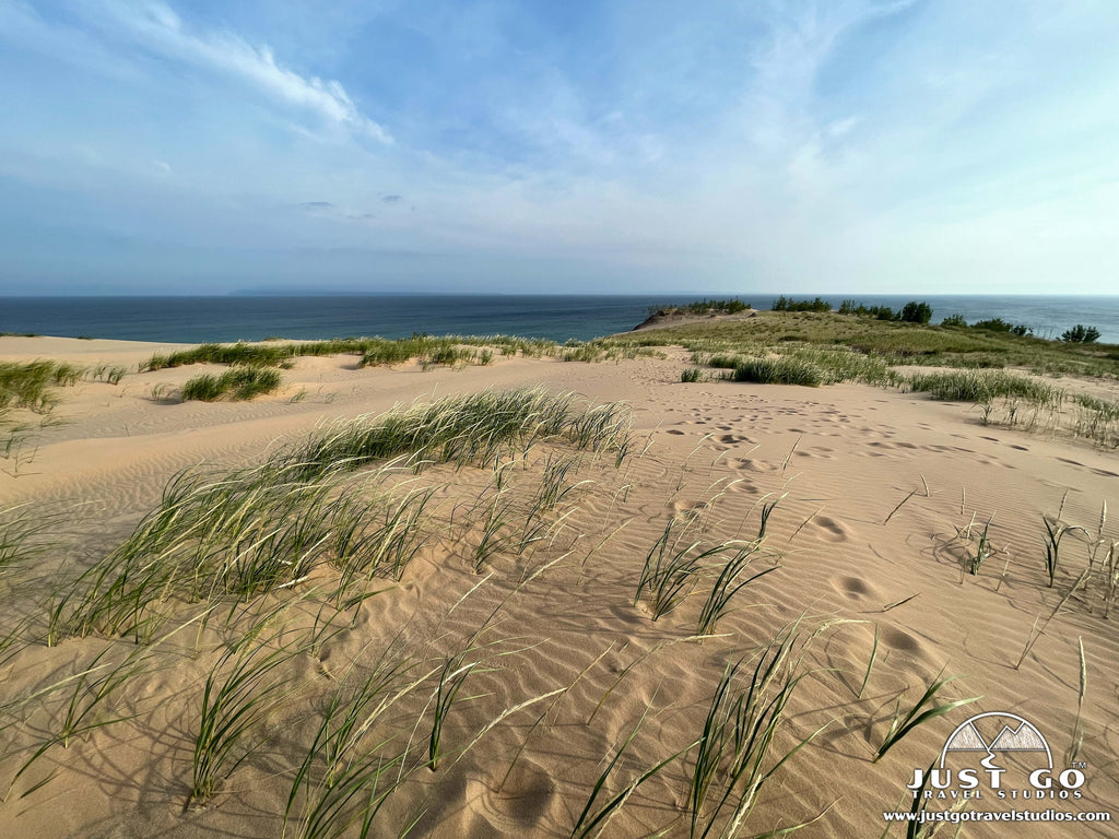
- The Dune Climb (moderate, 3.6-miles (round-trip), 645 ft. elevation gain)). This epic climb gets to the top of the dunes with great views of Lake Michigan and the surrounding area. It’s pretty grueling on a hot day in particular!

You can read all about the trails in the park, get directions and trail maps in our blog on the Best Hikes in Sleeping Bear Dunes National Lakeshore. You can also see Hiking Trails on the NPS site for more information on these and other trails at Sleeping Bear Dunes.
SOUTHERN AREA OF SLEEPING BEAR DUNES NATIONAL LAKESHORE
Sleeping Bear Dunes National Lakeshore southern area map, courtesy of the National Park Service
The southern area of Sleeping Bear Dunes National Lakeshore, just south of Empire, is home to some beautiful beaches, a hiking trail that leads to one of the best scenic overlooks in the park and the Platte River. Allow at least a half-day to explore this area of the park, or more if you plan to spend a lazy summer afternoon floating down the Platte River.
When visiting the southern area of Sleeping Bear Dunes, our recommendations include:
Philip A. Hart Visitor Center
Stop in at the park’s visitor center, located in Empire, MI, for maps and information, exhibits about the area and Junior Ranger programs. Check out the large relief map of Sleeping Bear Dunes and watch the park film, Water, Sand and Sky. The visitor center also has a small park store and restrooms. If you don’t already have a park pass (which is required while visiting Sleeping Bear Dunes), you can purchase one at the visitor center. The Philip A. Hart Visitor Center is open year-round—except for New Year’s Day, Thanksgiving and Christmas Day.
Peterson Road Beach
Located at the end of Peterson Road, this Lake Michigan beach is one of the most secluded on Sleeping Bear Dunes’ lakeshore. Follow a gravel road through the woods until reaching a small parking area atop a bluff. The trail from the parking lot to the beach crosses some low-lying sand dunes. From Peterson Road Beach, enjoy views of Empire Bluff to the north and Platte River Point to the south. To reach Peterson Road Beach, turn onto Peterson Road from M-22 (just north of Lake Michigan Road). The sandy, southern end of the beach (to the left of the boardwalk) is pet friendly. However, pets are not allowed on the north end of the beach.
Platte River Point
Located at the end of Lake Michigan Road, Platte River Point is a popular spot during the height of the summer season. This is where the Platte River flows into Lake Michigan and is the take-out point for many tubing and kayaking trips. For those not interested in floating or paddling, Platte River Point is also a great spot for a picnic, walk on a sandy beach or sunbathing. To reach Platte River Point Beach, park at one of three paved lots at the end of Lake Michigan Road. Two of the lots are National Park lots which require a park pass. The third lot (closest to the picnic area which is a part of Lake Township Park) is the Lake Township lot and a daily parking fee is required to park here (look for the automated fee station). There are also restroom facilities at the township lot. Be prepared for parking lots to be full at times during busy summer months. Pets are not allowed on this beach.
Paddle or Float Down the Platte River
The Lower Platte River flows from Platte Lake into Lake Michigan and is a popular area to get on the water in the southern part of the park. Rentals are available where Lake Michigan Road meets M-22, near the Platte River Campground.
Hiking
There are only a few trails to explore in the southern region of Sleeping Bear Dunes National Lakeshore, but one of our favorite hikes in the park is located here!
There are only a few trails to explore in the southern region of Sleeping Bear Dunes National Lakeshore, but one of our favorite hikes in the park is located here!
- Empire Bluff Trail (moderate, 1.5-miles (round-trip), 175 ft. elevation gain)). This is a great sunset hike in particular. The trail leads through a hardwood forest before a beautiful overview of Lake Michigan.
- Black Arrow and Green Arrow Loop (easy, 3.1-miles (round-trip), 80 ft. elevation gain)). This This easy trail heads through the area near the dunes with views to the lake and the dunes as well as North and South Manitou Islands.

MANITOU ISLANDS AT SLEEPING BEAR DUNES NATIONAL LAKESHORE
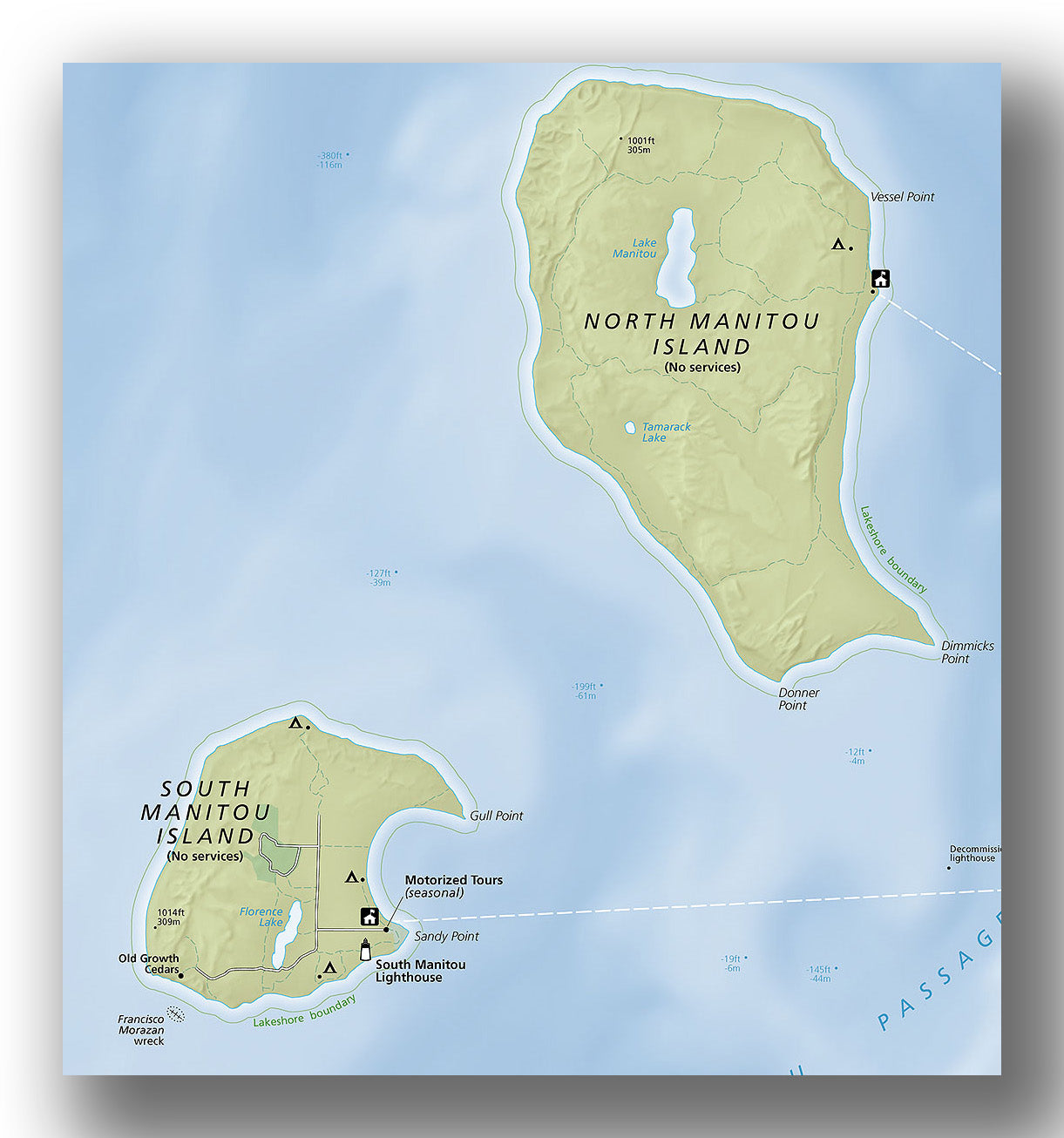
Manitou Islands map, courtesy of the National Park Service
Visitors seeking to get away from the summer crowds on Sleeping Bear Dune’s mainland may prefer heading to the Manitou Islands. Extending north to the straights of Mackinac, North and South Manitou Islands are rich in history and offer a peaceful refuge for backcountry campers, hikers, and birdwatchers.
Access to the Manitou Islands is by private boat or by ferry service run by Manitou Island Transit. Ferries operate from Fishtown Dock in Leland and typically run from Memorial Day to Labor Day. Ferry service to North Manitou Island is for campers only, as there are no daytrips out to the primitive northernmost island. Manitou Island Transit does offer daytrips to South Manitou Island, in addition to the ferry service for South Manitou campers. Reservations are recommended. Visitors to both islands also need a national park pass. There are no stores or restaurants on the islands, so be sure to pack all food, drinks and supplies needed for your trip.
North Manitou Island
North Manitou Island, the larger of the two islands, is a designated wilderness area offering 15,000 acres for back-country camping, hiking, and exploring. Since there are no daytrips to the island, visitors are required to camp overnight.
When back-country camping on North Manitou Island, our recommendations include:
North Manitou Island Village
North Manitou is managed as designated wilderness with the exception of a 27-acre area around the village (visible from the ferry dock). This settlement was started in the mid-1850s when the lumbering industry was thriving. However, the remaining buildings are all related to later activities. Surviving buildings include the U.S. Life-Saving Service Complex, Cottage Row, and Manitou Island Association office. See the Sleeping Bear Dunes NPS site for more information on the buildings of North Manitou Island Village. As you explore, be sure to respect the privacy of those who live in the village.
Hiking
North Manitou Island has almost 23 miles of maintained trails that wind through forests, old farm fields, and along bluffs that overlook Lake Michigan.
- North Manitou Island Loop Trail (moderate, 13.7-miles (round-trip), 650 ft. elevation gain)). This trail is for ambitious hikers and includes visits to the village, South Cherry Orchard and numerous camps.
South Manitou Island
South Manitou Island, the more developed of the two islands, features lighthouse, a grove of old growth White Cedars, a shipwreck, perched sand dunes, miles of beaches and three primitive campgrounds. Manitou Island Transit offers transport for campers as well as daytrips. For those not interested in camping on the island, a daytrip offers the chance to experience the beauty and history of one of the Manitou Islands. Day trip ferries depart Leland at 10 am and return at 5:30 pm. The trip to the island takes about 1 ½ hours each way--allowing visitors 4 ½ hours to explore, hike and/or take a guided tour.
When visiting South Manitou Island, our recommendations include:
South Manitou Island Village and Visitor Center
South Manitou Island was once the center of commerce in the Manitou Passage; however, when logging operations ended, the original village was abandoned and life on the island shifted a bit south to a site near the life-saving station. When you get off the ferry, the first building you’ll see on the left as you exit the dock is the ranger station, originally built as a home for USLSS keepers and surfmen. Other buildings in the village included the general store, post office and housing for married members of the USLSS and later the US Coast Guard. Some historic buildings are open to the public. The South Manitou Island Visitor Center is housed in what used to be the island’s general store.
South Manitou Island Tours
Manitou Island Transit offers two historic tours via tractor and trailer to allow visitors to see more of the island during their short visit. There is only enough time for one tour: either the Farm and Schoolhouse Tour or the Cedar and Shipwreck Tour. The Cedar and Shipwreck Tour also requires participants to hike about a mile. For more information about each tour and costs, see the Manitou Island Transit See the crew on board your ferry to sign up for either tour.
Hiking for daytrippers
If you are only visiting the island for a few hours (and choose to explore on your own instead of taking a tour), there are a few short hikes you can take to explore beyond the village.
- Lighthouse. A half mile hike from the village leads to the lighthouse, which was built in 1871. It was the final lighthouse built along the Manitou Passage. When the lighthouse is open, visitors can climb the 117-step spiral staircase for great views of the Manitou Passage and Sleeping Bear Point on the mainland. The trailhead starts from the boardwalk just beyond the visitor center.
- Florence Lake. Hike 1 ¼ miles to the only inland lake on South Manitou Island. Florence Lake was named after Florence Hass was a mid-wife who also served as the postmaster for the island. To reach Florence Lake, follow Burdick Road about a mile to Ohio Road. Then follow the trail straight to a sandy beach on the east side of the lake.
Hiking for campers
For those who have more time to hike, South Manitou Island offers miles of maintained trails to explore its unique features including the wreck of the Francisco Morazan (a Liberian cargo ship that ran aground offshore in 1960), giant cedar trees and perched dunes. Two popular options include:
- Florence Lake Loop (with Morazan shipwreck) (moderate, 6.8-miles (round-trip), 145 ft. elevation gain)). This hike features the wreck of the Francisco Morazan.
- Valley of the Giants (with Morazan shipwreck) (moderate, 6.9-miles (round-trip), 120 ft. elevation gain)). This hike includes the shipwreck and ends at the Valley of the Giants, which is an incredible grove of white cedars. The Valley of Giants is considered one of the oldest groves of White Cedar trees in North America. Some of the trees reach over 100 feet tall! After walking among these giants, return the way you came back to the village. Another option is to hike beyond the Valley of Giants to reach the perched dunes, which adds another ½ mile to the roundtrip hike.
WHAT TO DO NEAR SLEEPING BEAR DUNES NATIONAL LAKESHORE
If you have extra time while visiting Sleeping Bear Dunes, there are some great nearby towns and attractions to explore. Our recommendations include:
- Leelanau Peninsula. Located just north of mainland Sleeping Bear Dunes, the Leelanau Peninsula is a travel destination in itself. Be sure to explore Fishtown in Leland, go shopping in Suttons Bay, try some wine at French Valley Vineyards, and visit the Grand Traverse Lighthouse.
- Old Mission Peninsula. The Old Mission Peninsula is just north of Traverse City and extends into Grand Traverse Bay. Take a drive on an 18-mile scenic heritage route to the tip of the peninsula. This area offers numerous wineries, antique shops, restaurants featuring local cuisine and the Mission Point Lighthouse.
- Point Betsie Lighthouse Beach. Point Betsie Lighthouse is located south of Sleeping Bear Dunes and is one of the most photographed lighthouses in Michigan. Built in 1858, the lighthouse marks the southern entrance to the Manitou Passage. Lighthouse tours are offered for a small fee.
HOW TO GET TO SLEEPING BEAR DUNES NATIONAL LAKESHORE AND OTHER TRAVEL INFORMATION
The closest airport to Sleeping Bear Dunes National Lakeshore is Cherry Capital Airport, located about 45 minutes away in Traverse City, Michigan. Another airport to consider is Detroit Metropolitan Wayne County Airport, located about a 4 1/2-hour drive from Sleeping Bear Dunes NL. No matter how you reach Sleeping Bear Dunes, you’ll need a rental car to get around the area since there’s no public transportation in the park.
We recommend spending at least two to three days to fully experience what the Sleeping Bear Dunes area has to offer. How you spend your time in the park may depend upon where you are staying (camping inside the park or staying at lodging in a nearby town).
WHERE TO STAY IN AND NEAR SLEEPING BEAR DUNES NATIONAL LAKESHORE
The park does not offer any lodging, but there are options to suit all sorts of travelers in nearby towns—Glen Arbor, Beulah, and Traverse City (further away but lots of options).
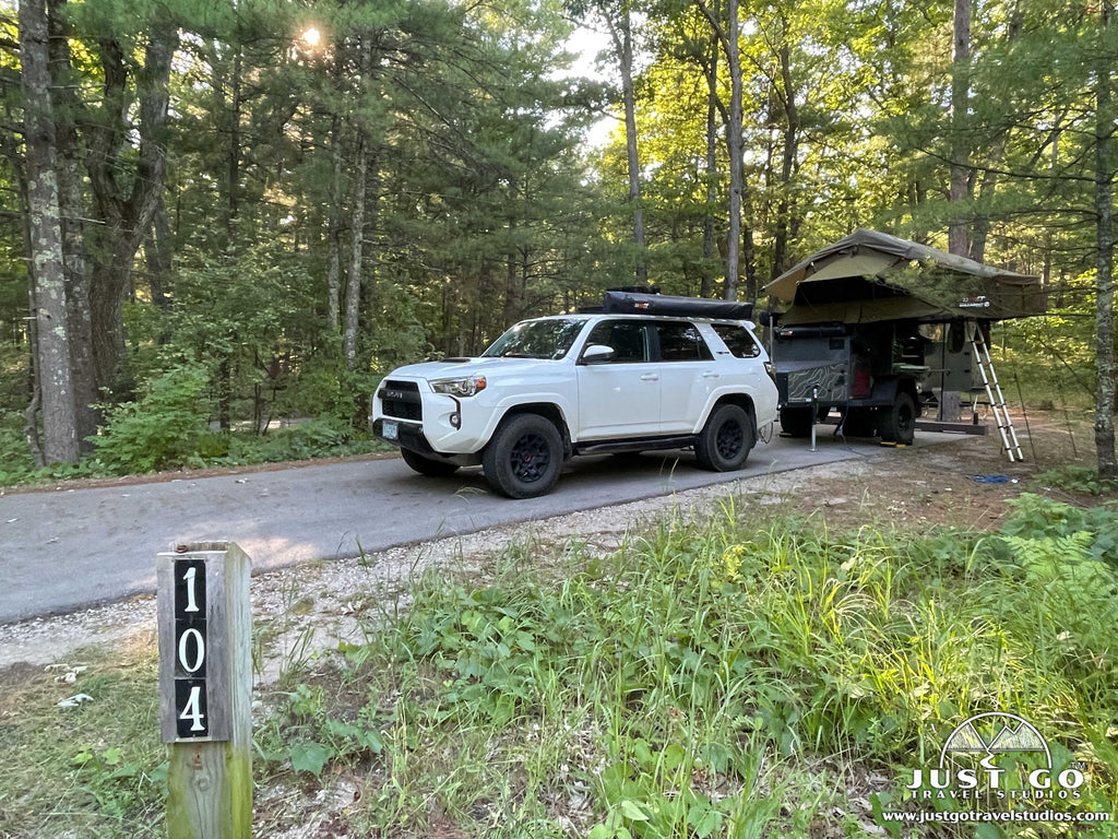
Camping inside Sleeping Bear Dunes National Lakeshore: There are two front-country campgrounds inside the park—the Platte River Campground and D.H. Day Campground. The Platte River Campground (where we stayed) is located in the southern area of the park and offers electric hook-ups, modern restrooms, and hot showers. The campground also has camp sinks located at the restrooms for washing dishes, a dump station and potable water spigots throughout the campground. The rustic D.H. Day Campground has vault toilets and no hook-ups or showers but is located in the northern area of the park and close to several popular park sites.
You can read all about both campgrounds, as well as the backcountry camping options and camping on Manitou Islands in our blog, Camping in Sleeping Bear Dunes National Lakeshore.
WHEN IS THE BEST TIME TO VISIT SLEEPING BEAR DUNES NATIONAL LAKESHORE?
Sleeping Bear Dunes National Lakeshore is open year-round; however, there are some seasonal closures. The best time of year to visit Sleeping Bear Dunes depends on what you want to see and do. When the park is fully open (typically between mid-May and October), you’ll be able to experience all the park has to offer.
Summer is the busiest time of year at Pictured Rocks, but it is also the best time to visit for outdoor activities like hiking, camping, and floating down the Platte River. Temperatures in the summer typically range from the 70s to 90s during the daytime, and nights can dip into the 50s.
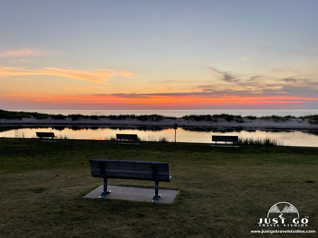
Fall is a great time of year to visit the park since it is less crowded than summer and the cooler temperatures are perfect for hiking. If you get lucky and time your visit to the park just right (early to mid-October), the fall colors can be spectacular!
Late spring is also an ideal time to visit the park to avoid crowds. Temperatures may still chilly, but visitors can catch spring blooms.

Average high and low temperatures in Sleeping Bear Dunes National Lakeshore

VISITING SLEEPING BEAR DUNES NATIONAL LAKESHORE IN THE WINTER
Sleeping Bear Dunes can be a wonderful place to explore in the winter for outdoor enthusiasts who don’t mind the snow and cold! Some park attractions and roads, like the Pierce Stocking Scenic Drive, are closed during the winter. However, most hiking trails and scenic views are still accessible and there are lots of winter activity options in the park! If you enjoy snowshoeing, cross-country skiing, or sledding, you will love Sleeping Bear Dunes in the winter! See the NPS website for more information on winter activities at Sleeping Bear Dunes.
Be sure to check the NPS website for current conditions in the park (including road and trail closures).
IS THERE CELLULAR SERVICE IN SLEEPING BEAR DUNES NATIONAL LAKESHORE?
Cellular reception is varied throughout the park, but public WiFi is available at the Philip A. Hart Visitor Center in Empire, the Dune Center at the Dune Climb and at the Glen Haven General Store.
ARE PETS ALLOWED AT SLEEPING BEAR DUNES NATIONAL LAKESHORE?
Pets are only allowed in some areas of Sleeping Bear Dunes National Lakeshore. Leashed pets are allowed on most trails, at both Platte River and D.H. Day campgrounds, and on specific stretches of beach within the park. There are some beaches where pets are NOT allowed to protect the endangered Great Lakes Piping Plover that nests on the lakeshore. Areas where pets are not allowed include the Dune Climb, Platte Point Beach, Maritime Museum grounds, North Bar Lake, and the Manitou Islands. Please check the NPS website regarding rules, restrictions, and specific locations where pets are allowed at the national lakeshore.
Pets must always be kept on a leash no longer than six feet (even on beaches and when swimming). They are not allowed in visitor centers or at public ranger programs. Visitors must clean up after their pets on all NPS land. Be aware that sand can be hot enough to burn paw pads in the summer.
IS THERE AN ENTRANCE FEE TO VISIT SLEEPING BEAR DUNES NATIONAL LAKESHORE?
Yes, there is a fee to enter the park. All visitors are required to have a Park Entrance Pass, which must be clearly visible through the windshield of your vehicle. If you do not already have an America the Beautiful annual park pass, you can purchase a pass for Sleeping Bear Dunes year-round at the visitor center. Park passes are also available for purchase seasonally at one of several locations, including the entrance stations (for the Dune Climb or Pierce Stocking Scenic Drive) and campground offices.
RELATED INFORMATION ON SLEEPING BEAR DUNES NATIONAL LAKESHORE FROM JUST GO TRAVEL STUDIOS
- Be sure to get a copy of our itinerary for Sleeping Bear Dunes National Lakeshore! We cover all you need to know for your trip.
- We also have two great articles on the park, including Camping in Sleeping Bear Dunes and Hiking in Sleeping Bear Dunes.
- Don’t forget about other parks in Michigan! A nearby state park that is worth checking out is Fisherman’s Island State Park.
- When you get back from your trip, be sure to send us a photo and we’ll create a cool vintage travel poster, with your own custom wording right from your photo!