7 Best Hikes in Badlands National Park: Trail Maps, Directions & More
Peter BrahanIf you are heading to the Rapid City area of South Dakota, then taking a day or two to explore and go hiking in Badlands National Park is a fantastic way to really see and immerse yourself in this rugged and beautiful landscape. Taking a drive on the scenic road through the park is a great idea if you are short on time, but to really see the area, you just can’t beat a hike.
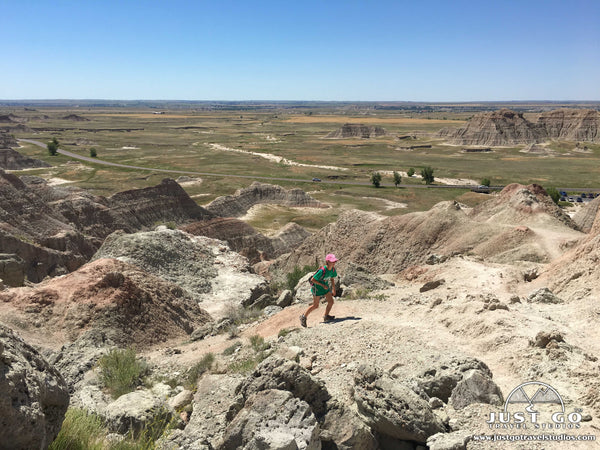
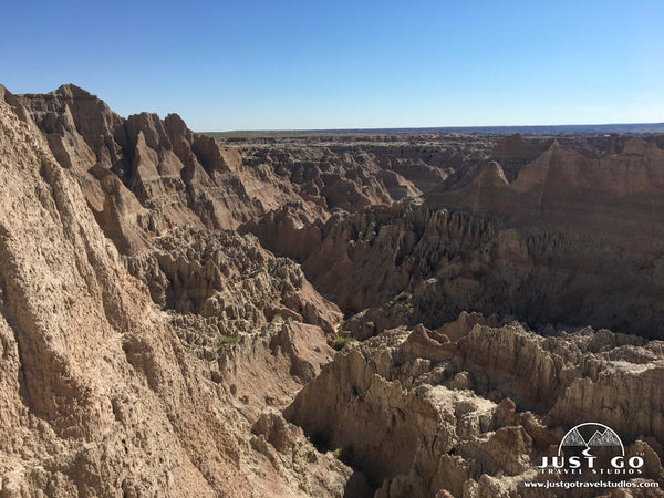
To be honest, Badlands National Park isn’t known for its amazing hiking. You won’t find grand peaks to climb, but what you will find are a good selection of easy and moderate hikes that lead to sprawling views that are quite impressive and worth your time.
One thing that is worth noting that is unique to only a few parks in the nation is that you can hike anywhere you want in Badlands National Park. That means that you can hike “off trail” and truly explore wherever you want to go! Now, be advised that you’ll want to be sure you bring a good map with you (or a GPS for navigation) and plenty of water if you go off trail, but it’s a great opportunity to do so if you are prepared!
We hope this guide helps you find what your best options are for hiking in Badlands National Park!
BADLANDS NATIONAL PARK HIKING: DISTANCES AND ELEVATION GAIN
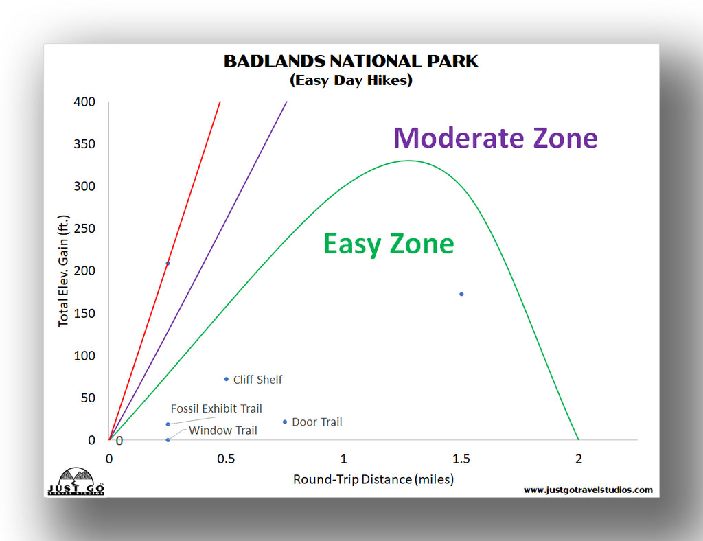
For a good overview, we provide several charts to help you narrow down your choices on what to hike in the park. If you are interested in an easier hike, this chart will help you find the right hike.
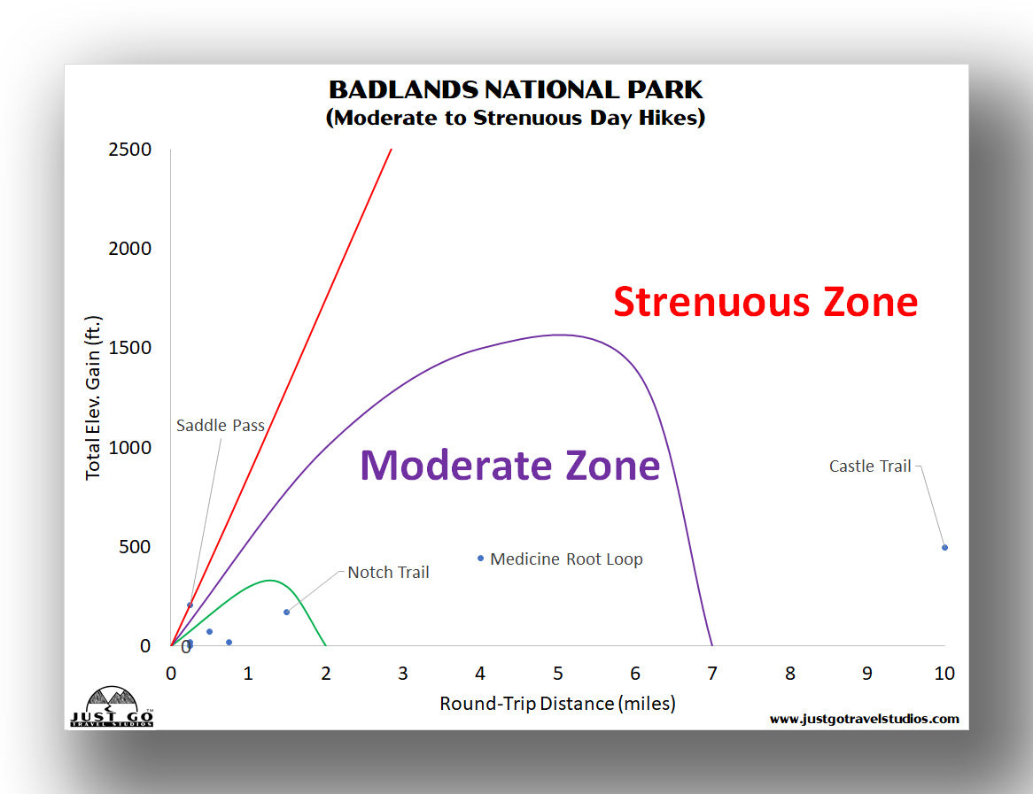
While there aren’t any truly challenging hikes in the park, this will help you narrow in on a good hike that is moderate or strenuous (named strenuous in the case solely due to the length and exposure, not the elevation change).

Ahead of your visit, download our National Parks of the Dakotas Itinerary. We cover the best hikes, but also the sights to see, what to pack ahead of your trip, what to expect for weather and what you should do when visiting the area.
BEST HIKES IN BADLANDS NATIONAL PARK: TRAIL DESCRIPTIONS AND TRAIL MAPS
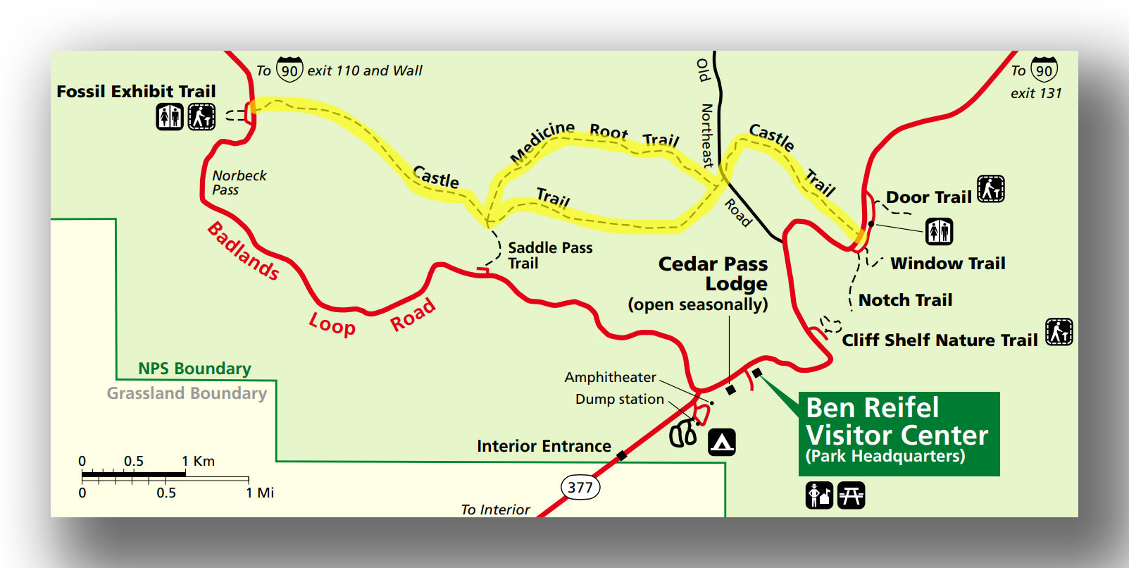
CASTLE TRAIL
- Difficulty: Moderate / Hard
- Distance (round-trip): 10.0 miles
- Elevation gain: 505 feet
- Hiking time (approximate): 5 to 6 hours
Castle Trail map, courtesy of the National Park Service
There is really only one trail that will take you most of the day in the park, and that is the Castle Trail. This moderately strenuous hike (mainly because of the length, not the elevation gain) is not crowded at all, and many consider this to be the best hike in the park because of that (and the amazing views!).
The trail is flat for the first three miles as you head west from Highway 240, before climbing slowly until you get to the Fissile Exhibit Trail and turn around. The views are amazing along the way. Be advised that the hike is completely exposed, so you’ll need to be sure you have plenty of sunblock, water (bring more than you think you need!) and some snacks. Return on the Medicine Root Trail for a different view (with rolling plains to the north), before meeting back up with the Castle Trail and heading back to the parking area.
The entire hike is about 10.0 miles (round-trip) and will take you about 5-6 hours. There is about 500 feet total elevation gain.
The trailhead for the Castle Trail is near the Ben Reifel Visitor Center, at the Door and Window parking area.
NOTCH TRAIL
- Difficulty: Moderate
- Distance (round-trip): 1.5 miles
- Elevation gain: 170 feet
- Hiking time (approximate): 2 hours
Notch Trail map, courtesy of the National Park Service
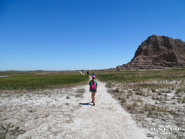
If you are looking for a shorter trail that offers a bit of a challenge as well as a great view at the end, then the Notch Trail is probably your best bet in the park. This moderately challenging trail includes a log ladder, which is really cool, especially if you are a kid that likes to hike and climb!
The trail starts off easy by heading south from the parking lot. This is a flat area that passes through some dry washes and heads through grasses. Be careful through here, as there have been rattlesnakes found in the area!
At the 0.3-mile point is a log ladder, which consists of about 50 steps to help you get up the hillside. It isn’t hard to climb, but it does get steeper as you go up. Be patient here, as lines can form both at the top and bottom.
After the ladder, the trail is relatively flat along the rough landscape before coming to an amazing overlook to the east of the White River Valley!
The trail is about 1.5 miles (round-trip) with about 170 feet of total elevation gain. It will take about 2 hours.
The trailhead is near the Ben Reifel Visitor Center, at the south end of the Door and Window Parking area.

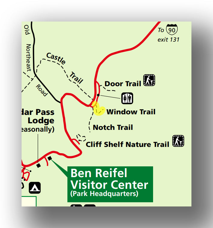
DOOR TRAIL
- Difficulty: Easy
- Distance (round-trip): 0.75 miles
- Elevation gain: Minimal
- Hiking time (approximate): 1 hour
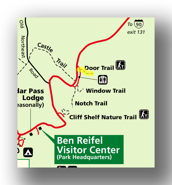
Door Trail map, courtesy of the National Park Service
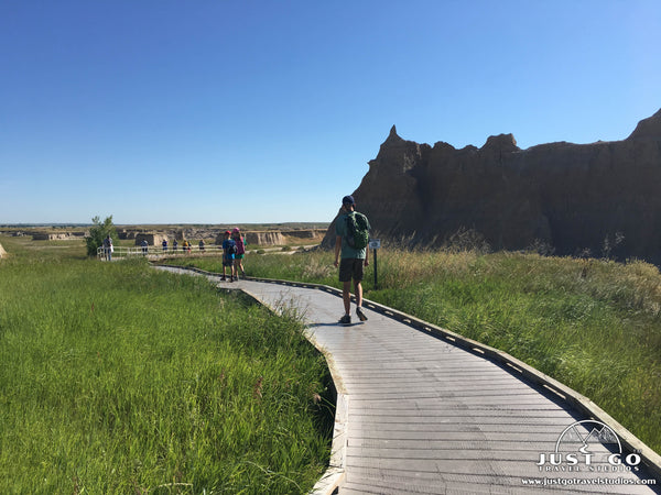
Though a relatively short and easy hike, the Door Trail is a great option to take after you finish the Notch or Caste Trail, since it is in the same area and will only take a little bit of your energy! The hike starts off with a 0.25-mile boardwalk that and in a break in the Badlands Wall.
This is especially great during sunset. You can go past the “end” of the established trail by heading up into the formations but be advised that it is very uneven. You can also bring dogs on this trail too, as long as they are leashed.
The entire trail is only about 0.75-miles (round-trip, assuming you explore a bit beyond the boardwalk), and should take you less than an hour.
The trailhead is near the Ben Reifel Visitor Center at the Door and Window Parking area.
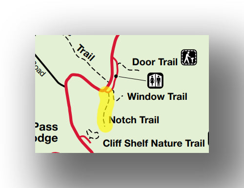
WINDOW TRAIL
- Difficulty: Easy
- Distance (round-trip): 0.25 miles
- Elevation gain: Minimal
- Hiking time (approximate): 15 minutes
Window Trail map, courtesy of the National Park Service
Another very short and easy trail is the Window Trail. This boardwalk “hike” (more of a walk!) ends at a natural window. You can see quite a bit from this viewpoint, and it’s great for pictures! It’s quick and easy, but great to do in the heat of the day as it is so short.
The trail is only about 0.25-miles (round-trip) with minimal elevation gain. Expect to be here for about 15 minutes.
The trailhead is near the Ben Reifel Visitor Center at the Door and Window Parking area.
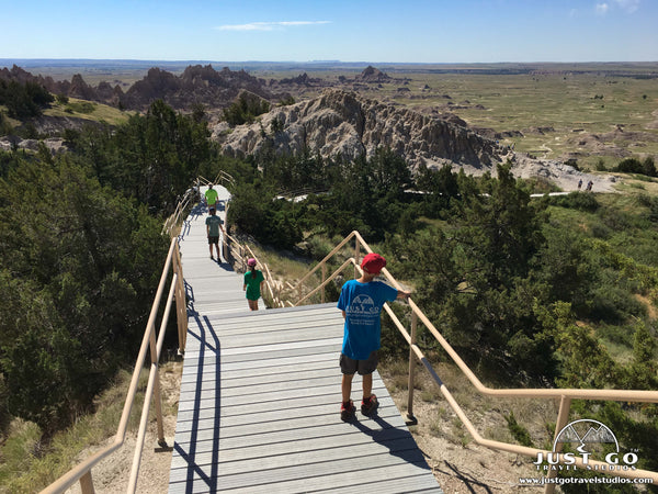
CLIFF SHELF NATURE TRAIL
- Difficulty: Easy
- Distance (round-trip): 0.6 miles
- Elevation gain: 70 feet
- Hiking time (approximate): 1 hour
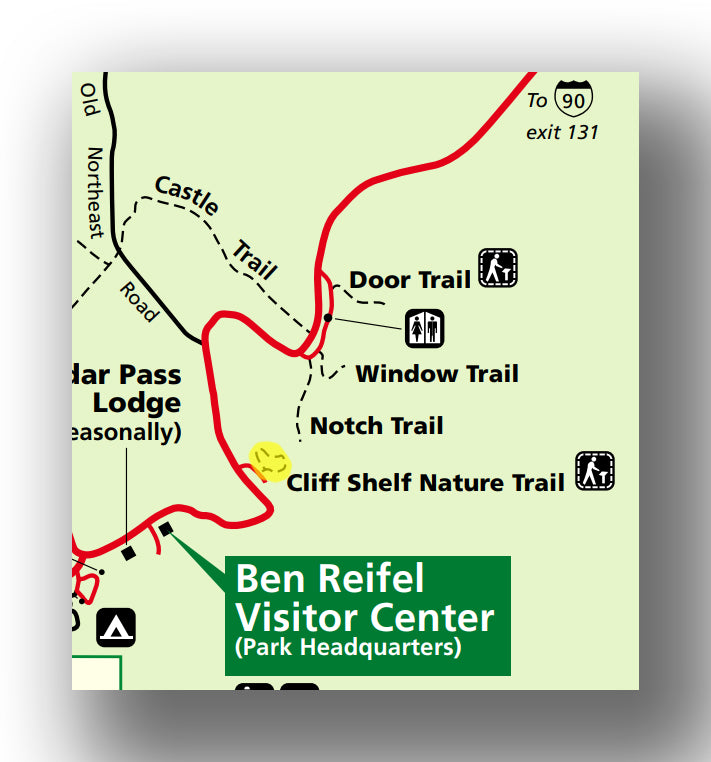
Cliff Shelf Nature Trail map, courtesy of the National Park Service
There are a lot of short trails in Badlands National Park, but the Cliff Shelf Nature trail is different than the others. While it’s short, it is almost exclusively on elevated boardwalks with stairs and interpretive signs. There is also a cedar forest that you’ll pass through, which attracts wildlife (like deer). You will also find a bit of shade and greenery on the trail!
The trail is easy, and has about 70 feet of total elevation gain. Expect to spend less than an hour here.
The trailhead is just north of the Ben Reifel Visitor Center.
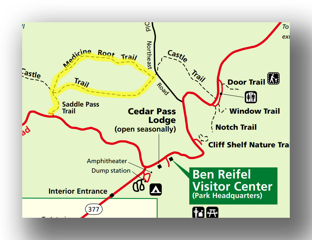
MEDICINE ROOT LOOP TRAIL
- Difficulty: Moderate
- Distance (round-trip): 4.3 miles
- Elevation gain: 450 feet
- Hiking time (approximate): 2.5 to 3 hours
Medicine Root Loop Trail map, courtesy of the National Park Service
The Medicine Root Loop trail is one of the medium length hikes in the park. At a round-trip distance of about 4.3 miles, the trail starts off by heading up the steep Saddle Pass Trail. After you get to the top, the trail is flat and loops around the grasslands on the top of the ridge. Head back on the Castle Trail along the mixed grass prairie.
You’ll have great views along this hike, with good opportunity to see sheep or other wildlife.
The entire hike has about 450 feet of elevation gain, and you can expect it to take about 2.5 to 3 hours to hike.
The trailhead is shared with the Saddle Pass trail and starts on the Badlands Loop Road west of Hwy 337.
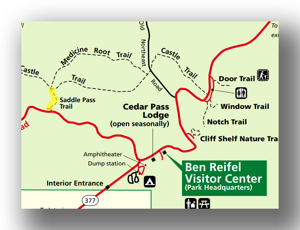
SADDLE PASS TRAIL
- Difficulty: Moderate / Hard
- Distance (round-trip): 0.25 miles
- Elevation gain: 200 feet
- Hiking time (approximate): 30 minutes
Saddle Pass Trail map, courtesy of the National Park Service
The Saddle Pass trail is a short but strenuous hike that goes up and down the side of “the Wall” and ends in a view of the White River Valley. The trail is slippery, with loose dirt and rocks to navigate on the way up. However, the views are great, and the hike is short!
The trail is 0.25-miles (round-trip) with about 200 feet of elevation gain. Expect to take about 30 minutes on this hike.
The trailhead starts on the Badlands Loop Road west of Hwy 337.
FURTHER INFORMATION ON BADLANDS NATIONAL PARK FROM JUST GO TRAVEL STUDIOS
- Ahead of your trip, we recommend downloading our itinerary for Badlands National Park (and the surrounding area). We include what you need to know about the park, what to bring, ideas on where to stay and what to do in the area!
- We have an extensive blog on What to See and Do in Badlands National Park, as well as information on one of our favorite hikes, Hiking the Notch Trail!
- When you return, be sure to check out our custom, vintage-style posters that are personalized with your wording, stylized in a vintage style and made just for you!